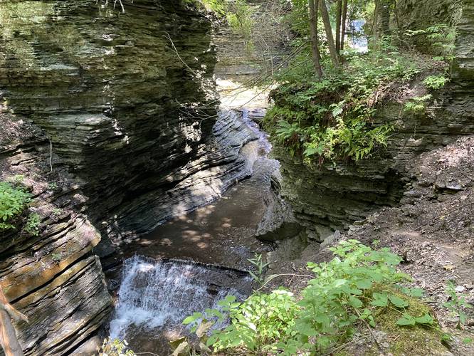
The Deckertown Falls Trail in Montour Falls, New York is a moderate 0.5-mile out-and-back trail that leads to a popular swimming hole and waterfall known as Deckertown Falls. Deckertown Falls has several cascades that spill down Mill Creek within Mill Creek Gorge.
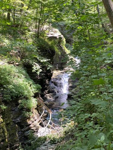
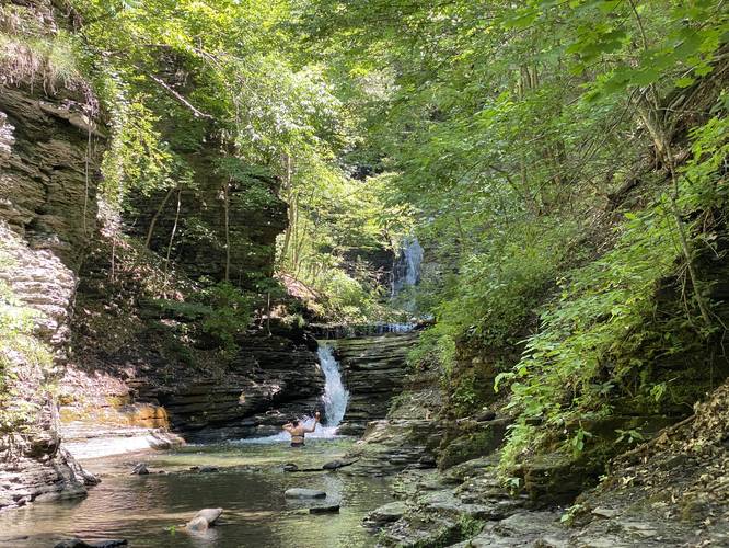
This short, but steep, out-and-back trail runs uphill and alongside the series of waterfalls known as Deckertown Falls. The lower falls are approximately 10-feet tall while the largest fall - Deckertown Falls - is approximately 60-feet tall (give or take a few feet). The creek within the gorge below has a couple of places where smaller waterfalls (approximately 10-feet tall or shorter) cascade into pools - most of these must be climbed within the creek to reach the pool of Deckertown Falls. Deckertown Falls, assuming is the largest of the waterfalls, sits furthest back within this gorge - so the best way to see the falls is from the trail itself is near the top of the hill.
Hikers should note that you can also hike / wade / swim the creek upstream as many people do here during the Summer months. The water is at least waist-high after the first small waterfall climb that leads to the following pools and waterfalls behind it.
Viewing the Falls from the Trail
Hikers should note that the view of the waterfalls from the trail is obstructed by the surrounding trees. The gorge's cliff, adjacent to the trail, is extremely steep and can cause serious injury if not death if you accidentally fall into it. I took some stupid risks to take photos here along this trail, but I would not recommend any of them as most of the views from these weird ledges are not worth the photos. If you want the best photos of Deckertown Falls, plan to hike up the creek itself and plan to get very wet in the process.
Other Waterfalls in Town
Also check out Shequaga Falls and Aunt Sarah's Falls - both in Montour Falls, NY.
Parking
Hikers and visitors must note that the parking lot here is large enough to fit no more than 4 or 5 vehicles. The parking lot sits at the end of a residential street and the street has no off-street parking at all. If the parking lot is full when you arrive, please leave and try again later. Do not disturb the local residents or park on/in their property to see the waterfall.
Pets
Dogs are allowed if leashed and should be kept on the trail at all times. Due to the steep drop-offs of this trail, it's best to keep your dogs leashed.