The Ruins Trail at Dead Man's Hollow Conservation Area in McKeesport, Pennsylvania is an easy 0.4 mile loop hike that runs around old industrial ruins and out to the Great Allegheny Passageway trail.
This recording does include a small section of the Great Allegheny Passageway trail, so it technically goes outside of the Dead Man's Hollow Park. During the cooler months, when there are no leaves on the trees, you can get a view of the Youghiogheny River along the Great Allegheny Passageway too.
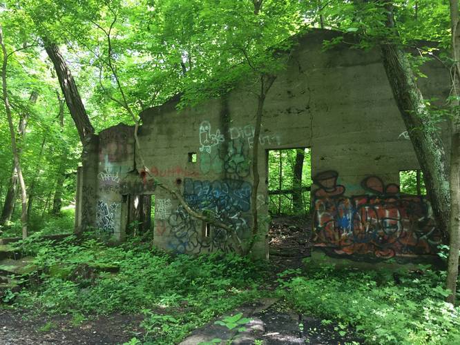
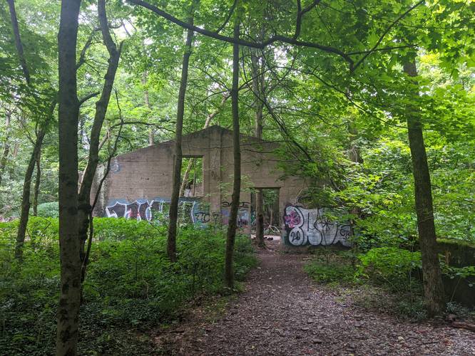
The industrial ruins is that of an old factory that sat along Dead Man's Run. To the sides of the trail, near the ruins, are bluff-like cliff formations, not very tall, but make for an interesting area nonetheless. There also appears to be a sinkhole area just east of the ruins, just before heading out onto the Great Allegheny Passageway.
Dogs and biking are both allowed on this trail.
This trail can be very buggy during warmer months.
Parking: Parking can be found at the end of Orchard Drive in McKeesport, PA; however, as of May 2018, I have not mapped the trail from this parking lot down to the Ruins Trail. Please see the park map for trail details about how to connect to the Ruins Trail.
Hunting: Hunting is allowed at Dead Man's Hollow.
This recording does include a small section of the Great Allegheny Passageway trail, so it technically goes outside of the Dead Man's Hollow Park. During the cooler months, when there are no leaves on the trees, you can get a view of the Youghiogheny River along the Great Allegheny Passageway too.
The industrial ruins is that of an old factory that sat along Dead Man's Run. To the sides of the trail, near the ruins, are bluff-like cliff formations, not very tall, but make for an interesting area nonetheless. There also appears to be a sinkhole area just east of the ruins, just before heading out onto the Great Allegheny Passageway.
Dogs and biking are both allowed on this trail.
This trail can be very buggy during warmer months.
Parking: Parking can be found at the end of Orchard Drive in McKeesport, PA; however, as of May 2018, I have not mapped the trail from this parking lot down to the Ruins Trail. Please see the park map for trail details about how to connect to the Ruins Trail.
Hunting: Hunting is allowed at Dead Man's Hollow.