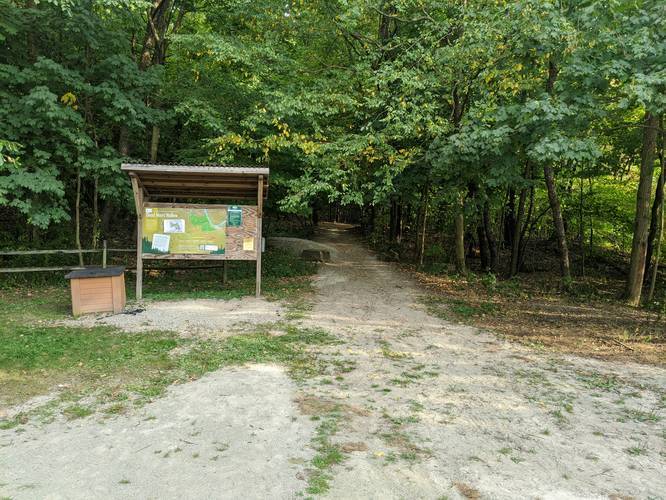
The Cool Spirit Trail at Dead Man's Hollow Conservation Area in McKeesport, Pennsylvania is a moderate 1.9 mile loop trail that brings you deeper into Dead Man's Hollow. The trail begins and ends at the main parking lot off of Scene Ridge Rd.
This recording starts out by heading left after the trailhead, which seemed to be the difficult section of the trail. You start out by heading uphill before the trail descends, with switchbacks, toward Dead Man's Run Creek and the Table Rock Trail. If you want more of a challenge, you can start by heading right after the trailhead.
You can use this trail to get further into Dead Man's Hollow and onto trails like the Table Rock Trail, Dead Man's Loop, the Ruins Trail, and more. The trail isn't very wide, but it's well maintained. Dogs and biking are both allowed on this trail.
Lookout: In the Winter and Fall, there's a small lookout point in the northern part of the trail that looks out to the neighborhood below. During the Spring and Summer, you can see the neighborhood, but the view is obstructed by the leaves.
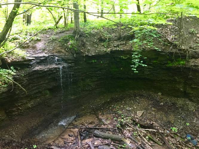
Waterfall: There's a waterfall, about 10 feet tall, that sits under a footbridge along the trail only about 0.2 miles down the trail if you take a right-hand turns after the trailhead.
Parking: Parking can be tricky due to google maps misinterpreting the parking location, so the parking marker is located at the entrance to the Dead Man's Hollow parking lot. The entrance to the parking lot can be found at the junction of Scene Ridge Rd and River Ridge Rd.
Blazes: Follow the blue blazes with black arrows to stay on the trail.
Hunting: Hunting is allowed at Dead Man's Hollow.
This recording starts out by heading left after the trailhead, which seemed to be the difficult section of the trail. You start out by heading uphill before the trail descends, with switchbacks, toward Dead Man's Run Creek and the Table Rock Trail. If you want more of a challenge, you can start by heading right after the trailhead.
You can use this trail to get further into Dead Man's Hollow and onto trails like the Table Rock Trail, Dead Man's Loop, the Ruins Trail, and more. The trail isn't very wide, but it's well maintained. Dogs and biking are both allowed on this trail.
Lookout: In the Winter and Fall, there's a small lookout point in the northern part of the trail that looks out to the neighborhood below. During the Spring and Summer, you can see the neighborhood, but the view is obstructed by the leaves.
Waterfall: There's a waterfall, about 10 feet tall, that sits under a footbridge along the trail only about 0.2 miles down the trail if you take a right-hand turns after the trailhead.
Parking: Parking can be tricky due to google maps misinterpreting the parking location, so the parking marker is located at the entrance to the Dead Man's Hollow parking lot. The entrance to the parking lot can be found at the junction of Scene Ridge Rd and River Ridge Rd.
Blazes: Follow the blue blazes with black arrows to stay on the trail.
Hunting: Hunting is allowed at Dead Man's Hollow.