Davies Sanctuary Trail at Peaks Island Land Preserve on Peaks Island, Maine is an easy 0.2-mile out-and-back hike that leads to views of the ocean at Elm Tree Cove.
Hike Description
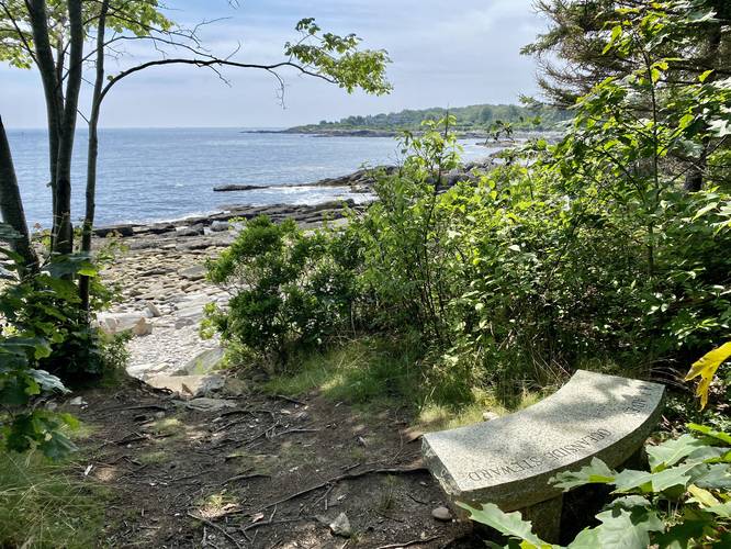
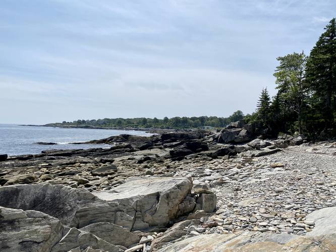
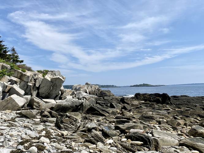
This hike begins at a seldom-used trailhead on Reed Ave and heads down the hill at a gradual grade to each Elm Tree Cove. Near the end of the trail, it becomes a bit steep between the forest and rocky cove beach, so watch your step. Once in the cove, hikers will get nice views of the neighboring Long Island.
The hike out, while uphill, is not very difficult, hence the easy difficulty.
Warning
Buggy: This trail is and can be very buggy, even down by the ocean.
Parking
If driving, there are some small parking turnouts near the coordinates provided. The parking turnouts are mostly for golf carts, which can be rented on the island.
Pets
Dogs are allowed if leashed and should be cleaned up after.
Getting to and Getting Around Peaks Island
To access Peaks Island, travelers must buy a ticket from Casco Bay Lines to hitch a ride on the ferry in Portland. Peaks Island ferry runs on a different schedule each season and year. Please use this Casco Bay Lines link to find out more about when the ferry leaves Portland and/or Peaks Island to plan your trip. As of July 2023, the price for a ticket to Peaks Island cost $7 for one adult and there's no return fee as the trip from Peaks Island to Portland is free. Visitors can pay more money to bring their cars, however, folks that bring vehicles to Peaks Island are generally locals. Instead, visitors can either plan to walk/hike the island or they can rent golf carts for a moderate hourly fee on the island. Each golf cart rental business, as of July 2023, is located right off of the dock where the ferry drops passengers off on the island. On our trip we used Mike's Carts which cost $50/hour to rent the golf cart for up to 5 hours max. Mike's Carts, as of July 2023, did not require prior reservations, however, any first-come first-serve carts might sell out by late morning. There's another company called Peaks Island Golf Carts which require a reservation in advance. Last, weekends on Peaks Island - especially during the Summer - can be very very busy. If you wish to explore Peaks Island without a massive crowd, plan on a quiet weekday.
Hike Description
This hike begins at a seldom-used trailhead on Reed Ave and heads down the hill at a gradual grade to each Elm Tree Cove. Near the end of the trail, it becomes a bit steep between the forest and rocky cove beach, so watch your step. Once in the cove, hikers will get nice views of the neighboring Long Island.
The hike out, while uphill, is not very difficult, hence the easy difficulty.
Warning
Buggy: This trail is and can be very buggy, even down by the ocean.
Parking
If driving, there are some small parking turnouts near the coordinates provided. The parking turnouts are mostly for golf carts, which can be rented on the island.
Pets
Dogs are allowed if leashed and should be cleaned up after.
Getting to and Getting Around Peaks Island
To access Peaks Island, travelers must buy a ticket from Casco Bay Lines to hitch a ride on the ferry in Portland. Peaks Island ferry runs on a different schedule each season and year. Please use this Casco Bay Lines link to find out more about when the ferry leaves Portland and/or Peaks Island to plan your trip. As of July 2023, the price for a ticket to Peaks Island cost $7 for one adult and there's no return fee as the trip from Peaks Island to Portland is free. Visitors can pay more money to bring their cars, however, folks that bring vehicles to Peaks Island are generally locals. Instead, visitors can either plan to walk/hike the island or they can rent golf carts for a moderate hourly fee on the island. Each golf cart rental business, as of July 2023, is located right off of the dock where the ferry drops passengers off on the island. On our trip we used Mike's Carts which cost $50/hour to rent the golf cart for up to 5 hours max. Mike's Carts, as of July 2023, did not require prior reservations, however, any first-come first-serve carts might sell out by late morning. There's another company called Peaks Island Golf Carts which require a reservation in advance. Last, weekends on Peaks Island - especially during the Summer - can be very very busy. If you wish to explore Peaks Island without a massive crowd, plan on a quiet weekday.