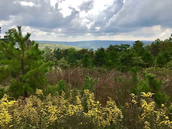
Dark Hollow Overlook Trail
This hike can be as long or as short as you want. You can drive directly up to the overlook, but it can be easy to miss while driving. This GPS track leads from the intersection down the street where Ridge rd, Stillhouse Hollow Rd, and the AT meet. You can park at the pull-off at the intersection and hike down the road to the overlook, which is 0.8 miles out-and-back.
Know Before You Go
Interactive topographic map for Dark Hollow Overlook Trail located in Fayetteville, PA. Click the "View Map" button to load GPS coordinates and trail markers.
View map
Get directions
- Distance
- 0.8 mi
- Difficulty
- Easy
- Type
- Out-and-Back
- Est. Time
- 24 min
- Elev. Gain
- 51'
- Rating
- 0.0
- Added
- September 18, 2017
- Updated
- November 27, 2017
Weather Forecast
Don't let Google decide who you trust.


Loading...
<strong>Trail map and elevation chart not rendering in print mode?</strong> Simply scroll to the trail map section, then try printing again!
Total Change
56 ft.
17 m
17 m
Ascent
51 ft.
16 m
16 m
Descent
51 ft.
16 m
16 m
Loading...
Features
- Vista / Lookout Point
- Dogs
Points of interest
-
Parking
39.948271, -77.483993 -
Main Trailhead
39.947036, -77.490757 -
Dark Hollow Overlook vista point
39.948128, -77.484139
Safety information
For your own safety: plan ahead, let someone know where you'll be, and hike at your own risk.
Availability
All seasons
Surface type
Dirt
Trip Reports (Reviews)
Ready to help fellow hikers? Add a trip report to share your experience!
0.1
miles
/ 0.2 km
June 04, 2023
Hiking
No community routes found. To add your own hike as a Community Route for this Trail guide, leave a Trip Report with an attached GPX file.


You may also like

Explore
Pennsylvania's Grand Canyon
Explore Pennsylvania's Grand Canyon, officially named Pine Creek Gorge, including hiking trails, vistas, overlooks, waterfalls, backcountry campsites, backpacking trails.

Explore
New York's Best Waterfalls
Whether you're planning a day hike, roadside stop, or a leisurely short walk, this guide provides hikers, travelers, and locals alike with 63 different locations to over 100 scenic waterfalls to help plan your next adventure!

Explore
25 Best Day Hikes in West Virginia
Discover 25 of the best day hikes in West Virginia, from scenic overlooks to wilderness trails—perfect for every level of hiker.

Explore
Best of the Alps: Hiking, Adventure & Scenery
Plan your ultimate European Alps adventure! Discover the best hiking trails, epic scenery, and villages in the Swiss Alps, Dolomites, Chamonix, and Lake Como.
michaux state forest

