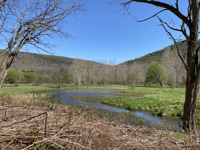
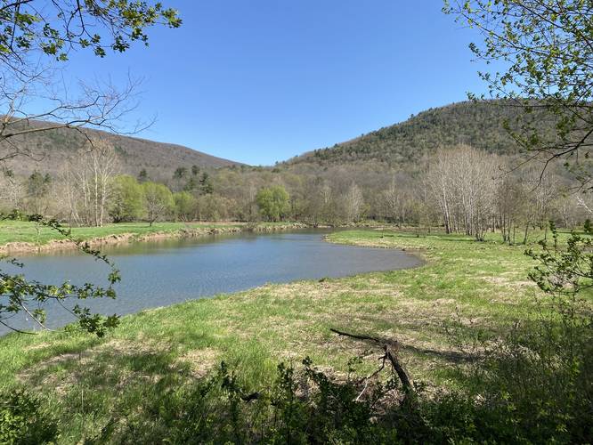
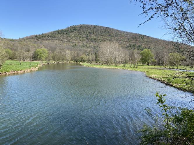
The Crooked Creek Trail (aka Old PA-287) at Ives Run Recreation Area near Crooked Creek, Pennsylvania is an easy 5.2-mile out-and-back trail that connects Hillscreek Road to Ives Run Lane via the old route PA-287 and features beautiful views of Crooked Creeks, the surrounding mountains, osprey nests, and opportunities for bird watching. This trail is also the closest footpath to the ancient Native American trail that once passed alongside Crooked Creek - the Crooked Creek Path.
Hike Description
This trail begins at the yellow gate and follows a service road with substrate of old pavement that's seen better days. This pavement lasts for the majority of the trail as it slowly makes its way down Crooked Creek. Note that during the Summer, it's possible this trail has overgrown sections in the pavement.
Railroad Bridge Pile - Mile 0.75
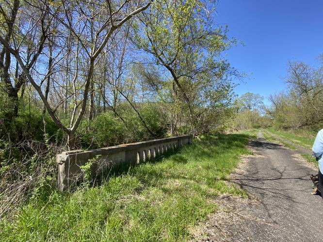
Around mile 0.75, as of May 2022, hikers can find an old railroad bridge pile sitting in the creek. This appears to be an artifact from the long-abandoned railroad from the logging days in the late 1800s and early 1900s.
Osprey Nest - Mile 1.4
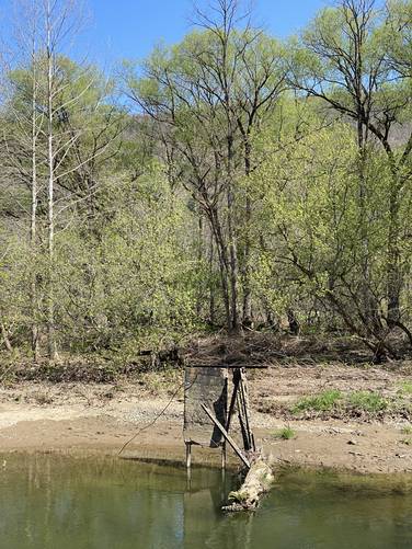
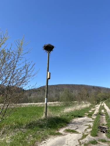
As of May 2022, around mile 1.4, hikers will find an osprey nest located on a tall pole built for birds to roost. Just below is a bat house, which helps encourage bat populations to take shelter here. This spot is perfect for both species - the marsh fills in on the north side and on the south side Crooked Creek is just a stone's throw away. If hiking by, the osprey will make a couple of calls before fleeing its nest, to then circle above, as it watches you and its nest for safety.
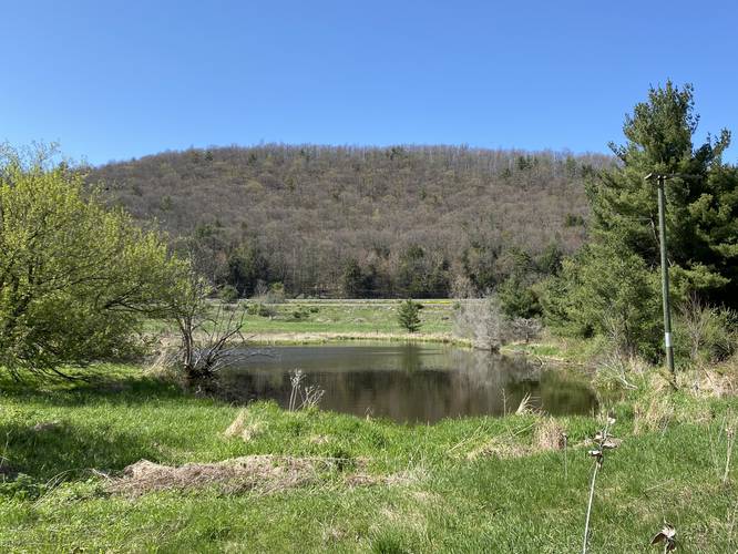
Along the trail, hikers will find different stands of trees like Norway Spruce and White Birch that can be seen from the trail. It also appears as though some of the fields are still being used to harvest a crop - which may be land leased by the US Army Corps of Engineers or could be used for research by them (just a guess).
Pavement Ends - Overgrowth - Creekside Trail - Mile 2.3
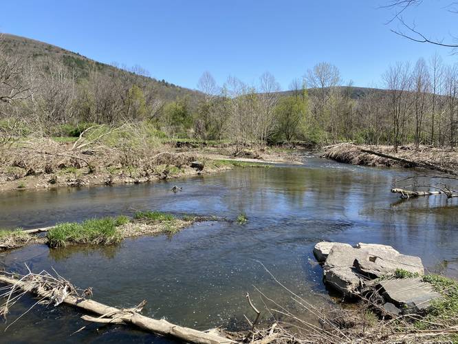
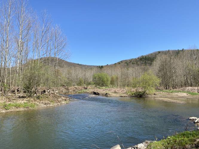
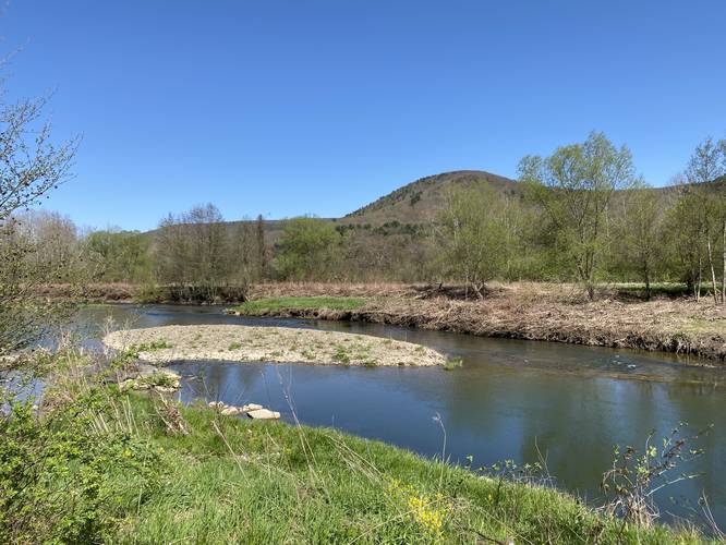
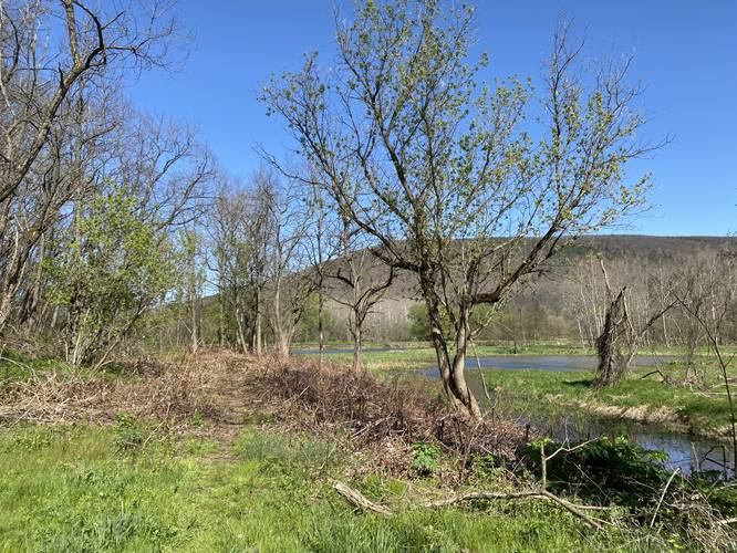
Around mile 2.3, the pavement will end and the trail will enter a bamboo-infested forest. Just beyond the bamboo, the trail follows a skinny path that works its way alongside Crooked Creek - here, hikers get the best view of the creek and the surrounding mountains. Eventually, the trail will pass through a grassy area and then ascend a very small hill which reaches Ives Run Lane. Here is where the trail terminates and the hike back begins. Note that the trailhead located along Ives Run Lane is not marked nor is an "official" trailhead for the park.
Parking
Hikers will find parking at the coordinates provided along Hillscreek Road. The turnout is large enough to fit a half-dozen vehicles or so. Please do not block the gate.
Pets
Dogs are allowed if leashed and their waste should be carried out by the hiker.
Historical Native American Path
Long before settlers moved to Tioga County, the Seneca Tribe had footpaths for hunting and traveling that cut through the thick and dark evergreen forests that covered the landscape. One route, named the Crooked Creek Path (likely labeled by settlers), followed Crooked Creek from what's known today as Tioga, PA down into Middlebury Center, PA and eventually met up with the Pine Creek Path just north of Stokesdale, PA (a small village just north of Wellsboro proper). Crooked Creek Path was eventually widened by the settlers to create roads for travel. This road eventually turned into PA-287 and this trail follows the old route of that road, which may have followed parts of the Native American footpath. While this trail may not follow the exact location of the Seneca's Crooked Creek Path, it's the closest people can get today to following in their footsteps as this trail winds its way along the creek, just as the Seneca's ancient footpath once did.
Hunting & Fishing
Fishing in Crooked Creek along this trail is allowed and less crowded than across the creek along the Railroad Grade Trail during the Spring since motorized vehicles are not allowed. 99% of the fisherman will be parked along the Railroad Grade Trail fishing in the Spring. Hunting is also allowed off-trail here, so wearing blaze orange during hunting season is recommended.
Hike Description
This trail begins at the yellow gate and follows a service road with substrate of old pavement that's seen better days. This pavement lasts for the majority of the trail as it slowly makes its way down Crooked Creek. Note that during the Summer, it's possible this trail has overgrown sections in the pavement.
Railroad Bridge Pile - Mile 0.75
Around mile 0.75, as of May 2022, hikers can find an old railroad bridge pile sitting in the creek. This appears to be an artifact from the long-abandoned railroad from the logging days in the late 1800s and early 1900s.
Osprey Nest - Mile 1.4
As of May 2022, around mile 1.4, hikers will find an osprey nest located on a tall pole built for birds to roost. Just below is a bat house, which helps encourage bat populations to take shelter here. This spot is perfect for both species - the marsh fills in on the north side and on the south side Crooked Creek is just a stone's throw away. If hiking by, the osprey will make a couple of calls before fleeing its nest, to then circle above, as it watches you and its nest for safety.
Along the trail, hikers will find different stands of trees like Norway Spruce and White Birch that can be seen from the trail. It also appears as though some of the fields are still being used to harvest a crop - which may be land leased by the US Army Corps of Engineers or could be used for research by them (just a guess).
Pavement Ends - Overgrowth - Creekside Trail - Mile 2.3
Around mile 2.3, the pavement will end and the trail will enter a bamboo-infested forest. Just beyond the bamboo, the trail follows a skinny path that works its way alongside Crooked Creek - here, hikers get the best view of the creek and the surrounding mountains. Eventually, the trail will pass through a grassy area and then ascend a very small hill which reaches Ives Run Lane. Here is where the trail terminates and the hike back begins. Note that the trailhead located along Ives Run Lane is not marked nor is an "official" trailhead for the park.
Parking
Hikers will find parking at the coordinates provided along Hillscreek Road. The turnout is large enough to fit a half-dozen vehicles or so. Please do not block the gate.
Pets
Dogs are allowed if leashed and their waste should be carried out by the hiker.
Historical Native American Path
Long before settlers moved to Tioga County, the Seneca Tribe had footpaths for hunting and traveling that cut through the thick and dark evergreen forests that covered the landscape. One route, named the Crooked Creek Path (likely labeled by settlers), followed Crooked Creek from what's known today as Tioga, PA down into Middlebury Center, PA and eventually met up with the Pine Creek Path just north of Stokesdale, PA (a small village just north of Wellsboro proper). Crooked Creek Path was eventually widened by the settlers to create roads for travel. This road eventually turned into PA-287 and this trail follows the old route of that road, which may have followed parts of the Native American footpath. While this trail may not follow the exact location of the Seneca's Crooked Creek Path, it's the closest people can get today to following in their footsteps as this trail winds its way along the creek, just as the Seneca's ancient footpath once did.
Hunting & Fishing
Fishing in Crooked Creek along this trail is allowed and less crowded than across the creek along the Railroad Grade Trail during the Spring since motorized vehicles are not allowed. 99% of the fisherman will be parked along the Railroad Grade Trail fishing in the Spring. Hunting is also allowed off-trail here, so wearing blaze orange during hunting season is recommended.