The Cow Pasture Trail at the Cranberry Wilderness in Hillsboro, West Virginia is a 6.4 mile trail that leads through the woods along the edge of the cranberry glades. The Cranberry Wilderness lies in the southern part of the Monongahela National Forest and is one of the most remote wilderness areas on the east coast.
The trail is marked with blue blazes/reflectors. To start the trail from the parking area, hike south ~1/4 mile to the southern terminal or hike 1.1 miles north to the northern terminal. Unfortunately you don't get to hike directly along the glades like on the Boardwalk Trail; however, there are really nice views along the way.
This trail is relatively flat with minimal inclines. The grass can get overgrown in the open areas, so beware of snakes and bears! The Cranberry Wilderness is home to many black bears as this area is a black bear sanctuary. We saw a couple of bear cub paw prints in the mud along this trail too.
As of early June 2017, the south end of the trail (at the hairpin turn), the footbridge over the creek has been washed out - this may happen more frequently after heavy rainfalls or during wet seasons. Make sure to follow the blue markers for the short detour right up the trail.
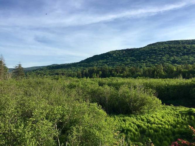
Lookout Point: At mile 5.7 (in the GPS data) there's a lookout area well worth stopping at.
Trail Map: For further details, check out this Cranberry Wilderness trail map PDF.
The trail is marked with blue blazes/reflectors. To start the trail from the parking area, hike south ~1/4 mile to the southern terminal or hike 1.1 miles north to the northern terminal. Unfortunately you don't get to hike directly along the glades like on the Boardwalk Trail; however, there are really nice views along the way.
This trail is relatively flat with minimal inclines. The grass can get overgrown in the open areas, so beware of snakes and bears! The Cranberry Wilderness is home to many black bears as this area is a black bear sanctuary. We saw a couple of bear cub paw prints in the mud along this trail too.
As of early June 2017, the south end of the trail (at the hairpin turn), the footbridge over the creek has been washed out - this may happen more frequently after heavy rainfalls or during wet seasons. Make sure to follow the blue markers for the short detour right up the trail.
Lookout Point: At mile 5.7 (in the GPS data) there's a lookout area well worth stopping at.
Trail Map: For further details, check out this Cranberry Wilderness trail map PDF.