Loading...

Distance:
3.4 Miles
Type:
Out-and-Back
Difficulty:
Easy
Time to Hike:
1 hour, ~42 minutes
Features:
Surface Type:
Dirt
Park:
Highbanks Metro Park
Town:
Lewis Center, Ohio
Directions:
40.151777, -83.023632
10
Added:
January 23, 2018
Updated:
August 01, 2023

The Coyote Run Trail at Highbanks Metro Park in Lewis Center, Ohio is a moderate 3.4 mile easy out-and-back trail that goes through woods and fields. The trail starts off at the nature center on a spur trail that leads into the woods, but quickly opens into fields. The trail has two main loops and one small loop on the northern side. The largest loop can be found just over a half mile from the trail head, while the other is located on the far west side. This trail is reserved for cross-country skiing during the winter when conditions are suitable.

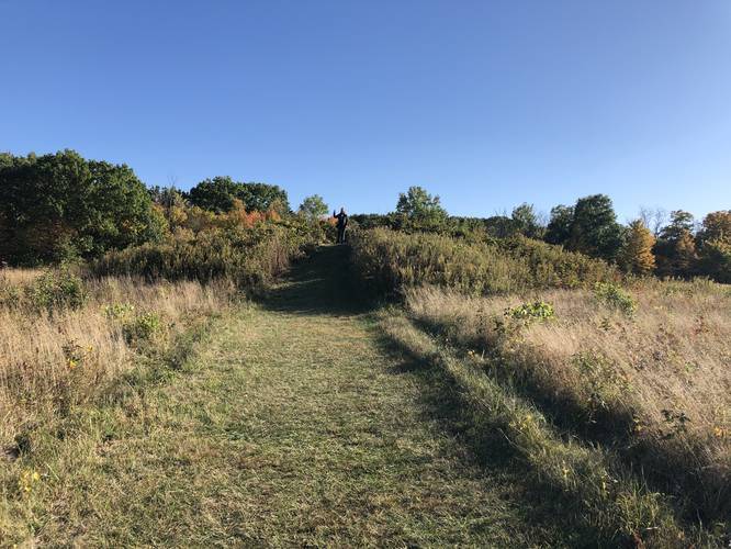
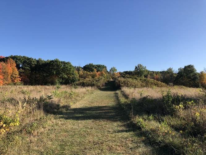
Adena Burial Mound - Mile 0.65
This trail's main feature is the Adena Mound - located around mile 0.65 - a burial mound that was constructed by a Native American tribe of the Adena culture. The Adena culture existed from approximately 500BCE to 100AD.

Pets
Dogs are allowed on this trail if leashed and should be cleaned up after the hiker.

Explore 127 trails near Lewis Center, OH

Seasons

All
Loading...
Loading...
25 '

Total Change
63 '

Ascent
64 '

Descent
Coyote Run Trail default picture

Photo Albums

6 Trip Reports

No Star-Ratings
3.4 miles
Trail added
January 23, 2018
Updated on
August 01, 2023
3.5 miles
July 29, 2023
Great trail, woods, and open fields. Unimproved with dirt, and grass surfaces. The burial mound is very solemn yet beautiful and peaceful location.
Hiking
3.4 miles
October 12, 2019
Nice trail that connects to the Dripping Rock trail (even though it doesn’t appear to on the park map). The Highbanks Metropark Mound 1 (aka Adena Indian mound, North Mound, Muma Mound) is in a meadow adjacent to the trail. There is a mowed path to the top. Beautiful view of the Mound and meadow.
Hiking
3.4 miles
October 18, 2018
Hiking
3.4 miles
September 16, 2018
Hiking

Find Hiking Trails Near Me:

Map of MyHikes' trails in North America

Weather Forecast

In Lewis Center, OH
Find your quest with MyHikes

Explore Hiking Trails

New Hikes

1
Upheaval Dome Trail
1.4 Miles
Moderate Out-and-Back
Candlestick Tower Overlook
0.1 Miles
Easy Out-and-Back
Geronimo Trail
4.8 Miles
Moderate Loop
Shafer Trail Viewpoint
0.1 Miles
Easy Out-and-Back

Before you leave...

MyHikes is an indie web platform aimed to make exploring public trails easier for everyone. The site has no investors and is owned and operated by one person, Dave Miller / Admin. As the main contributor and doer-of-all-things for MyHikes, I share my experiences from hikes and backpacking trips on MyHikes for fun on a volunteer basis and I believe that public trail information should be available to everyone.

It takes a lot of time 🕦, money 💰, and effort (including espresso shots ☕) to run MyHikes, including hiking , mapping , writing , and publishing new trails with high-quality content... along with building new features, moderating, and site maintainance . I simply ask that if you find our content helpful or useful when planning your next adventure that you consider making a small donation to help keep the site running.

You can become a Supporter* (*MyHikes user account required) to unlock perks for as little as $0.83/month with a 1-time non-recurring payment 👍 Or you can simply Donate any amount without a MyHikes user account. Otherwise, telling your friends about MyHikes is the next-best thing to a donation - both quick and free 😄

Thanks for visiting MyHikes and have a great hike! ✌

Admin user profile picture

Dave Miller
MyHikes Founder & Admin