Cottonwood Falls Loop at Worlds End State Park near Forksville, Pennsylvania is a moderate 1.2-mile loop hike that features several waterfalls, including the ~13-foot tall Cottonwood Falls.
Trails
This hike follows two named trails in both Worlds End State Park and Loyalsock State Forest: Loyalsock Trail (LT, yellow blazes), Double Run Nature Trail (green blazes).
Hike
The trailhead listed here begins at a small parking turnout located on the south side of SR-3009 / Worlds End Road on the west side of the park. As of April 2024, there's no signage, but hikers can hop on the Loyalsock Trail here. Additionally, you can start this hike for a little more mileage down PA-154 near these coordinates (41.465943,-76.5789). Once on the Loyalsock Trail, hikers will head down following the yellow blazes for ~200-feet before taking a right-hand turn. This right-hand turn will lead you along the Double Run Nature Trail (green blazes) as it makes its way upstream along West Branch Double Run.
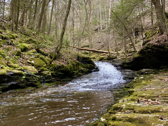
West Branch Double Run Waterfalls - Mile 0.1 to 0.3
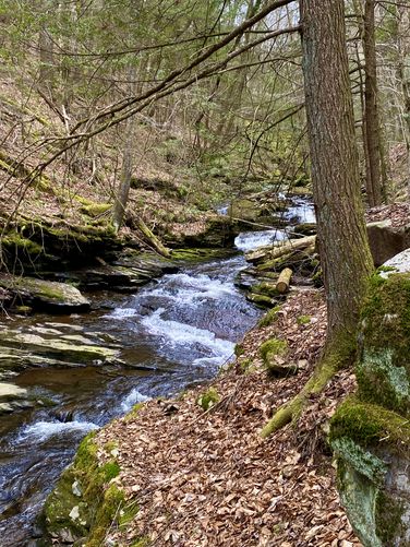
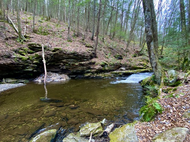
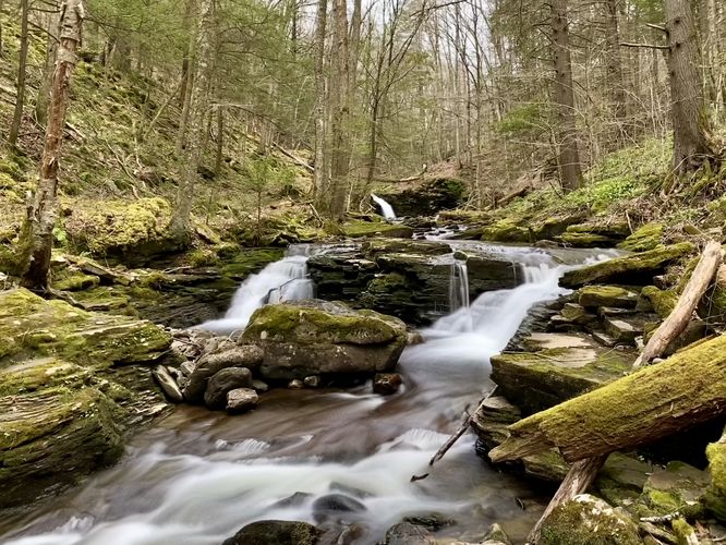
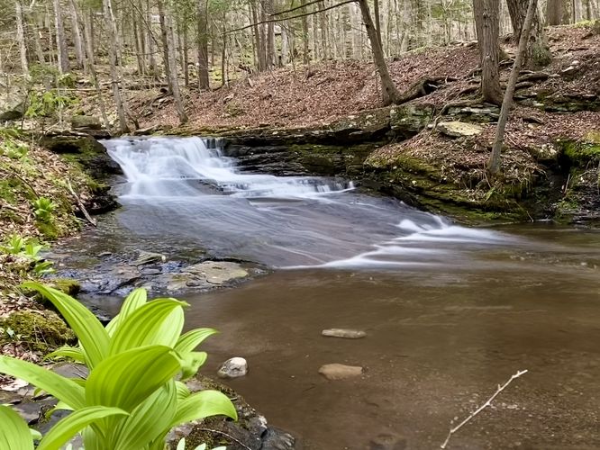
Starting around mile 0.1, hikers will begin to find small waterfalls and cascades within West Branch Double Run. The first is a ~3-foot tall waterfall that spills off of a bedrock ledge in the creek. From the viewpoint below the trail, you'll find a similar rock ledge that lines the creek, making for a nice spot to take in the scenery. Just upstream is a slide waterfall with several breakpoints that cause miniature rapids in the flow, which can be appreciated on-trail. Around mile 0.15, is a swimming hole in the creek that also includes a ~2-foot tall cascade that feeds into the crystal-clear water. Just beyond the swimming hole is a ~4-foot tall slide waterfall that provides another nice place to take a break along the trail. Around mile 0.18, hikers will find "Double Cascades", two 3-foot tall split waterfalls that spill down around the bedrock within the creek with a view of Cottonwood Falls upstream.
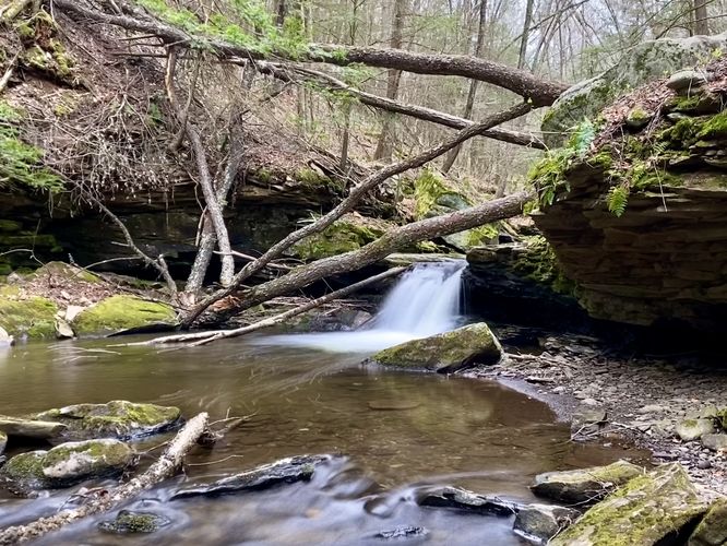
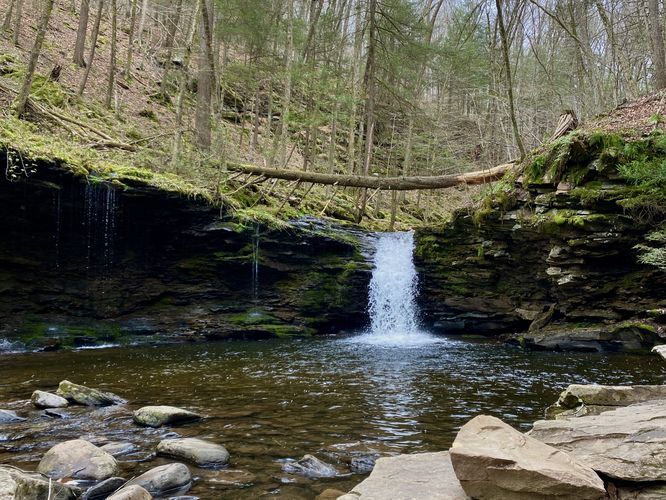
Cottonwood Falls - Mile 0.25
At mile 0.25, hikers will find the short spur trail that leads to the base of the pool that Cottonwood Falls spills into. The waterfall is approximately 13-feet tall from the top of the bedrock and spills over an amphitheater rock ledge covered in moss and ferns. During wet months, the amphitheater rock ledge can be found trickling with water seeping out from the surrounding mountainsides and into the pool below, adjacent to Cottonwood Falls. This is a great spot to take a short break along the hike and take in the sights of Cottonwood Falls, however, due to the terrain there's not a ton of room to sit around.
Upper Cottonwood Falls - Mile 0.3
Just uphill and around the bend from Cottonwood Falls is a ~5-foot tall waterfall nicknamed Upper Cottonwood Falls. This short but scenic waterfall is one of the last you'll get to enjoy on this hike, so take it in while you can.
Just beyond Upper Cottonwood Falls is a creek crossing via a footbridge (which looked new in April 2024). Just beyond the footbridge is where the hike becomes moderate as it follows several staircases up the mountainside before hitting a switchback or two. The trail eventually levels out and follows an easy grade through the forest along the southern portion of the Double Run Nature Trail.
Left-Hand Turn - Mile 0.8
Hikers will want to take a left-hand turn at mile 0.8 to follow yellow blazes downhill and back toward West Branch Double Run. Along this section of the trail, you'll follow alongside a portion of the creek which provides views to Lower Falls.
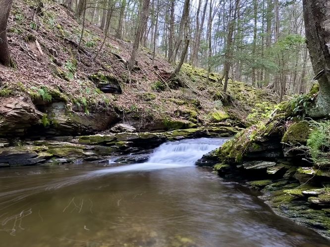
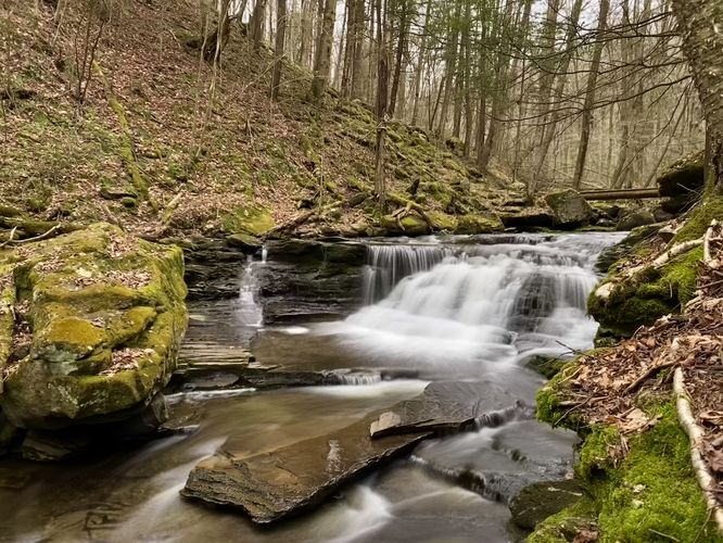
Lower Falls - Mile 0.87
Around mile 0.87, hikers will reach Lower Falls, a ~6-foot tall waterfall that includes a 2 or 3-foot tall slide. The creek is very wide here thus making this waterfall another scenic stop along the loop. This isn't the last time you'll get to enjoy Lower Falls on the hike, but the view from mile 0.87 on the south side of the creek is by far the best view of the cascade.
Left-Turn - Mile 0.95
Double Run Nature Loop will eventually meet back up with the Loyalsock Trail at mile 0.95. Take this left-hand turn to follow the Loyalsock Trail and Double Run Nature Loop back toward parking.
Lower Falls - Mile 1.05
The last stop on the hike is the same waterfall you visited earlier - Lower Falls. At mile 1.05, you'll find another viewpoint of Lower Falls from the north side of the creek located adjacent to the top of the waterfall. This is the last scenic point along the hike before you complete the loop.
After visiting Lower Falls for the 2nd and last time on this hike, complete the loop by following the LT and Double Run Nature Loop back uphill toward the spur trail you hiked in on. Take the spur trail back to parking to complete the loop for 1.2 miles.
Parking
Hikers will find a small parking turnout located on the south side of SR-3009 / Worlds End Road on the west side of the park, at the coordinates provided. As of April 2024, there's no signage, but hikers can hop on the Loyalsock Trail here. Additionally, you can start this hike for a little more mileage down PA-154 near these coordinates (41.465943,-76.5789).
Pets
Dogs are allowed only if leashed and must be cleaned up after.
Warning
Timber Rattlesnakes: This area is home to the Timber Rattlesnake which can be found roaming the forest between the end of April and early October each year. While you're unlikely to run into any rattlers, be on the lookout and give any you find plenty of space.
Trails
This hike follows two named trails in both Worlds End State Park and Loyalsock State Forest: Loyalsock Trail (LT, yellow blazes), Double Run Nature Trail (green blazes).
Hike
The trailhead listed here begins at a small parking turnout located on the south side of SR-3009 / Worlds End Road on the west side of the park. As of April 2024, there's no signage, but hikers can hop on the Loyalsock Trail here. Additionally, you can start this hike for a little more mileage down PA-154 near these coordinates (41.465943,-76.5789). Once on the Loyalsock Trail, hikers will head down following the yellow blazes for ~200-feet before taking a right-hand turn. This right-hand turn will lead you along the Double Run Nature Trail (green blazes) as it makes its way upstream along West Branch Double Run.
West Branch Double Run Waterfalls - Mile 0.1 to 0.3
Starting around mile 0.1, hikers will begin to find small waterfalls and cascades within West Branch Double Run. The first is a ~3-foot tall waterfall that spills off of a bedrock ledge in the creek. From the viewpoint below the trail, you'll find a similar rock ledge that lines the creek, making for a nice spot to take in the scenery. Just upstream is a slide waterfall with several breakpoints that cause miniature rapids in the flow, which can be appreciated on-trail. Around mile 0.15, is a swimming hole in the creek that also includes a ~2-foot tall cascade that feeds into the crystal-clear water. Just beyond the swimming hole is a ~4-foot tall slide waterfall that provides another nice place to take a break along the trail. Around mile 0.18, hikers will find "Double Cascades", two 3-foot tall split waterfalls that spill down around the bedrock within the creek with a view of Cottonwood Falls upstream.
Cottonwood Falls - Mile 0.25
At mile 0.25, hikers will find the short spur trail that leads to the base of the pool that Cottonwood Falls spills into. The waterfall is approximately 13-feet tall from the top of the bedrock and spills over an amphitheater rock ledge covered in moss and ferns. During wet months, the amphitheater rock ledge can be found trickling with water seeping out from the surrounding mountainsides and into the pool below, adjacent to Cottonwood Falls. This is a great spot to take a short break along the hike and take in the sights of Cottonwood Falls, however, due to the terrain there's not a ton of room to sit around.
Upper Cottonwood Falls - Mile 0.3
Just uphill and around the bend from Cottonwood Falls is a ~5-foot tall waterfall nicknamed Upper Cottonwood Falls. This short but scenic waterfall is one of the last you'll get to enjoy on this hike, so take it in while you can.
Just beyond Upper Cottonwood Falls is a creek crossing via a footbridge (which looked new in April 2024). Just beyond the footbridge is where the hike becomes moderate as it follows several staircases up the mountainside before hitting a switchback or two. The trail eventually levels out and follows an easy grade through the forest along the southern portion of the Double Run Nature Trail.
Left-Hand Turn - Mile 0.8
Hikers will want to take a left-hand turn at mile 0.8 to follow yellow blazes downhill and back toward West Branch Double Run. Along this section of the trail, you'll follow alongside a portion of the creek which provides views to Lower Falls.
Lower Falls - Mile 0.87
Around mile 0.87, hikers will reach Lower Falls, a ~6-foot tall waterfall that includes a 2 or 3-foot tall slide. The creek is very wide here thus making this waterfall another scenic stop along the loop. This isn't the last time you'll get to enjoy Lower Falls on the hike, but the view from mile 0.87 on the south side of the creek is by far the best view of the cascade.
Left-Turn - Mile 0.95
Double Run Nature Loop will eventually meet back up with the Loyalsock Trail at mile 0.95. Take this left-hand turn to follow the Loyalsock Trail and Double Run Nature Loop back toward parking.
Lower Falls - Mile 1.05
The last stop on the hike is the same waterfall you visited earlier - Lower Falls. At mile 1.05, you'll find another viewpoint of Lower Falls from the north side of the creek located adjacent to the top of the waterfall. This is the last scenic point along the hike before you complete the loop.
After visiting Lower Falls for the 2nd and last time on this hike, complete the loop by following the LT and Double Run Nature Loop back uphill toward the spur trail you hiked in on. Take the spur trail back to parking to complete the loop for 1.2 miles.
Parking
Hikers will find a small parking turnout located on the south side of SR-3009 / Worlds End Road on the west side of the park, at the coordinates provided. As of April 2024, there's no signage, but hikers can hop on the Loyalsock Trail here. Additionally, you can start this hike for a little more mileage down PA-154 near these coordinates (41.465943,-76.5789).
Pets
Dogs are allowed only if leashed and must be cleaned up after.
Warning
Timber Rattlesnakes: This area is home to the Timber Rattlesnake which can be found roaming the forest between the end of April and early October each year. While you're unlikely to run into any rattlers, be on the lookout and give any you find plenty of space.