The Copper Ridge Dinosaur Tracks Hike at Copper Ridge Dinosaur Trackways Interpretive Site near Moab, Utah is a moderate 0.3-mile out-and-back hike that leads to two different well-preserved dinosaur footprint tracks.
Hike Description
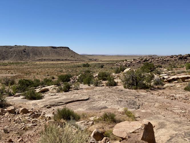
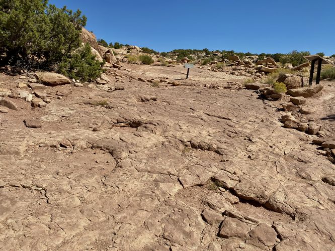
This hike begins at the main parking lot for the Copper Ridge Dinosaur Trackway and leads up the main trail, located on the western side of the parking lot, to reach the footprints. The hike is virtually uphill the entire way from the parking lot, which provides a chance to get a decent uphill workout, but it doesn't last long. Hikers will quickly find the dinosaur tracks at the top of the hill, located around mile 0.15 to 0.17.
Sauropod Dinosaur Tracks - Mile 0.15
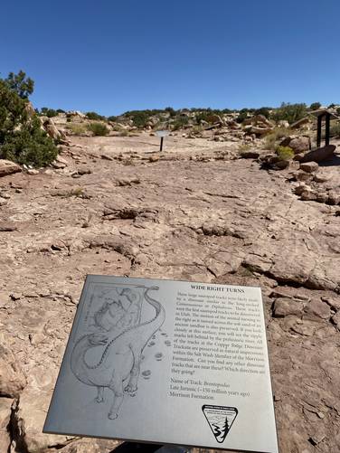
The first set of dinosaur tracks are the wide and circular-shaped tracks made by an ancient Sauropod. As quoted from the interpretive sign: "These large sauropod tacks were likely made by a dinosaur similar to the long-nacked Camarasuarus or Diplodocus. These tracks were the first sauropod tracks to be discovered in Utah. The motion of the animal turning to the right as it moved across the soft sand of an ancient sandbar is also preserved. If you look closely at this surface, you will see the ripple marks left behind by the prehistoric river. All of the tracks at Copper Ridge Dinosaur Tracksite are preserved as natural impressions within the Salt Wash Member of the Morrison Formation... Name of Track: Brontopodus, Late Jurassic (~150 million years ago), Morrison Formation."
Theropod Dinosaur Tracks - Mile 0.17
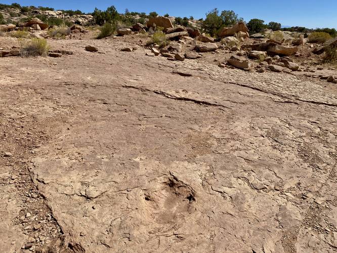
Just behind (or to the east) of the Sauropod tracks are the Theropod tracks, which are more defined in their shape with 3 large talons that extend outward from the main, ob-longed, foot portion of the track. As quoted from the interpretive sign: "Tracks of large theropod dinosaurs are relatively common in the Late Jurassic rocks in the western United States. These specific tracks are special as they represent the tracks left behind by a limping theropod (meat-eating) dinosaur, possibly Allosaurus. The right-to-left steps are shorter than the left-to-right steps, suggesting this animal was suffering from a leg injury. From these tracks we can tell that the animal was moving at a speed of 4.5 miles per hour, and was just over 7-feet tall at the hip. These are seven theropod tracks preserved in this trackway, although they are occasionally covered by debris that washed into them. Please do not attempt to remove this sediment, as this can damage the tracks. Name of Track: Hispanosauropus, Late Jurassic (~150 million years ago), Morrison Formation."
After exploring the two sets of dinosaur tracks, hikers will end their journey here and hike back down the hill to reach the parking lot for a short 0.4-mile out-and-back walk.
Parking
Hikers will find a large parking lot at the coordinates provided. The lot is large enough to fit a couple dozen vehicles.
Pets
Dogs are allowed only if leashed and must be cleaned up after.
Warnings
Sun exposure: This trail has very little shade and no water sources. Pack-in all water and wear sun screen and a hat to protect against sun exposure. It's smart to hike either in the early morning or late afternoon to avoid the intense desert sun.
No water: This trail has no water sources so you must pack-in all water. A general rule of thumb in the desert is 1 gallon of water per person per day.
Rattlesnakes: This is rattlesnake territory, so be on the lookout and give any rattlers you find plenty of space.
Hike Description
This hike begins at the main parking lot for the Copper Ridge Dinosaur Trackway and leads up the main trail, located on the western side of the parking lot, to reach the footprints. The hike is virtually uphill the entire way from the parking lot, which provides a chance to get a decent uphill workout, but it doesn't last long. Hikers will quickly find the dinosaur tracks at the top of the hill, located around mile 0.15 to 0.17.
Sauropod Dinosaur Tracks - Mile 0.15
The first set of dinosaur tracks are the wide and circular-shaped tracks made by an ancient Sauropod. As quoted from the interpretive sign: "These large sauropod tacks were likely made by a dinosaur similar to the long-nacked Camarasuarus or Diplodocus. These tracks were the first sauropod tracks to be discovered in Utah. The motion of the animal turning to the right as it moved across the soft sand of an ancient sandbar is also preserved. If you look closely at this surface, you will see the ripple marks left behind by the prehistoric river. All of the tracks at Copper Ridge Dinosaur Tracksite are preserved as natural impressions within the Salt Wash Member of the Morrison Formation... Name of Track: Brontopodus, Late Jurassic (~150 million years ago), Morrison Formation."
Theropod Dinosaur Tracks - Mile 0.17
Just behind (or to the east) of the Sauropod tracks are the Theropod tracks, which are more defined in their shape with 3 large talons that extend outward from the main, ob-longed, foot portion of the track. As quoted from the interpretive sign: "Tracks of large theropod dinosaurs are relatively common in the Late Jurassic rocks in the western United States. These specific tracks are special as they represent the tracks left behind by a limping theropod (meat-eating) dinosaur, possibly Allosaurus. The right-to-left steps are shorter than the left-to-right steps, suggesting this animal was suffering from a leg injury. From these tracks we can tell that the animal was moving at a speed of 4.5 miles per hour, and was just over 7-feet tall at the hip. These are seven theropod tracks preserved in this trackway, although they are occasionally covered by debris that washed into them. Please do not attempt to remove this sediment, as this can damage the tracks. Name of Track: Hispanosauropus, Late Jurassic (~150 million years ago), Morrison Formation."
After exploring the two sets of dinosaur tracks, hikers will end their journey here and hike back down the hill to reach the parking lot for a short 0.4-mile out-and-back walk.
Parking
Hikers will find a large parking lot at the coordinates provided. The lot is large enough to fit a couple dozen vehicles.
Pets
Dogs are allowed only if leashed and must be cleaned up after.
Warnings
Sun exposure: This trail has very little shade and no water sources. Pack-in all water and wear sun screen and a hat to protect against sun exposure. It's smart to hike either in the early morning or late afternoon to avoid the intense desert sun.
No water: This trail has no water sources so you must pack-in all water. A general rule of thumb in the desert is 1 gallon of water per person per day.
Rattlesnakes: This is rattlesnake territory, so be on the lookout and give any rattlers you find plenty of space.