The Cobble Hill Trail at Adirondack Park in Lake Placid, New York is a moderate 2.9-mile out-and-back hike that features views from the summit of Cobble Hill.
Hike
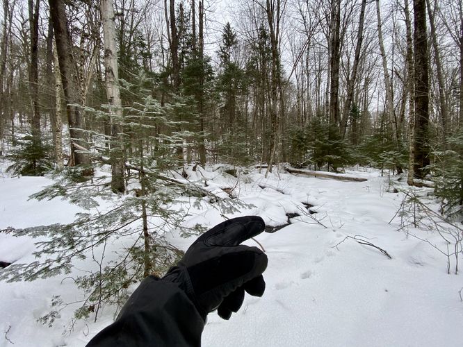
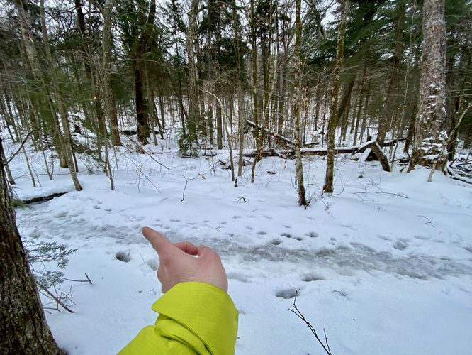
This hike begins at the less-popular Eastern trailhead for Cobble Hill, located along NY-86 Northeast of the town of Lake Placid. While lacking prominent signage for Cobble Hill, this lesser-known trailhead serves as the official route within the Saranac Lakes Wild Forest. Begin by traversing northwest into the evergreen-filled forest, then veer sharply westward, following the trail parallel to NY-86. Along the way, expect intermittent creek crossings as Cobble Hill sends its waters down the trail, which can be especially challenging during winter when the path sees fewer adventurers. Note that during our hike here in late January 2024, we were the only people on this section of the trail for what seemed like the entire winter so far.
Left-Hand Turn - Mile 0.8
At mile 0.8, hikers will reach a trail junction that leads to the summit of Cobble Hill. Take a left-hand turn here to hop onto the very-popular "main" way to hike Cobble Hill. If hiking during the winter, the trail will transition from having to break trail in the snow to likely a very icy beaten-down trail.
Ascend the main trail, encountering minor rock obstacles that pose little challenge. Delight in the transition from hardwood to evergreen surroundings, enhanced by snow-covered boughs and glimpses of exposed bedrock. As you near Cobble Hill's summit, a junction below offers an alternative, albeit steeper, ascent route.
Cobble Hill Summit - Mile 1.4
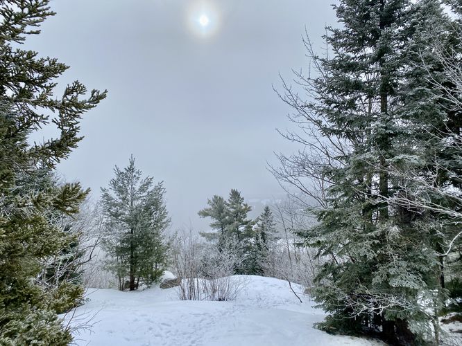
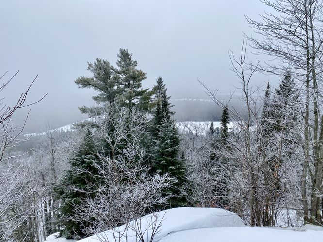
Around mile 1.4, hikers will finally reach the summit of Cobble Hill. During this hike we simply went to the highest point on the mountain which was an exposed area of bedrock that sat higher than the surrounding ground; however, most maps place the "summit" a bit Northeast of here. Just below the summit, within the exposed area, are views you'll want to checkout. While our winter hike here didn't afford sweeping vistas, clear days unveil panoramic views of Lake Placid and the High Peaks Wilderness.
After exploring the summit of Cobble Hill, this hike follows the exact but opposite hike back to parking. During the winter, hikers should be mindful of the large patches of ice and the steeper sections of trail as you descend Cobble Hill. Make sure you take the proper right-hand turn to head back to the eastern parking lot to complete the hike.
Parking
Hikers will find a small parking lot at the coordinates provided, located along NY-86. The lot is large enough to fit a half dozen vehicles or so.
Pets
Dogs are allowed if leashed and must be cleaned up after.
Hike
This hike begins at the less-popular Eastern trailhead for Cobble Hill, located along NY-86 Northeast of the town of Lake Placid. While lacking prominent signage for Cobble Hill, this lesser-known trailhead serves as the official route within the Saranac Lakes Wild Forest. Begin by traversing northwest into the evergreen-filled forest, then veer sharply westward, following the trail parallel to NY-86. Along the way, expect intermittent creek crossings as Cobble Hill sends its waters down the trail, which can be especially challenging during winter when the path sees fewer adventurers. Note that during our hike here in late January 2024, we were the only people on this section of the trail for what seemed like the entire winter so far.
Left-Hand Turn - Mile 0.8
At mile 0.8, hikers will reach a trail junction that leads to the summit of Cobble Hill. Take a left-hand turn here to hop onto the very-popular "main" way to hike Cobble Hill. If hiking during the winter, the trail will transition from having to break trail in the snow to likely a very icy beaten-down trail.
Ascend the main trail, encountering minor rock obstacles that pose little challenge. Delight in the transition from hardwood to evergreen surroundings, enhanced by snow-covered boughs and glimpses of exposed bedrock. As you near Cobble Hill's summit, a junction below offers an alternative, albeit steeper, ascent route.
Cobble Hill Summit - Mile 1.4
Around mile 1.4, hikers will finally reach the summit of Cobble Hill. During this hike we simply went to the highest point on the mountain which was an exposed area of bedrock that sat higher than the surrounding ground; however, most maps place the "summit" a bit Northeast of here. Just below the summit, within the exposed area, are views you'll want to checkout. While our winter hike here didn't afford sweeping vistas, clear days unveil panoramic views of Lake Placid and the High Peaks Wilderness.
After exploring the summit of Cobble Hill, this hike follows the exact but opposite hike back to parking. During the winter, hikers should be mindful of the large patches of ice and the steeper sections of trail as you descend Cobble Hill. Make sure you take the proper right-hand turn to head back to the eastern parking lot to complete the hike.
Parking
Hikers will find a small parking lot at the coordinates provided, located along NY-86. The lot is large enough to fit a half dozen vehicles or so.
Pets
Dogs are allowed if leashed and must be cleaned up after.