The Cliff Trail at Dick & Nancy Eales Preserve at Moosic Mountain near Jessup, Pennsylvania is an easy 0.8-mile out-and-back trail that leads to a rocky cliff view point.
This trail sits on the south side of the nature preserve and gives hikers access to the Heath Barrens Trail which sits about half-way between the parking lot and the cliff . The trail is mostly flat and follows a well-beaten path along mountain laurel and other low-growing shrubs.
Parking
Hikers will find a large parking lot at the coordinates provided. The lot is large enough to fit about a dozen vehicles as of May 2021.
Pets
Dogs are allowed if leashed and their waste must be carried out by the hiker.
Blaze Color
This trail follows purple blazes as of May 2021.
About the Heath Barrens
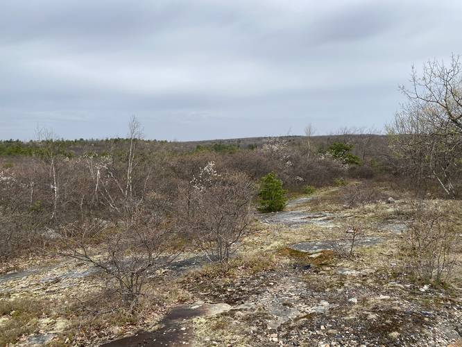
The Moosic Mountain heath barrens are made up of stunted pine and oak forests that are dominated by low-growing shrubs like blueberry, huckleberry, rhodora, and others species that affect an entire ecosystem of wildlife including birds, butterflies, deer, bear, and other native animals to Pennsylvania. Additionally, the globally-rare swallow moth and barrens buckmoth call this area home.
In 2001, The Nature Conservancy purchased 1,200 acres in the center of Moosic Mountain that were previously designated for development. With this purchase, TNC was able to protect this rare natural ecosystem.
In 2009, TNC named the preserve after Dick and Nancy Eales, whose generosity has allowed the expansion of the preserve, which today encompasses around 2,250 acres.
This trail sits on the south side of the nature preserve and gives hikers access to the Heath Barrens Trail which sits about half-way between the parking lot and the cliff . The trail is mostly flat and follows a well-beaten path along mountain laurel and other low-growing shrubs.
Parking
Hikers will find a large parking lot at the coordinates provided. The lot is large enough to fit about a dozen vehicles as of May 2021.
Pets
Dogs are allowed if leashed and their waste must be carried out by the hiker.
Blaze Color
This trail follows purple blazes as of May 2021.
About the Heath Barrens
The Moosic Mountain heath barrens are made up of stunted pine and oak forests that are dominated by low-growing shrubs like blueberry, huckleberry, rhodora, and others species that affect an entire ecosystem of wildlife including birds, butterflies, deer, bear, and other native animals to Pennsylvania. Additionally, the globally-rare swallow moth and barrens buckmoth call this area home.
In 2001, The Nature Conservancy purchased 1,200 acres in the center of Moosic Mountain that were previously designated for development. With this purchase, TNC was able to protect this rare natural ecosystem.
In 2009, TNC named the preserve after Dick and Nancy Eales, whose generosity has allowed the expansion of the preserve, which today encompasses around 2,250 acres.