The Cherry Springs Working Forest Interpretive Trail at Cherry Springs State Park in Coudersport, Pennsylvania is an easy 1.2-mile loop hike that passes through the western side of the park. This trail is also technically part of the Susquehannock State Forest, but begins at Cherry Springs.
The trail starts out at the first small parking lot after pulling into Cherry Springs State Park. There's an info sign with a map and the name of the trail, so you can become familiar with the hike before you head into the woods.
Follow the crushed stone path along the spur trail that leads to the loop. Once you reach a small utility shed, take a right-hand turn or continue straight to stay on the loop. This recording takes a right-hand turn to follow the loop counter-clockwise; however, it's easier to follow the trail clockwise.
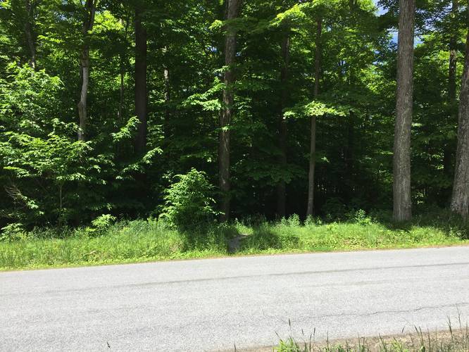
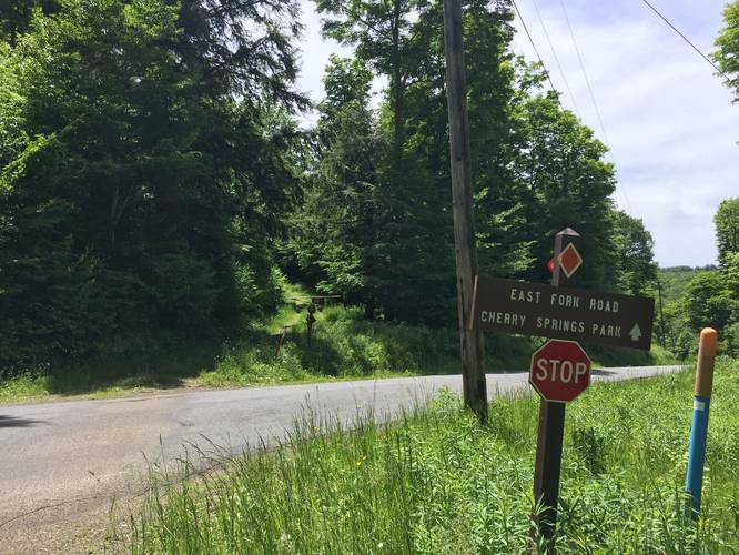
The trail will cross East Fork Rd twice - in each place, the trail is pretty obvious where it goes; however, on the southern portion of the loop is where you need to pay attention to where to go. If you're hiking this loop counter-clockwise, cross East Fork Rd and hike uphill until you reach a fork. At the fork, stay right to continue on the proper trail. About 30-feet after the fork is a left-hand turn where the trail continues - do not continue hiking straight or you'll end up getting lost.
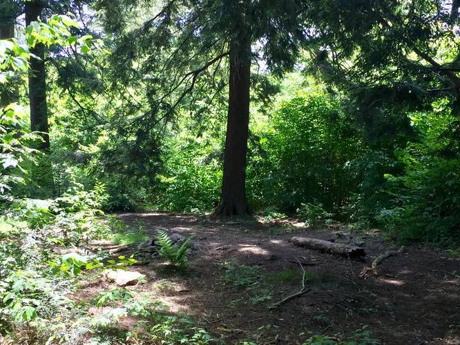
You know you're on the right trail when you see the yellow/red blazes. Continue following the blazes to complete the loop and end up back at the parking area.
Camping: There's a small campsite located half-way through the trail within the Susquehannock State Forest portion of the trail. Since the state forest allows camping, camping is also allowed on this trail, but only within the state forest area.
Blaze colors: The blaze color is a combination of yellow and red in the same blaze. The site lists out blaze color and blaze dot color - there are no blaze dots, just a combination yellow/red blaze.
Pets: Dogs are not allowed at Cherry Springs within any of the boundaries in the state park. Dogs are allowed, however, within Susquehannock State Forest - which this trail passes through. If you begin your hike outside of the state park and stay within the state forest boundaries, dogs are allowed.
The trail starts out at the first small parking lot after pulling into Cherry Springs State Park. There's an info sign with a map and the name of the trail, so you can become familiar with the hike before you head into the woods.
Follow the crushed stone path along the spur trail that leads to the loop. Once you reach a small utility shed, take a right-hand turn or continue straight to stay on the loop. This recording takes a right-hand turn to follow the loop counter-clockwise; however, it's easier to follow the trail clockwise.
The trail will cross East Fork Rd twice - in each place, the trail is pretty obvious where it goes; however, on the southern portion of the loop is where you need to pay attention to where to go. If you're hiking this loop counter-clockwise, cross East Fork Rd and hike uphill until you reach a fork. At the fork, stay right to continue on the proper trail. About 30-feet after the fork is a left-hand turn where the trail continues - do not continue hiking straight or you'll end up getting lost.
You know you're on the right trail when you see the yellow/red blazes. Continue following the blazes to complete the loop and end up back at the parking area.
Camping: There's a small campsite located half-way through the trail within the Susquehannock State Forest portion of the trail. Since the state forest allows camping, camping is also allowed on this trail, but only within the state forest area.
Blaze colors: The blaze color is a combination of yellow and red in the same blaze. The site lists out blaze color and blaze dot color - there are no blaze dots, just a combination yellow/red blaze.
Pets: Dogs are not allowed at Cherry Springs within any of the boundaries in the state park. Dogs are allowed, however, within Susquehannock State Forest - which this trail passes through. If you begin your hike outside of the state park and stay within the state forest boundaries, dogs are allowed.