Loading...

WINTER SALE! 50% OFF Supporter Accounts — now through January 31st. Learn More.

Charley's Loop Trail

Charley's Loop Trail at Purgatory Chasm State Reservation in Sutton, Massachusetts is an easy 1.3-mile loop trail featuring views of Purgatory Chasm.

The trailhead is located by the entrance to the chasm on the right-hand side. This trail, marked by yellow blazes and traverses the right-hand ledges above the chasm. Much like the Chasm Loop Trail, the yellow blazes are more of a guide in the general direction since you can walk along most of the edges within site of the trail.

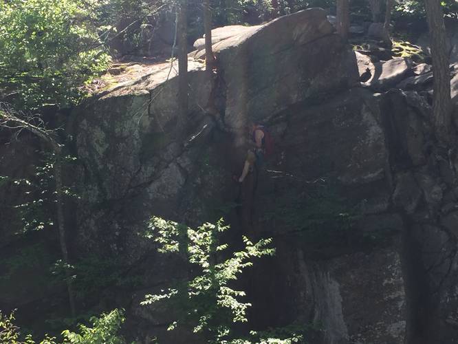
Like the other side of the chasm, there are plenty of optional scrambles and overlooks along the way. The trail loops at the end of the Chasm Loop Trail and follows a wide path sweeping out into the woods and eventually back to the trailhead. The second portion of the trail offers no overlooks, but its a wonderful walk none the less.

Parking: Parking can be found at the coordinates provided and extra lots can be found very close by.

Fees: A daily parking fee is charged Memorial Day weekend through October 31: MA resident $5, Non-MA resident $10. Credit/debit cards only.

Pets: Dogs are allowed, if leashed and their waste must be carried out.
Explore 26 trails near Sutton, MA

Know Before You Go

  • Charley's Loop Trail is an easy 1.3-mile loop in Sutton, MA, offering views of Purgatory Chasm.
  • The trail is marked with yellow blazes and features optional scrambles and overlooks along the chasm edges.
  • Parking fees apply from Memorial Day weekend through October 31 ($5 for MA residents, $10 for non-residents) and dogs are allowed on leash.
Interactive topographic map for Charley's Loop Trail located in Sutton, MA. Click the "View Map" button to load GPS coordinates and trail markers.
Get directions
Distance
1.3 mi
Difficulty
Easy
Type
Loop
Est. Time
39 min
Elev. Gain
95'
Rating
0.0
Added
June 10, 2019
Updated
June 18, 2019

Weather Forecast

Loading...
Total Change
89'
Ascent
95'
Descent
72'
Loading...

Download the GPX Data for Offline Use

Supporters get exclusive access to download trail routes to the MyHikes app for offline use. Stay prepared on your adventure, even without an internet connection! Become a Supporter today to unlock this feature and hike with confidence.

Download Charley's Loop Trail GPX Data to the MyHikes Mobile App

Features

Vista / Lookout Point
Dogs

Points of interest

  1. Parking

    42.129188, -71.714931
  2. Main Trailhead

    42.128863, -71.714908

Safety information

For your own safety: plan ahead, let someone know where you'll be, and hike at your own risk.

Markers

Blaze Color

Yellow

Availability

All seasons

Surface type

Dirt

Trip Reports (Reviews)

Your opinion matters! Be the first to rate this trail.

Ready to help fellow hikers? Add a trip report to share your experience and provide valuable insights for other hikers!

No community routes found. To add your own hike as a Community Route for this Trail guide, leave a Trip Report with an attached GPX file.

Popular categories

Scenic mountain view representing vista trails
Vista trails
Scenic gorge of cascades representing waterfall trails
Waterfall hikes
Rugged mountain terrain representing summit trails
Summit trails
Scenic mountain view representing dog-friendly trails
Dog-friendly
Scenic campsite with a view representing camping trails
Camping trails
Appalachian Trail logo representing A.T. hikes
A.T. hikes

You May Also Like

Colorado's Million Dollar Highway - Plan a day's drive adventure along the iconic Million Dollar Highway in Colorado. Explore the best short trails, roadside stops, waterfalls, vistas, ghost towns, and hot springs within a ~6 hour road trip.
Explore

Colorado's Million Dollar Highway

Plan a day's drive adventure along the iconic Million Dollar Highway in Colorado. Explore the best short trails, roadside stops, waterfalls, vistas, ghost towns, and hot springs within a ~6 hour road trip.

Read
Glacier's Going-to-the-Sun Road - Discover the breathtaking beauty of Glacier National Park along the iconic Going-to-the-Sun Road. From stunning roadside stops to picturesque waterfalls and vistas, this engineering marvel offers endless opportunities for exploration.
Explore

Glacier's Going-to-the-Sun Road

Discover the breathtaking beauty of Glacier National Park along the iconic Going-to-the-Sun Road. From stunning roadside stops to picturesque waterfalls and vistas, this engineering marvel offers endless opportunities for exploration.

Read
🍪 We use cookies to learn about site usage and to serve map tiles. You may block cookies manually in the browser. By continuing you agree. Learn more