Trail name(s)
Sargent Mountain South Ridge TrailLocation
Brown Mountain Gatehouse, Route 3, Acadia National Park, Mount Desert Isle, MainePermitted uses
Hiking, bird watching, nature study. Bicycling with a speed limit of 20mph and must yield to all other hikers or equestrians and are permitted only on carriage roads, Horseback riding is allowed on carriage roads only. Cross country skiing and snowshoeing.Prohibited uses
No Class 2 & 3 E biking, No camping, No fires, No horses or bikes on trails. No collecting of plants, rocks or animals, No feeding of wildlife. Do not build or add to any cairns along the trail. No use of drones.Hours
Parts of Acadia National Park are open year round and are open 24 hours a day. However, not all areas are accessible or staffed year round. It's best to check the park’s website and plan ahead for your visit. Follow the link below to find out if the area you want to visit is open during the time you want to visit. https://www.nps.gov/acad/planyourvisit/hours.htmFees and Parking
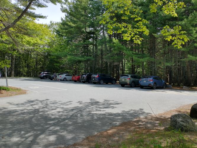
There is a parking lot for this trailhead at the Brown Mountain Gatehouse. Alternatively, hikers are able to access this trailhead by use of the Free Acadia Shuttle Island Explorer bus as there is a bus stop at this parking area. The free shuttle service runs from May 20 Mid August and is available to all visitors with a valid Acadia National Park entrance pass. For more information on the use of the Island Explorer, visit the link below: https://www.nps.gov/acad/planyourvisit/island-explorer.htm There is a lot of room for parking at the trailhead with room for at least a dozen cars. There is a fee to enter Acadia National Park. The fee schedule can be found at the park’s website or by following this link: https://www.nps.gov/acad/planyourvisit/fees.htmPets
Dogs are allowed on the trails and must be kept on a leash that is not longer than 6 feet. This is a Federal law. Pets waste must be properly disposed of by the owner.Accessibility
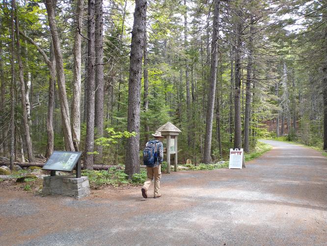
This hike is not wheelchair accessible and is going to be difficult for anyone with mobility challenges and balance problems.Hiker amenities: There is a gender neutral bathroom at the trailhead and a bear proof trash bin. There is an information kiosk with a posted map.
Length and Trail information
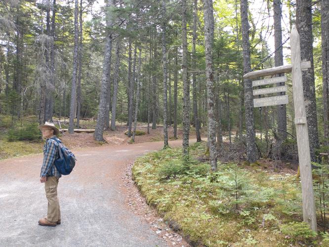
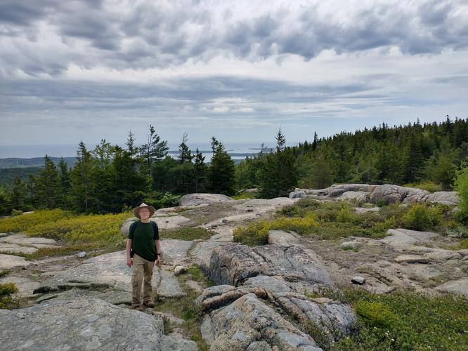
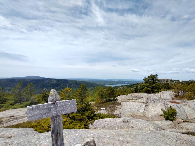
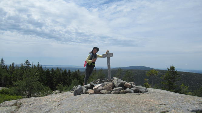
This hike was done as an out and back hike that was approximately 4.3 miles in length and is considered to be a moderate hike. The trail is marked by a blue blaze. Our goal for this hike was to reach the 942 foot summit of Cedar Swamp Mountain, see the views and enjoy a picnic lunch.The hike began on Carriage Road 18 followed by Carriage Road 19. Carriage roads are wide and flat with a crushed gravel substrate and horses and bicycles are allowed on them. Remember hikers need to yield to horses. The junction of the Sargent Mountain South Ridge Trail was clearly marked by an engraved wooden sign post as are all trail junctions.
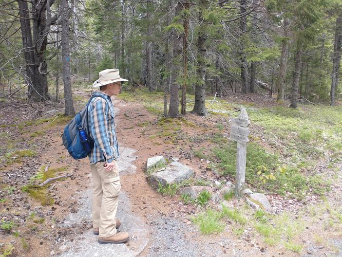
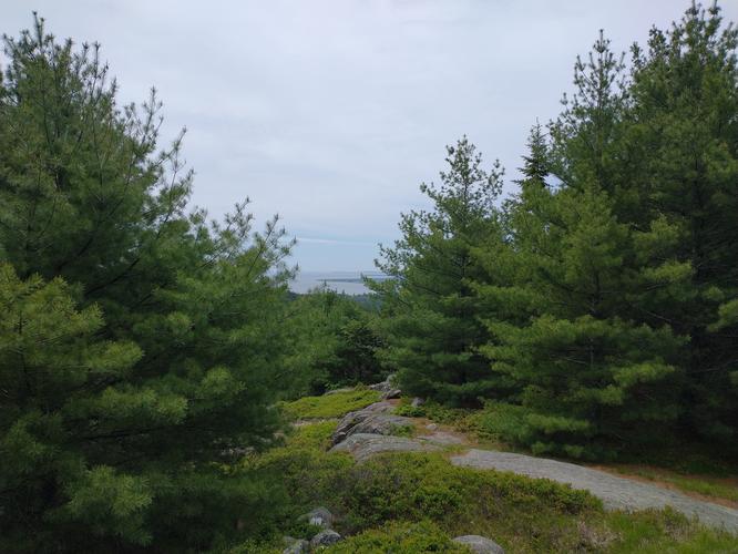
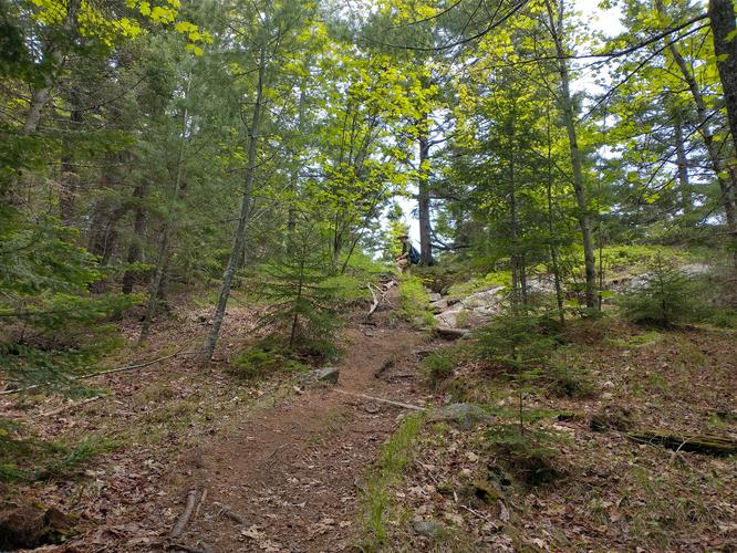
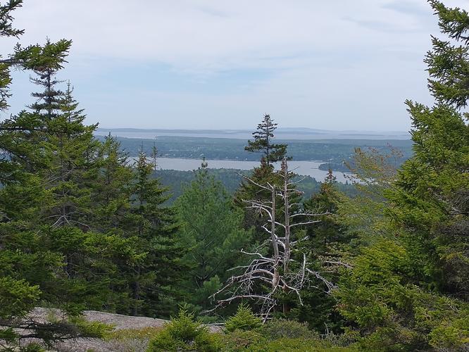
The Sargent Mountain South Ridge Trail is much narrower and more “wild” than the carriage road, and with that comes the usual trip hazards: roots, rocks and slippery pine needles. The trail was steep in sections as we traveled, but no steep sections were long in duration. We enjoyed the many birds alerting our presence on the trail and wished we were able to be on this trail when all the blueberries were ready to pick. Instead of snacking on blueberries we enjoyed the views. Even when the views are “pocket” views through the trees, they are beautiful. We were lucky to be hiking in clear weather so our views reached all the way to the ocean to what we believed was Somes Sound.
From the rocky summit of Cedar Swamp Mountain, we were able to see nearby summits of Parkman Mountain and Bald Peak. There is supposed to be a plane crash site off of this trail, however we didn't learn about this until after our hike. With some planning, this could be an interesting addition to your hike up this beautiful mountain.