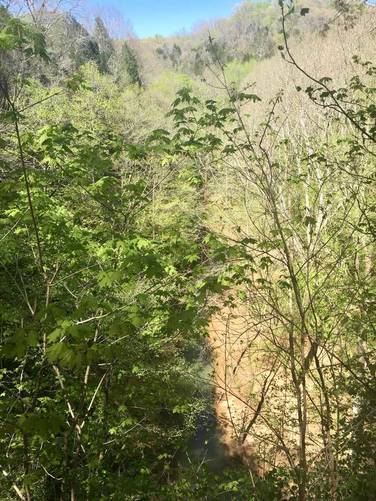
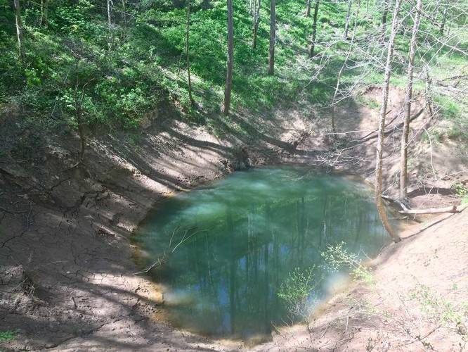
The Cedar Sink Trail at Mammoth Cave National Park in Smiths Grove, Kentucky is a moderate 1.9 mile out-and-back (lollipop) trail that leads out to a massive sinkhole, which is technically a karst window - a sinkhole where a subterrainian river emerges above ground before heading right back underground.
This trail is one of the more popular surface day hikes at Mammoth Cave National Park since you get unique views on this trail; however, if you arrive on a weekday, you can usually beat the crowds.
The trail starts off winding through a cedar forest before heading into a mix of coniferous and deciduous trees for about 0.7 miles before you hit the loop. Upon hitting the loop, if you stay to the right, you'll uncover more unique vistas along the way than heading left.
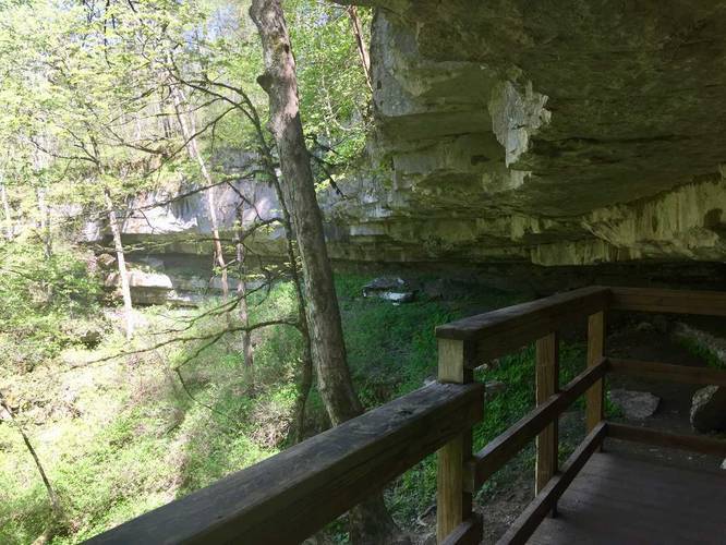
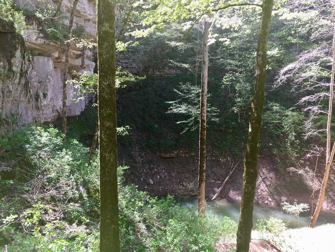
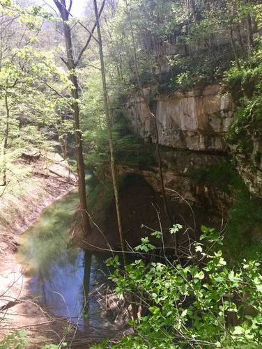
Lookout points: The first lookout point is situated high above the Karst Window - with views of the water below and an information sign. Continuing further down the trail, you'll find a metal staircase - before heading down the staircase, take a right-hand turn to find yet another lookout point high above the sinkhole. Head down the metal staircase and hike over to the river itself, further down inside of the sinkhole. Hike along another 0.1 to 0.2 miles or so to two more lookout points - one sits above the river and another lies down a spur trail behind the lookout point over the river. Make sure to head down each spur trail to make sure you're not missing any views of the sinkhole as there are at least 5 good lookout points.
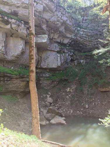
Cave Entrance: When you hike down to the river, look up along the cliff side of the sinkhole and you'll notice a large dark hole with a metal grate covering it - this is an entrance to the underground cave system which likely connects with Mammoth Cave.
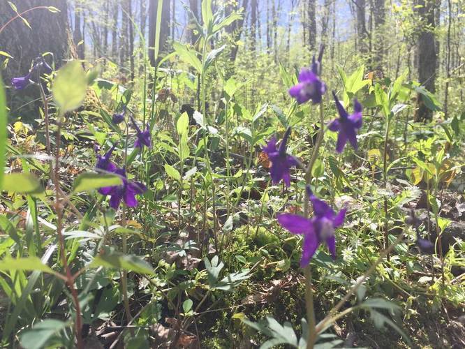
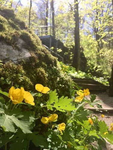
Wildflowers: This is one of the best trails at Mammoth Cave National Park to find wildflowers in the Spring. The usual flowers you'll see are Fire Pink, Celandine Poppy, Jack-in-the-Pulpit, Sessile Trillium, and Violets.
Karst Windows: Karst Windows give a glimpse into a much larger hydraulic system that lies hundreds of feet underground. And eventually the water will surface for the last time and be deposited into the Green River.
Difficulty: The elevation gain/loss on this trail is not much, but for the average hiker this trail is more moderate due to the steep elevation gain and sheer number of stairs you have to climb to get in and out of the sinkhole area.
Poison Ivy: Much like the rest of the surface trails at Mammoth Cave National Park, this trail has plenty of poison ivy to the sides of the trail. Be sure to stay on the trail.
Pets: Dogs are allowed on this trail.
This trail is one of the more popular surface day hikes at Mammoth Cave National Park since you get unique views on this trail; however, if you arrive on a weekday, you can usually beat the crowds.
The trail starts off winding through a cedar forest before heading into a mix of coniferous and deciduous trees for about 0.7 miles before you hit the loop. Upon hitting the loop, if you stay to the right, you'll uncover more unique vistas along the way than heading left.
Lookout points: The first lookout point is situated high above the Karst Window - with views of the water below and an information sign. Continuing further down the trail, you'll find a metal staircase - before heading down the staircase, take a right-hand turn to find yet another lookout point high above the sinkhole. Head down the metal staircase and hike over to the river itself, further down inside of the sinkhole. Hike along another 0.1 to 0.2 miles or so to two more lookout points - one sits above the river and another lies down a spur trail behind the lookout point over the river. Make sure to head down each spur trail to make sure you're not missing any views of the sinkhole as there are at least 5 good lookout points.
Cave Entrance: When you hike down to the river, look up along the cliff side of the sinkhole and you'll notice a large dark hole with a metal grate covering it - this is an entrance to the underground cave system which likely connects with Mammoth Cave.
Wildflowers: This is one of the best trails at Mammoth Cave National Park to find wildflowers in the Spring. The usual flowers you'll see are Fire Pink, Celandine Poppy, Jack-in-the-Pulpit, Sessile Trillium, and Violets.
Karst Windows: Karst Windows give a glimpse into a much larger hydraulic system that lies hundreds of feet underground. And eventually the water will surface for the last time and be deposited into the Green River.
Difficulty: The elevation gain/loss on this trail is not much, but for the average hiker this trail is more moderate due to the steep elevation gain and sheer number of stairs you have to climb to get in and out of the sinkhole area.
Poison Ivy: Much like the rest of the surface trails at Mammoth Cave National Park, this trail has plenty of poison ivy to the sides of the trail. Be sure to stay on the trail.
Pets: Dogs are allowed on this trail.