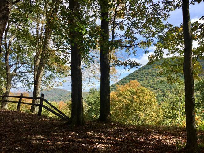
The Castle Vista Trail at Ole Bull State Park in Cross Fork, Pennsylvania is a moderate 0.7-mile out-and-back trail that features a beautiful overlook with views of the surrounding mountains.
This short trail follows a wide and well-maintained path from the Ole Bull memorial up to the lookout point of Nordjeuskald, which is the formal name for this vista. The hike uphill is not easy for inexperienced hikers and is certainly moderate for experienced hikers; however, the climb up is not very far and well worth the trek.
Along the way, there are a few trails that lead off from this one, but hikers can follow the signs easily to stay along the Castle Vista Trail. Once at the vista point, hikers will find the old foundation for Ole Bull's "castle", which was never fully built. A couple of benches can be found at the lookout point as well, so hikers can rest before heading back downhill.
After visiting the lookout point, hike back down the trail to one last spur trail that leads to the retaining wall for Ole Bull's "castle". This short, but very steep trail, leads to two places - one, to the retaining wall, and two, to the vista point again. If hikers really want to see the retaining wall, the trail is barely maintained and contains a lot of pricker bushes closer to the wall.
History
Ole Bornemann Bull (1810 - 1880), a once-famous Norwegian violinist, relocated a colony of fellow Norwegians near the site in September 1852. From this vantage point (Nordjeuskald), Ole Bull started to build his castle, but this large wooden cabin was never completed. All that remains today is the foundation and a stone retaining wall along the mountainside. The colony disbanded and moved west after a year of severe hardships.
Parking
Parking can be found on the opposite side of Kettle Creek in a parking lot that fits about four or five vehicles.
Blaze Colors
The blaze color for this trail is yellow and blue. The blaze marker is half yellow and half blue.
Pets
Dogs are allowed if on leash and their waste must be carried out by the hiker.
Biking
Mountain biking is allowed along the entire trail, except for the loop-portion that heads over to the vista point.
Warning
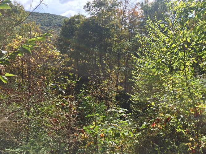
Sometimes hikers can find snakes along the trail. During Autumn, they can blend in with the leaves.
This short trail follows a wide and well-maintained path from the Ole Bull memorial up to the lookout point of Nordjeuskald, which is the formal name for this vista. The hike uphill is not easy for inexperienced hikers and is certainly moderate for experienced hikers; however, the climb up is not very far and well worth the trek.
Along the way, there are a few trails that lead off from this one, but hikers can follow the signs easily to stay along the Castle Vista Trail. Once at the vista point, hikers will find the old foundation for Ole Bull's "castle", which was never fully built. A couple of benches can be found at the lookout point as well, so hikers can rest before heading back downhill.
After visiting the lookout point, hike back down the trail to one last spur trail that leads to the retaining wall for Ole Bull's "castle". This short, but very steep trail, leads to two places - one, to the retaining wall, and two, to the vista point again. If hikers really want to see the retaining wall, the trail is barely maintained and contains a lot of pricker bushes closer to the wall.
History
Ole Bornemann Bull (1810 - 1880), a once-famous Norwegian violinist, relocated a colony of fellow Norwegians near the site in September 1852. From this vantage point (Nordjeuskald), Ole Bull started to build his castle, but this large wooden cabin was never completed. All that remains today is the foundation and a stone retaining wall along the mountainside. The colony disbanded and moved west after a year of severe hardships.
Parking
Parking can be found on the opposite side of Kettle Creek in a parking lot that fits about four or five vehicles.
Blaze Colors
The blaze color for this trail is yellow and blue. The blaze marker is half yellow and half blue.
Pets
Dogs are allowed if on leash and their waste must be carried out by the hiker.
Biking
Mountain biking is allowed along the entire trail, except for the loop-portion that heads over to the vista point.
Warning
Sometimes hikers can find snakes along the trail. During Autumn, they can blend in with the leaves.