The Cameron Overlook Hike within Cameron State Forest in Cameron, New York is an easy 3.3-mile out-and-back hike that features beautiful views of the Canisteo River and the surrounding canyon hills.
Hike
This hike begins at the main trailhead located on the corner of W Cameron Road within Cameron State Forest and heads downhill following the main trail which also acts as a service road. The trail bends around a corner before it meets up with a junction, located around mile 0.15 -- here, keep left (hiking in) to follow the service road / gas line trail as it heads due-South.
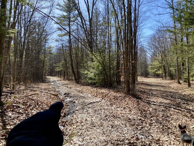
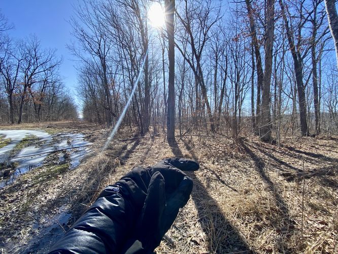
Once on the gas line trail / service road, hikers will meander in and out of evergreen and deciduous forests as the path interchanges from dry to wet sections. During our winter February hike here, it was ~20 degrees (F) outside, so most of the ground was frozen but we still hit plenty of muddy sections. During the Summer or wet months, these muddy/wet sections might be a lot worse. The trail begins to climb a small hill before hikers approach the spur trails that lead to the canyon's edge with views of the Canisteo River and West Cameron, New York.
Vista Spur Trail #1 - Mile 1.45
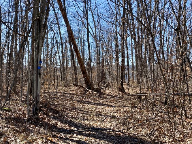
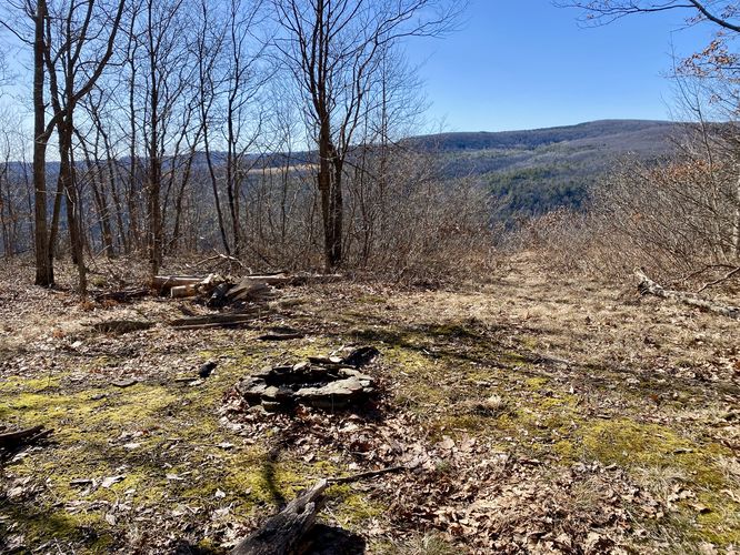
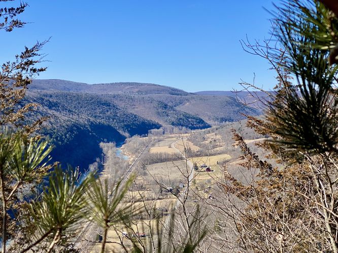
Around mile 1.45, hikers will reach a right-hand turn with blue trail markers on both sides of the first spur trail. This path leads out to the canyon's edge - passing a campsite - to reach views of the Canisteo River. Hikers can carefully walk down to the steep canyon cliff's edge to find views of West Cameron, the Canisteo River, and evergreen-lined hills that surround this wide canyon valley. There's also a small campsite located just before the vista, so backpackers have a spot to setup camp if they wish.
Vista Spur Trail #2 (Obstructed Views) - Mile 1.63
After exploring the first view and spur trail, hikers may want to explore the next one; however, be warned that the views you'll get are obstructed and if you don't care to see the same view from a different perspective, you can just skip this portion of the hike. Regardless, at mile 1.63, hikers will find a similar spur trail that leads to the canyon's edge. This one does not have a campsite, but has enough room for one. At the dead-end of the spur, hikers can very carefully walk down to the edge of the cliff near a grouping of white pine trees to find an obstructed view of the canyon, as seen through the pine branches.
After exploring the views of West Cameron, the Canisteo River, and the surrounding canyon hills, hikers will want to head back to parking following the same as an out-and-back. The hike back is easy with some uphill sections along the way -- none of which last very long, hence the easy difficulty rating. Remember to keep-right at the large service road junction to ensure you make it back to the parking lot.
Universal Access for Disabled (Permit-Required)
This trail and the trails that leads out to the views are universally-accessible (via ATVs) only to disabled persons that hold a valid permit from the State of New York. The permit allows disabled persons to ride ATVs along the trail. The northern view path is also ATV friendly for this reason. Please do not drive any vehicle on the trail unless you're a permit holder.
Parking
Hikers will find a parking turnout (semi-circle dirt road) at the corner of W Cameron Road, at the coordinates provided. The turnout is large enough to fit a half-dozen vehicles at most.
Pets
Dogs are allowed if leashed and must be cleaned up after.
Camping & Backpacking
A campsite can be found at the 1st spur trail overlook / vista. If planning to camp or backpack, please follow all state forest rules & regulations.
Hike
This hike begins at the main trailhead located on the corner of W Cameron Road within Cameron State Forest and heads downhill following the main trail which also acts as a service road. The trail bends around a corner before it meets up with a junction, located around mile 0.15 -- here, keep left (hiking in) to follow the service road / gas line trail as it heads due-South.
Once on the gas line trail / service road, hikers will meander in and out of evergreen and deciduous forests as the path interchanges from dry to wet sections. During our winter February hike here, it was ~20 degrees (F) outside, so most of the ground was frozen but we still hit plenty of muddy sections. During the Summer or wet months, these muddy/wet sections might be a lot worse. The trail begins to climb a small hill before hikers approach the spur trails that lead to the canyon's edge with views of the Canisteo River and West Cameron, New York.
Vista Spur Trail #1 - Mile 1.45
Around mile 1.45, hikers will reach a right-hand turn with blue trail markers on both sides of the first spur trail. This path leads out to the canyon's edge - passing a campsite - to reach views of the Canisteo River. Hikers can carefully walk down to the steep canyon cliff's edge to find views of West Cameron, the Canisteo River, and evergreen-lined hills that surround this wide canyon valley. There's also a small campsite located just before the vista, so backpackers have a spot to setup camp if they wish.
Vista Spur Trail #2 (Obstructed Views) - Mile 1.63
After exploring the first view and spur trail, hikers may want to explore the next one; however, be warned that the views you'll get are obstructed and if you don't care to see the same view from a different perspective, you can just skip this portion of the hike. Regardless, at mile 1.63, hikers will find a similar spur trail that leads to the canyon's edge. This one does not have a campsite, but has enough room for one. At the dead-end of the spur, hikers can very carefully walk down to the edge of the cliff near a grouping of white pine trees to find an obstructed view of the canyon, as seen through the pine branches.
After exploring the views of West Cameron, the Canisteo River, and the surrounding canyon hills, hikers will want to head back to parking following the same as an out-and-back. The hike back is easy with some uphill sections along the way -- none of which last very long, hence the easy difficulty rating. Remember to keep-right at the large service road junction to ensure you make it back to the parking lot.
Universal Access for Disabled (Permit-Required)
This trail and the trails that leads out to the views are universally-accessible (via ATVs) only to disabled persons that hold a valid permit from the State of New York. The permit allows disabled persons to ride ATVs along the trail. The northern view path is also ATV friendly for this reason. Please do not drive any vehicle on the trail unless you're a permit holder.
Parking
Hikers will find a parking turnout (semi-circle dirt road) at the corner of W Cameron Road, at the coordinates provided. The turnout is large enough to fit a half-dozen vehicles at most.
Pets
Dogs are allowed if leashed and must be cleaned up after.
Camping & Backpacking
A campsite can be found at the 1st spur trail overlook / vista. If planning to camp or backpack, please follow all state forest rules & regulations.