This section of the Cactus Wren Trail at Saguaro National Park is a 1 mile out-and-back hike from Signal Hill and north into the Saguaro National Park backcountry.
This trail technically runs for a couple of miles north and eventually ends at the northwest corner at the edge of Saguaro National Park; however, if you're looking for a short hike with great views beyond Signal Hill, this hike is for you.
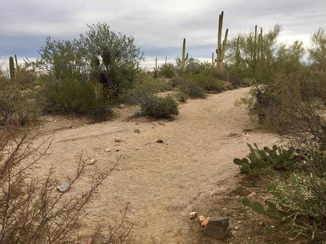
The trailhead can be found at the top of Signal Hill, so you'll need to hike in on that first. The trail immediately descends from Signal Hill and then climbs another small hill right after. As you descend from the 2nd hill, the trail meanders by cacti and desert brush before reaching an intersection with a wash - or temporary creek. When you reach the wash crossing, head directly across the trail to find the continuation of the Cactus Wren Trail - it can be a bit tricky.
Hike the trail for as little or as long as you'd like - the views are generally the same once the trail levels out.
Views: The best views along this trail can be found on the immediate uphill climb after descending from Signal Hill, so you don't need to go far to get great views.
This trail technically runs for a couple of miles north and eventually ends at the northwest corner at the edge of Saguaro National Park; however, if you're looking for a short hike with great views beyond Signal Hill, this hike is for you.
The trailhead can be found at the top of Signal Hill, so you'll need to hike in on that first. The trail immediately descends from Signal Hill and then climbs another small hill right after. As you descend from the 2nd hill, the trail meanders by cacti and desert brush before reaching an intersection with a wash - or temporary creek. When you reach the wash crossing, head directly across the trail to find the continuation of the Cactus Wren Trail - it can be a bit tricky.
Hike the trail for as little or as long as you'd like - the views are generally the same once the trail levels out.
Views: The best views along this trail can be found on the immediate uphill climb after descending from Signal Hill, so you don't need to go far to get great views.