Buzzards Rock Overlook Trail
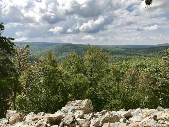
This trail is as long or as short as you want to make it, but it's essentially just a couple hundred feet. After you park, you'll notice a small trail to the south of the parking lot that leads down into a boulder field/rockfall. You can get better pictures of the mountains from this lookout point compared to the parking lot.
You can venture further down the boulders and follow other small trails around the lookout, but you don't need to go much further than 0.1 miles total to get great views here.
Know Before You Go
Interactive topographic map for Buzzards Rock Overlook Trail located in Shippensburg, PA. Click the "View Map" button to load GPS coordinates and trail markers.
View map
Get directions
- Distance
- 0.1 mi
- Difficulty
- Easy
- Type
- Out-and-Back
- Est. Time
- 5 min
- Elev. Gain
- 0'
- Rating
- 0.0
- Added
- September 18, 2017
- Updated
- November 27, 2017
Weather Forecast
Don't let Google decide who you trust.


Loading...
<strong>Trail map and elevation chart not rendering in print mode?</strong> Simply scroll to the trail map section, then try printing again!
Total Change
27 ft.
8 m
8 m
Ascent
0 ft.
0 m
0 m
Descent
0 ft.
0 m
0 m
Loading...
Features
- Vista / Lookout Point
Points of interest
-
Parking
40.03783, -77.384565 -
Main Trailhead
40.037662, -77.384813 -
Buzzards Rock Overlook
40.037508, -77.384865
Safety information
For your own safety: plan ahead, let someone know where you'll be, and hike at your own risk.
Availability
All seasons
Surface type
Dirt
Trip Reports (Reviews)
Ready to help fellow hikers? Add a trip report to share your experience!
No community routes found. To add your own hike as a Community Route for this Trail guide, leave a Trip Report with an attached GPX file.


You may also like

Explore
Pennsylvania's Grand Canyon
Explore Pennsylvania's Grand Canyon, officially named Pine Creek Gorge, including hiking trails, vistas, overlooks, waterfalls, backcountry campsites, backpacking trails.

Explore
New York's Best Waterfalls
Whether you're planning a day hike, roadside stop, or a leisurely short walk, this guide provides hikers, travelers, and locals alike with 63 different locations to over 100 scenic waterfalls to help plan your next adventure!

Explore
25 Best Day Hikes in West Virginia
Discover 25 of the best day hikes in West Virginia, from scenic overlooks to wilderness trails—perfect for every level of hiker.

Explore
Best of the Alps: Hiking, Adventure & Scenery
Plan your ultimate European Alps adventure! Discover the best hiking trails, epic scenery, and villages in the Swiss Alps, Dolomites, Chamonix, and Lake Como.
michaux state forest

