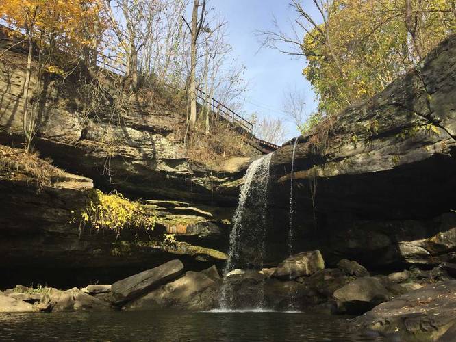
The Buttermilk Falls Trail at Buttermilk Falls Park in Beaver Falls, Pennsylvania is an easy 0.3 mile out-and-back hike to Buttermilk Falls which is also known as Homewood Falls. The waterfall is about 35 to 40 feet high that runs year-round, so this hike is great for any season.
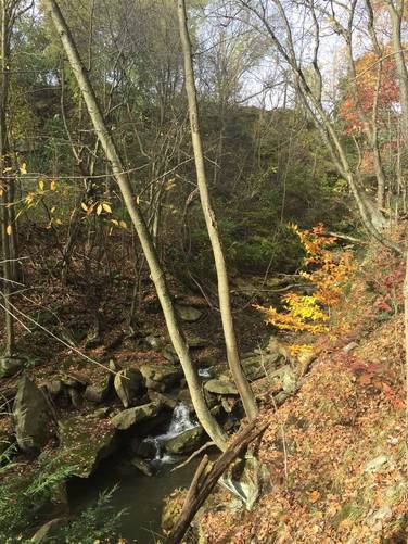
The trail starts out from the parking lot by heading downhill into an old quarry before heading up stairs which leads over to the falls. To your left is the creek that Buttermilk Falls feeds into and there are small waterfalls right off of the trail at the trailhead. To your right is the old quarry - you can see where the the sandstone was mined out. This sandstone was primarily used in the construction of the Western Penitentiary in Pittsburgh, which is located just off of the western end of the Northshore Riverfront Trail.
The GPS data provided here brings you from parking, over to the falls, and then out on a separate trail that runs along the ridge of one of the quarry's cliffs. The cliff is only about 20 feet high, so it's good to watch your step here.
This is likely one of the best waterfall hikes outside of Pittsburgh, PA.