The Buttermilk Falls via Mister Roger's Pathway at the Buttermilk Falls Natural Area in New Florence, PA, is an easy 0.4 mile loop hike that brings you down to the waterfall.
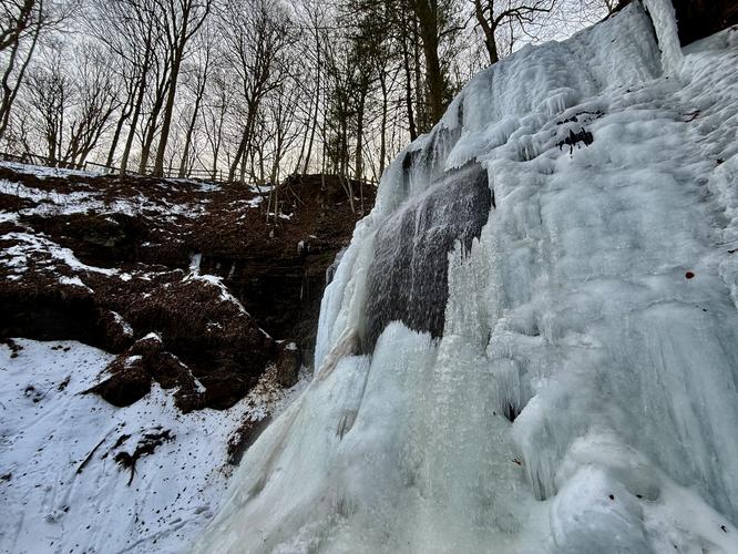
At approximately 46-feet tall, Buttermilk Falls is the tallest waterfall in western Pennsylvania and is a popular destination for locals, folks living in the Greater Pittsburgh Area, and road trip travelers alike.
This area was previously owned by Fred McFeely, grandfather of Fred Rogers. There's a lookout area above the waterfall and in 2017 a ramp was built leading down to the base of the falls; however, this recording does not reflect those updates yet.