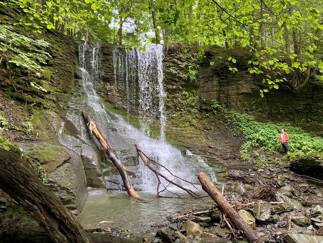
Bucktail Falls in Preble, New York is an easy 0.1-mile out-and-back walk that leads to the 25-foot tall waterfall, Bucktail Falls.
Walk Description
This is not a hike and barely a walk, as Bucktail Falls can be enjoyed right from the parking turn-out; however, for those willing to explore around the creek, this is a beautiful spot to take a short walk. Bucktail Falls spills over bedrock that appears to have been carved out by mining activity, likely in the late 1800's or earl 1900's. Hikers can walk right up to the base of the waterfall or walk around the creek below to get a different perspective.
Parking
There's a tiny parking turn-out at the coordinates provided along Moon Hill Road; however, it's only large enough to fit 1 vehicle as of July 2023. Please be respectful of this private neighborhood and only park along turn-outs on Moon Hill Road that can accommodate your vehicle, assuming the 1 parking turn-out for the waterfall is full.
Pets
Dogs are allowed if leashed and should be cleaned up after.