Bubb and Sis Lakes Trail at Adirondack Park near Old Forge, New York is an easy 2.1-mile out-and-back hike that features views of Bubb and Sis Lakes, a campsite, and neat boulders.
Hike
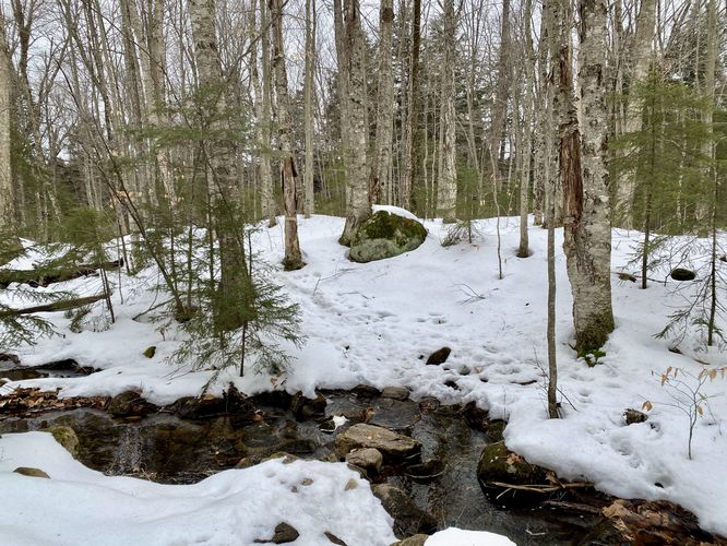
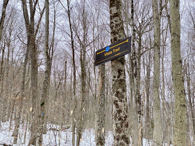
This hike begins along NY-28 North of Old Forge at the coordinates provided and heads-in along the Bubb and Sis Lakes Trail. As of January 2024, there was one small sign near the trailhead labeled "Sis and Bub Lakes" which is pretty easy to miss. The trail begins by heading uphill along an easy grade, passing one large blowdown tree along the way. Hikers will pass a trail labeled "Vista Trail" with blue blazes around mile 0.15 which provides additional exploration and likely views of Fourth Lake. The trail then levels out after the first quarter mile and begins to undulate its way out to Bubb Lake first. On the hike to Bubb Lake, hikers will find one very easy creek crossing.
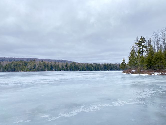
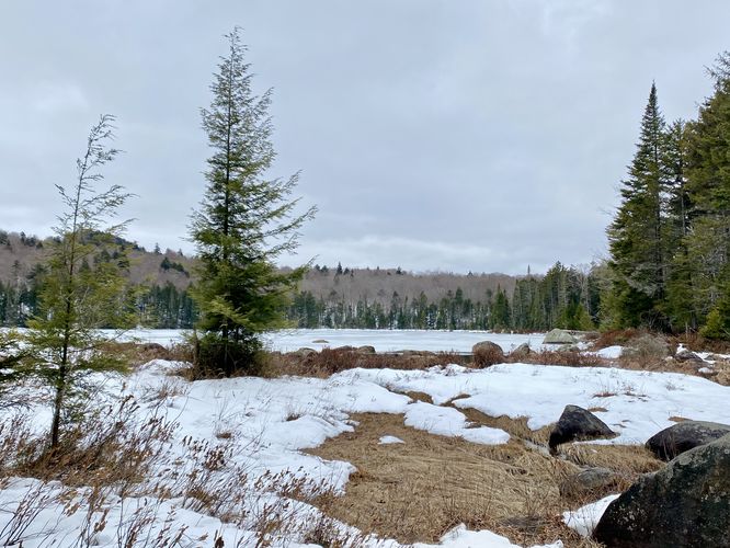
View of Bubb Lake - Mile 0.5
At mile 0.5, hikers will reach an off-trail view of Bubb Lake. To reach it, ignore the "Trail" sign with an arrow pointing left -- hike straight out to reach the view. From the shores of Bubb Lake, you can take in the scenery of the evergreen-dotted forest that surrounds the lake.
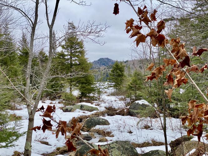
Continuing onward from the first view at Bubb Lake, hikers will cross another easy creek crossing before hiking uphill once again to follow an undulating trail. Along the way, you'll also pass at least one large boulder that appeared to be pretty decent for boulder climbing.
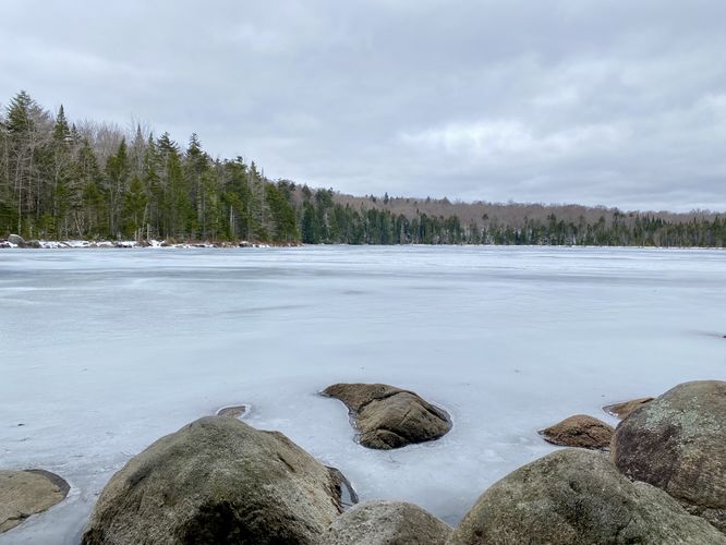
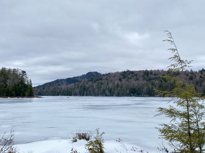
View of Sis Lake - Mile 0.9
After passing yet another "Trail" arrow sign, hikers will find a beautiful view of Sis Lake at mile 0.9. Here, you can take in the views of the smaller but still scenic Sis Lake. Sis Lake feeds into Bubb Lake within a connecting channel a bit further North from here.
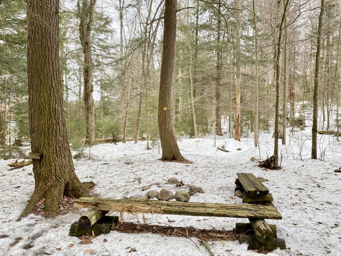
Campsite & View - Mile 1.1
Around mile 1.1 hikers will reach a campsite on the eastern side of the trail. Here, you can also bushwhack through the forest for 100-feet or less to reach another beautiful view of Bubb Lake, including a neighboring hill as the backdrop.
Just beyond the campsite is a boardwalk that crosses the connecting channel between Sis and Bubb Lakes. Don't miss the opportunity to stroll along the boardwalk crossing the connecting channel between Sis and Bubb Lakes, offering yet another perspective of the landscape -- especially during the winter. Beyond the boardwalk is where this hike ends, but the trail continues. Hikers can head back to parking to complete this easy 2.1-mile out-and-back hike.
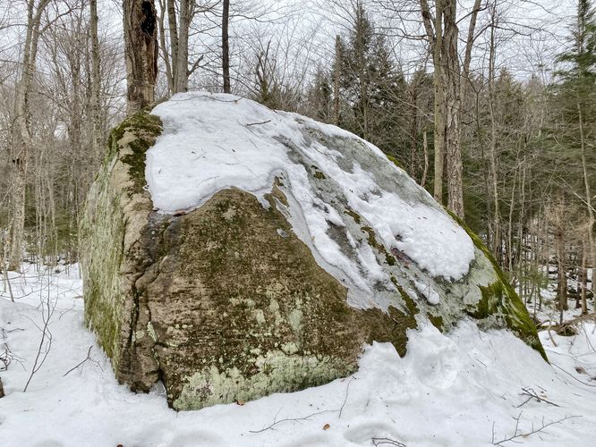
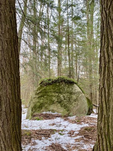
Fern Toupée Rock
On your way out, keep your eye out for fern toupée rock -- a large boulder adorned with ferns resembling a haircut or toupée.
Parking
Hikers will find two parking turnouts for this hike - both located along the north side of NY-28. The parking coordinates here will bring you to the eastern-most parking lot. If you miss it, you can park down the street just a bit west of there. Both lots are very large and can fit at least a dozen vehicles each.
Pets
Dogs are allowed only if leashed and must be cleaned up after.
Camping & Backpacking
Camping is permitted at designated campsites along this trail. Please follow all state park rules and regulations when primitive or backcountry camping.
Hike
This hike begins along NY-28 North of Old Forge at the coordinates provided and heads-in along the Bubb and Sis Lakes Trail. As of January 2024, there was one small sign near the trailhead labeled "Sis and Bub Lakes" which is pretty easy to miss. The trail begins by heading uphill along an easy grade, passing one large blowdown tree along the way. Hikers will pass a trail labeled "Vista Trail" with blue blazes around mile 0.15 which provides additional exploration and likely views of Fourth Lake. The trail then levels out after the first quarter mile and begins to undulate its way out to Bubb Lake first. On the hike to Bubb Lake, hikers will find one very easy creek crossing.
View of Bubb Lake - Mile 0.5
At mile 0.5, hikers will reach an off-trail view of Bubb Lake. To reach it, ignore the "Trail" sign with an arrow pointing left -- hike straight out to reach the view. From the shores of Bubb Lake, you can take in the scenery of the evergreen-dotted forest that surrounds the lake.
Continuing onward from the first view at Bubb Lake, hikers will cross another easy creek crossing before hiking uphill once again to follow an undulating trail. Along the way, you'll also pass at least one large boulder that appeared to be pretty decent for boulder climbing.
View of Sis Lake - Mile 0.9
After passing yet another "Trail" arrow sign, hikers will find a beautiful view of Sis Lake at mile 0.9. Here, you can take in the views of the smaller but still scenic Sis Lake. Sis Lake feeds into Bubb Lake within a connecting channel a bit further North from here.
Campsite & View - Mile 1.1
Around mile 1.1 hikers will reach a campsite on the eastern side of the trail. Here, you can also bushwhack through the forest for 100-feet or less to reach another beautiful view of Bubb Lake, including a neighboring hill as the backdrop.
Just beyond the campsite is a boardwalk that crosses the connecting channel between Sis and Bubb Lakes. Don't miss the opportunity to stroll along the boardwalk crossing the connecting channel between Sis and Bubb Lakes, offering yet another perspective of the landscape -- especially during the winter. Beyond the boardwalk is where this hike ends, but the trail continues. Hikers can head back to parking to complete this easy 2.1-mile out-and-back hike.
Fern Toupée Rock
On your way out, keep your eye out for fern toupée rock -- a large boulder adorned with ferns resembling a haircut or toupée.
Parking
Hikers will find two parking turnouts for this hike - both located along the north side of NY-28. The parking coordinates here will bring you to the eastern-most parking lot. If you miss it, you can park down the street just a bit west of there. Both lots are very large and can fit at least a dozen vehicles each.
Pets
Dogs are allowed only if leashed and must be cleaned up after.
Camping & Backpacking
Camping is permitted at designated campsites along this trail. Please follow all state park rules and regulations when primitive or backcountry camping.