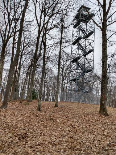
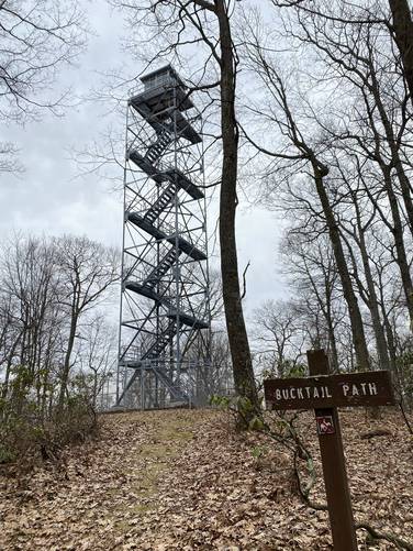
Exploring the Brooks Run Fire Tower in Lumber Township, Pennsylvania is the trace recording of this hike, which is an easy 1.9-mile out-and-back trek. This 9-story platform tower supported by steel framework on concrete piers is listed as 80-foot in height and sits at a base elevation of 2,380 feet on Brook Mountain overlooking the Sinnemahoning State Park.
Fire towers were popular in the early 1900s as the primary way for spotting wildfires. Perched high on the mountain top, these manned towers provided an excellent view point for smoke columns and flames. There is still an operational fire tower at the top of Brooks Run along the Bucktail Path in Elk State Forest in Cameron County. There is a gated road that tracks from the Brooks Run Road to the summit of Brook Mountain (elevation 2,380 feet) that is used by the Forest Service to access the fire tower.
Trails
The trails hiked along this route include the gated and unmarked Brooks Run Tower access road that runs to the Brooks Run Tower site from the parking area.
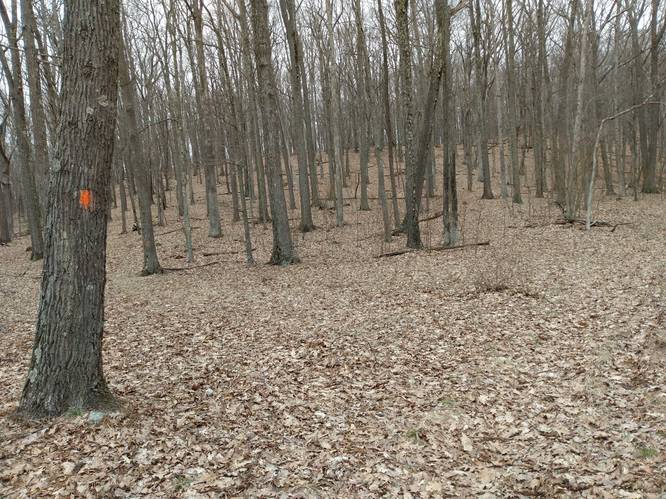
Simply follow the orange blazes of the Bucktail Path Trail (blazed orange) as it winds its way away from the tower site back to the parking area.
Length and Difficulty
The Brooks Run Tower access road out-and-back, is about 1.9-miles from start to finish. The difficulty should still be considered easy along the paths, but there is a bit of constant uphill in either direction once the service road meets the Bucktail Path.
At about one-half mile into the hike the hiker crosses a natural gas pipeline. Do not follow this pipeline on this hike. Hikers can use the service road and the Bucktail Path to make a lollipop loop or even an figure-8 loop. For the figure-8 option, stay on the Bucktail Path to cross over the service road on the return route, and continue on the Bucktail Path until to it comes to the Brooks Run Road then turn right on Brooks Run Road toward the Ridge Road intersection, to find the parking area.
Parking
Hikers can find parking at the coordinates provided; next to the trailhead, at the intersection of Brooks Run Road with Ridge Road. It is important not park in front of the gate across the Brooks Run Tower Road, which would block authorized vehicles from using the state forest road.
Pets
Dogs are allowed if leashed.
Camping and Backpacking
Backpackers are allowed to camp off-trail only within the Elk State Forest section of this route. Backpackers need to follow the state forest rules and regulations for dispersed / primitive / backcountry camping.
The Bucktail Path Trail is by far the best place to camp in this area; and it would be best for the camper to park at another designation parking area for any extended hikes or overnight camping trips. A good parking spot for extended hikes is the nearby Pepper Hill trailhead located at: 41.39971, -78.115492 along Ridge Road.
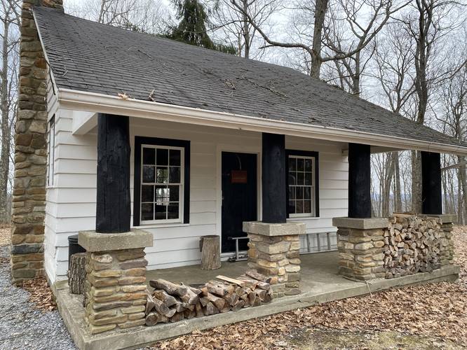
Forest Service Cabin with Outdoor Water Source and Restroom Faculty
There is a small Cabin at the tower site, presumably for use by the Forest Service who monitor from the tower during times when danger of wildfires in Pennsylvania occur. There were no Forest Service personnel on-site at the time of this hike.
There is an operational hand water pump outside the cabin. A sign clearly states that "The water has not been Tested". Hikers can use water filters to obtain drinkable water at this water source.
There is a latched but not locked outdoor restroom faculty accessible by hikers near the cabin.
Access to climb the fire tower is not allowed.
Biking
Biking is only permitted along the service road, but makes for a quick out-and-back bike ride.
Fire towers were popular in the early 1900s as the primary way for spotting wildfires. Perched high on the mountain top, these manned towers provided an excellent view point for smoke columns and flames. There is still an operational fire tower at the top of Brooks Run along the Bucktail Path in Elk State Forest in Cameron County. There is a gated road that tracks from the Brooks Run Road to the summit of Brook Mountain (elevation 2,380 feet) that is used by the Forest Service to access the fire tower.
Trails
The trails hiked along this route include the gated and unmarked Brooks Run Tower access road that runs to the Brooks Run Tower site from the parking area.
Simply follow the orange blazes of the Bucktail Path Trail (blazed orange) as it winds its way away from the tower site back to the parking area.
Length and Difficulty
The Brooks Run Tower access road out-and-back, is about 1.9-miles from start to finish. The difficulty should still be considered easy along the paths, but there is a bit of constant uphill in either direction once the service road meets the Bucktail Path.
At about one-half mile into the hike the hiker crosses a natural gas pipeline. Do not follow this pipeline on this hike. Hikers can use the service road and the Bucktail Path to make a lollipop loop or even an figure-8 loop. For the figure-8 option, stay on the Bucktail Path to cross over the service road on the return route, and continue on the Bucktail Path until to it comes to the Brooks Run Road then turn right on Brooks Run Road toward the Ridge Road intersection, to find the parking area.
Parking
Hikers can find parking at the coordinates provided; next to the trailhead, at the intersection of Brooks Run Road with Ridge Road. It is important not park in front of the gate across the Brooks Run Tower Road, which would block authorized vehicles from using the state forest road.
Pets
Dogs are allowed if leashed.
Camping and Backpacking
Backpackers are allowed to camp off-trail only within the Elk State Forest section of this route. Backpackers need to follow the state forest rules and regulations for dispersed / primitive / backcountry camping.
The Bucktail Path Trail is by far the best place to camp in this area; and it would be best for the camper to park at another designation parking area for any extended hikes or overnight camping trips. A good parking spot for extended hikes is the nearby Pepper Hill trailhead located at: 41.39971, -78.115492 along Ridge Road.
Forest Service Cabin with Outdoor Water Source and Restroom Faculty
There is a small Cabin at the tower site, presumably for use by the Forest Service who monitor from the tower during times when danger of wildfires in Pennsylvania occur. There were no Forest Service personnel on-site at the time of this hike.
There is an operational hand water pump outside the cabin. A sign clearly states that "The water has not been Tested". Hikers can use water filters to obtain drinkable water at this water source.
There is a latched but not locked outdoor restroom faculty accessible by hikers near the cabin.
Access to climb the fire tower is not allowed.
Biking
Biking is only permitted along the service road, but makes for a quick out-and-back bike ride.