The Broad Brook - Fitzgerald Lake Greenway Loop at the Fitzgerald Lake Conservation Area in Northampton, Massachusetts is an easy 2.4-mile wooded hike with views of Fitzgerald Lake.
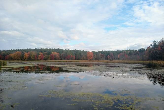
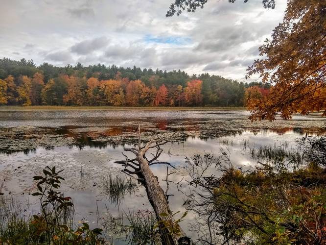
Here you will find one of the most ecologically rich areas of Northampton, consisting of nearly 300 acres of rocky woodlands, extensive wetlands, and abandoned fields. Drawing people and wildlife alike to its prominent feature —the lake—this public space includes an accessible paved path, wooden bridge, and boardwalk, that leads through a marsh to a canoe launch.
This accessible trail starts off flat and runs for a short distance beofre you take a right onto a boardwalk that passes through marshland and juts into the lake. Returning to the trail from the lookout spur trail, go right over the bridge and bear right to follow a short loop trail to the water’s edge and back to the main trail.
At the intersection follow the blue-blazed trail to the right (a red-blazed trail leads left), then turn right on a trail that brings you to the lakeside where you can often find ducks, otter, or beaver. Return to the main trail and turn right. As you pass through a rocky outcropping, notice the split rock. Continuing through the wooded terrain, bear right at a sharp intersection and follow the lakeside trail to the earthen dam. A footpath across the top of the dam’s short embankment provides an open view westward across the lake. Retrace your steps back to the intersection and follow the upper loop, a red-blazed hillside trail, that meanders up and down through the woods. At the intersection, turn right and retrace your steps to the bridge and bench you passed on the way in.
Partner: Kestrel Land Trust partners with the City and friends groups to create, conserve, and care for public lands to help everyone connect with nature. The conservation lands here are owned by the City and portions are monitored by Kestrel through a Conservation Restriction. Broad Brook Coalition maintains the trails and habitat.