The Bristlecone Loop Trail at Bryce Canyon National Park near Bryce Canyon City, Utah is an easy 1.2-mile loop hike that features 1,800-year old Bristlecone Pine trees along with stunning views from the Bryce Canyon rim.
Hike
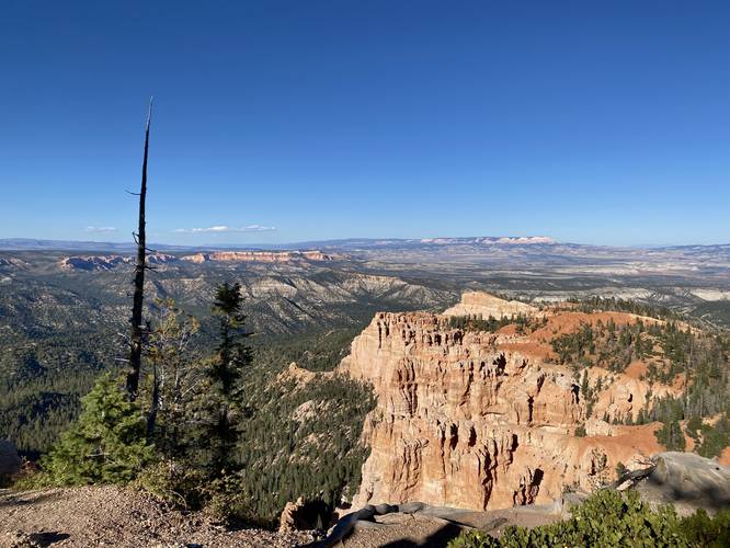
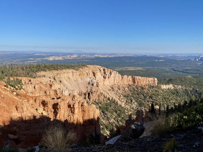
This hike begins at the main large parking lot for Rainbow Point and heads out along the Bristlecone Loop Trail for just one-hundred feet or so before reaching some really nice views of Bryce Canyon - facing northeast from the rim. Hikers will want to take a stop along these views either on the way in, way out, or both to get the most out of this hike.
Loop, Keep Right - Mile 0.1
Around mile 0.1, hikers will reach a junction in the trail. Here, the GPS data brings hikers along a counter-clockwise route, keeping right at the fork. This saves more views for last. After taking this right-hand turn, hikers will be walking through an undulating forest full of pine trees with a mostly-open forest floor.
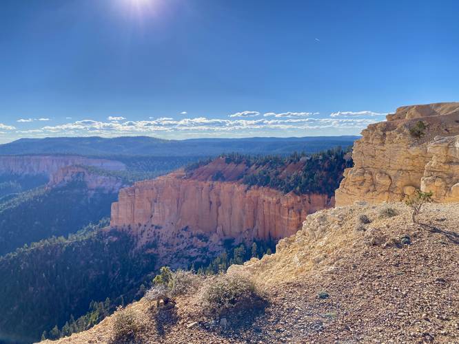
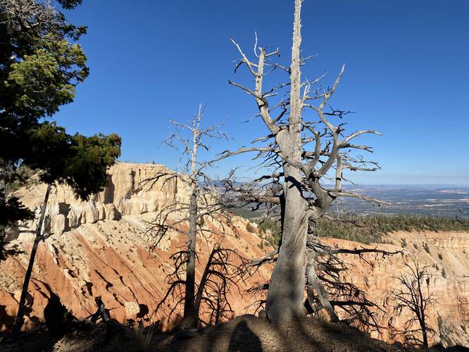
Cliff Edge, Views Open Up - Mile 0.5 to 0.6
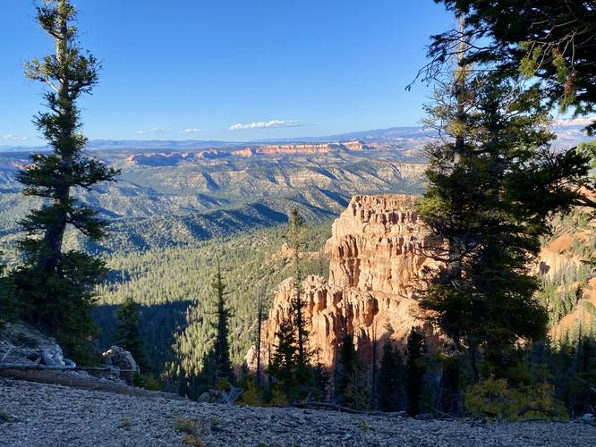
Around mile 0.5, hikers will reach the cliff's edge with a danger/warning sign telling folks to keep on-trail. Here, the views - facing southward - begin to open up along the steep canyon's cliff. For the next 500-feet or so, hikers will get different southward-facing views of Bryce Canyon.
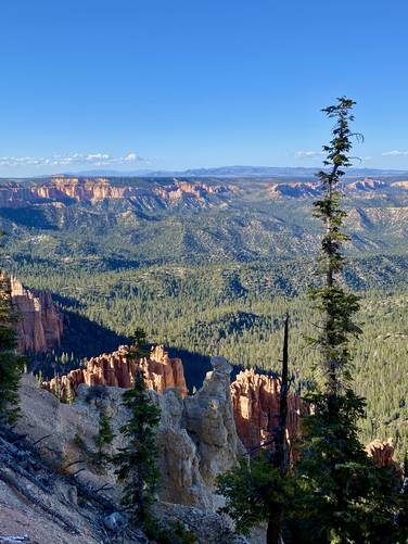
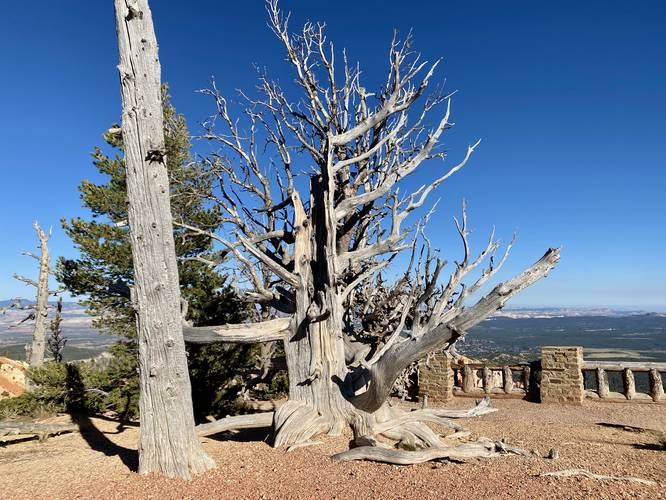
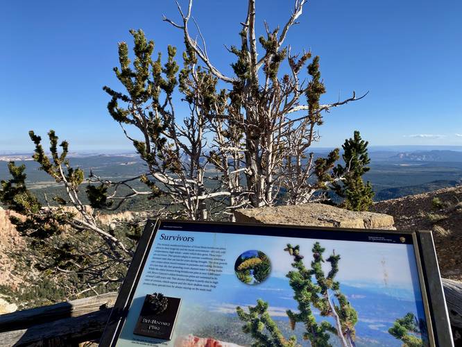
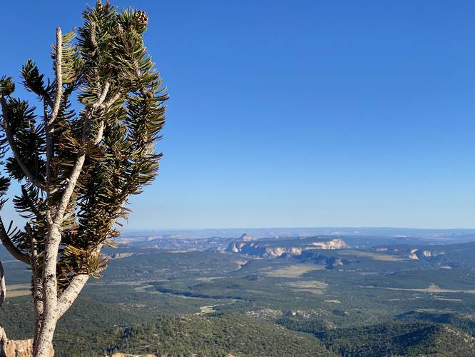
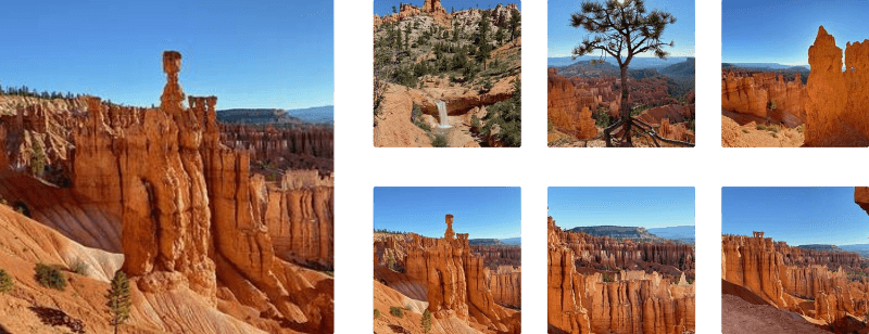
Bristlecone Pine Trees & Views - Mile 0.6
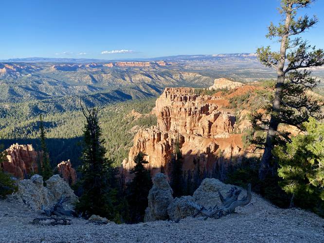
At mile 0.6, located at the very tip of the loop's southern end lie the 1,000-year-old (or more) Bristlecone Pines. The trailhead's signage mentioned some of these trees are over 1,000 years old while the park brochure says some are about 1,800-years old. While these are not the oldest Bristlecone Pine Trees in the world, they are extremely old. Bristlecone Pines also have the ability to lie dormant for many years when droughts hit, which ultimately slows their growth and prolongs their age; however, it was not clear to us on our hike which Bristlecone Pine Trees were dormant or which might actually be dead, so we assumed most of the gray-bark non-pine-needle Bristlecones may have just been dormant during our visit in September 2023. From the Bristlecone Pines, hikers will get more stunning, southward-facing views from Bryce Canyon's upper rim. Take in the views or take a closer look at the ancient Bristlecone Pines before you head back.
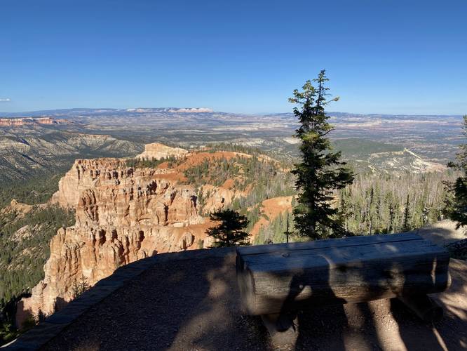
Viewpoint - Mile 0.7
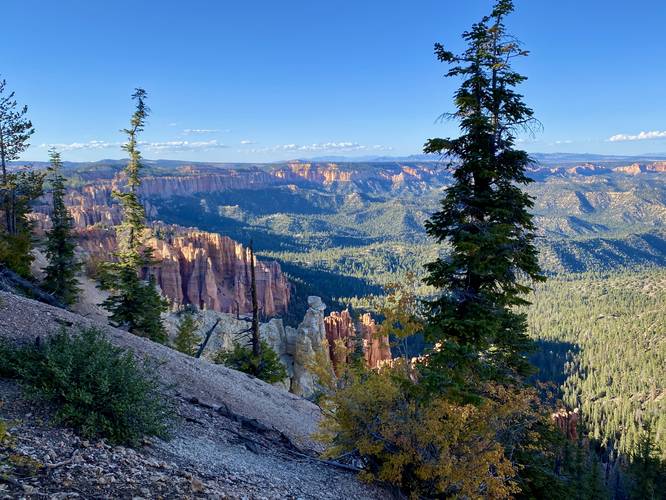
Around mile 0.7, after continuing the loop, hikers will reach another viewpoint from high above Bryce Canyon's rim - mostly facing southward once again. There's a small information kiosk and shelter located here to get out of the sun if you wish.
Hiking Out with Views - Mile 0.7 to 1.2
The hike out from the information kiosk/hut around mile 0.7 does not have a whole lot to offer hikers aside from some obstructed views into the canyon through a patch of forest that was hit by disease, which helped clear the view. Just before the hike is over, however, hikers will find more views of Bryce Canyon from the east side of the trail - the same views you passed on the way in - which are worthy of another stop before you leave the trail.
Fees
Bryce Canyon National Park has a $35/week entry fee as of September 2023. Visitors are highly encouraged to purchase an annual National Parks pass before their trip to reduce entry fees (especially if you're passing through multiple parks) and to also speed-up the very-long line that leads into the park.
Parking
Visitors will find a large parking lot at the coordinates provided.
Pets
Dogs are not allowed on this trail.
Hike
This hike begins at the main large parking lot for Rainbow Point and heads out along the Bristlecone Loop Trail for just one-hundred feet or so before reaching some really nice views of Bryce Canyon - facing northeast from the rim. Hikers will want to take a stop along these views either on the way in, way out, or both to get the most out of this hike.
Loop, Keep Right - Mile 0.1
Around mile 0.1, hikers will reach a junction in the trail. Here, the GPS data brings hikers along a counter-clockwise route, keeping right at the fork. This saves more views for last. After taking this right-hand turn, hikers will be walking through an undulating forest full of pine trees with a mostly-open forest floor.
Cliff Edge, Views Open Up - Mile 0.5 to 0.6
Around mile 0.5, hikers will reach the cliff's edge with a danger/warning sign telling folks to keep on-trail. Here, the views - facing southward - begin to open up along the steep canyon's cliff. For the next 500-feet or so, hikers will get different southward-facing views of Bryce Canyon.
Bristlecone Pine Trees & Views - Mile 0.6
At mile 0.6, located at the very tip of the loop's southern end lie the 1,000-year-old (or more) Bristlecone Pines. The trailhead's signage mentioned some of these trees are over 1,000 years old while the park brochure says some are about 1,800-years old. While these are not the oldest Bristlecone Pine Trees in the world, they are extremely old. Bristlecone Pines also have the ability to lie dormant for many years when droughts hit, which ultimately slows their growth and prolongs their age; however, it was not clear to us on our hike which Bristlecone Pine Trees were dormant or which might actually be dead, so we assumed most of the gray-bark non-pine-needle Bristlecones may have just been dormant during our visit in September 2023. From the Bristlecone Pines, hikers will get more stunning, southward-facing views from Bryce Canyon's upper rim. Take in the views or take a closer look at the ancient Bristlecone Pines before you head back.
Viewpoint - Mile 0.7
Around mile 0.7, after continuing the loop, hikers will reach another viewpoint from high above Bryce Canyon's rim - mostly facing southward once again. There's a small information kiosk and shelter located here to get out of the sun if you wish.
Hiking Out with Views - Mile 0.7 to 1.2
The hike out from the information kiosk/hut around mile 0.7 does not have a whole lot to offer hikers aside from some obstructed views into the canyon through a patch of forest that was hit by disease, which helped clear the view. Just before the hike is over, however, hikers will find more views of Bryce Canyon from the east side of the trail - the same views you passed on the way in - which are worthy of another stop before you leave the trail.
Fees
Bryce Canyon National Park has a $35/week entry fee as of September 2023. Visitors are highly encouraged to purchase an annual National Parks pass before their trip to reduce entry fees (especially if you're passing through multiple parks) and to also speed-up the very-long line that leads into the park.
Parking
Visitors will find a large parking lot at the coordinates provided.
Pets
Dogs are not allowed on this trail.