Bridal Veil Falls Trail at Bridal Veil Falls Park in Provo, Utah is an easy universally-accessible 1-mile out-and-back hike that leads to the 607-foot tall, multi-tiered waterfall, Bridal Veil Falls.
Hike Description
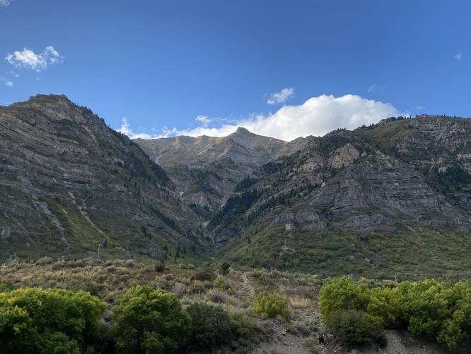
This short hike begins at the southern-most parking lot at Bridal Veil Falls Park, located off of Provo Canyon Road and follows the universally-accessible paved trail north as it leads through Provo Canyon and alongside the Provo River. The trail itself is flat and makes for easy walking, but watch out for bicycles as this is also a very-popular bike trail.
Bridal Veil Falls Viewpoint - Mile 0.4
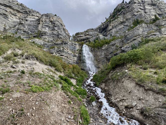
At mile 0.4, hikers will reach a viewing point of Bridal Veil Falls from the based of the waterfall. From here, you get the best view of the waterfall with some glimpses of Upper Bridal Veil Falls above the main cascade. The waterfall is stunning and massive - difficult for the brain to wrap around the 607-foot height. At the base of the falls, you'll likely find other people hanging out, taking photos, or just enjoying the cascade. Here, the hiker can choose to head out for a 0.8-mile hike or follow some difficult, steep, and somewhat sketchy rocky trails up to the "true" base of the waterfall. During this hike, we attempted reaching the base, but decided against that plan and thus hiked out from the steep trails.
Parking
Hikers can find parking at the coordinates provided, located at the southern end of the park along Provo Canyon Road. If you're not up for a 1-mile walk and simply want to hit the falls super fast, you can also park at the base of the waterfall at (40.340872,-111.602861) which provides views of the waterfall from the parking lot.
Hours
As of September 2023, Bridal Veil Falls Park is closed from 11PM to 5AM daily. Thus is open from 5AM to 10:59PM.
Pets
Dogs are allowed only if leashed and cleaned up after.
Warnings
Rockfalls: The steep slopes and cliffs of Bridal Veil Falls also provide an area where rockfalls can happen at any time. While the trail is set further back from potential falling rock, it's smart to be aware of this danger.
Snow-melt undermining: In the Spring, snow melt can cause undermining of snowfields which can be dangerous to hike on as the hiker doesn't know how thin the snow is or how far down it might plunge below. Sometimes this trail is closed in early Spring due to avalanches and snow-melt undermining.
Hike Description
This short hike begins at the southern-most parking lot at Bridal Veil Falls Park, located off of Provo Canyon Road and follows the universally-accessible paved trail north as it leads through Provo Canyon and alongside the Provo River. The trail itself is flat and makes for easy walking, but watch out for bicycles as this is also a very-popular bike trail.
Bridal Veil Falls Viewpoint - Mile 0.4
At mile 0.4, hikers will reach a viewing point of Bridal Veil Falls from the based of the waterfall. From here, you get the best view of the waterfall with some glimpses of Upper Bridal Veil Falls above the main cascade. The waterfall is stunning and massive - difficult for the brain to wrap around the 607-foot height. At the base of the falls, you'll likely find other people hanging out, taking photos, or just enjoying the cascade. Here, the hiker can choose to head out for a 0.8-mile hike or follow some difficult, steep, and somewhat sketchy rocky trails up to the "true" base of the waterfall. During this hike, we attempted reaching the base, but decided against that plan and thus hiked out from the steep trails.
Parking
Hikers can find parking at the coordinates provided, located at the southern end of the park along Provo Canyon Road. If you're not up for a 1-mile walk and simply want to hit the falls super fast, you can also park at the base of the waterfall at (40.340872,-111.602861) which provides views of the waterfall from the parking lot.
Hours
As of September 2023, Bridal Veil Falls Park is closed from 11PM to 5AM daily. Thus is open from 5AM to 10:59PM.
Pets
Dogs are allowed only if leashed and cleaned up after.
Warnings
Rockfalls: The steep slopes and cliffs of Bridal Veil Falls also provide an area where rockfalls can happen at any time. While the trail is set further back from potential falling rock, it's smart to be aware of this danger.
Snow-melt undermining: In the Spring, snow melt can cause undermining of snowfields which can be dangerous to hike on as the hiker doesn't know how thin the snow is or how far down it might plunge below. Sometimes this trail is closed in early Spring due to avalanches and snow-melt undermining.