Loading...

WINTER SALE! 50% OFF Supporter Accounts — now through January 31st. Learn More.

Orange Blaze Loop Trail

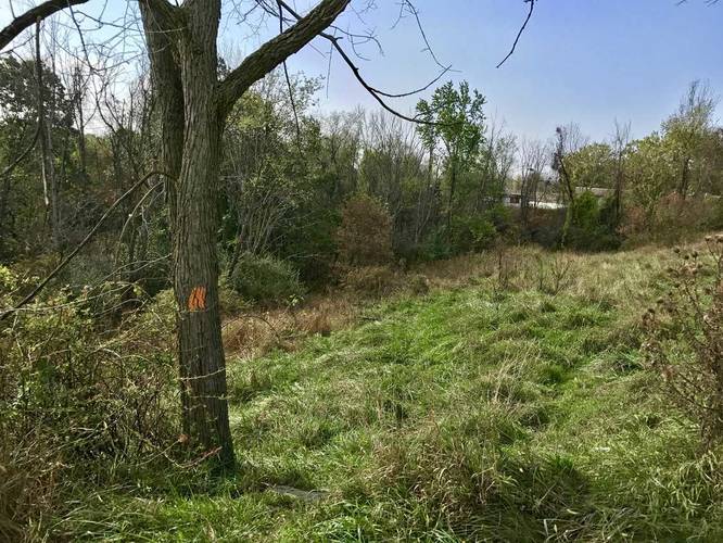
The Orange Blaze Loop Trail at Boyce Park in Monroeville, Pennsylvania is an easy 1.2 mile loop hike that brings you through the southern end of the park. The loop starts at the southwest corner of the parking lot - follow the trail towards the edge of the park and follow the fence line.

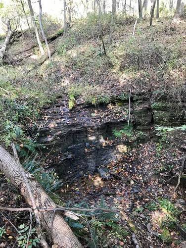
About half way through the trail is a waterfall, about 7 to 8 feet tall, but you can't access it very easily. To get to it, you'll have to hike down a small hill off the trail - you can see this tiny section in the GPS data provided along with the picture marker for the falls.

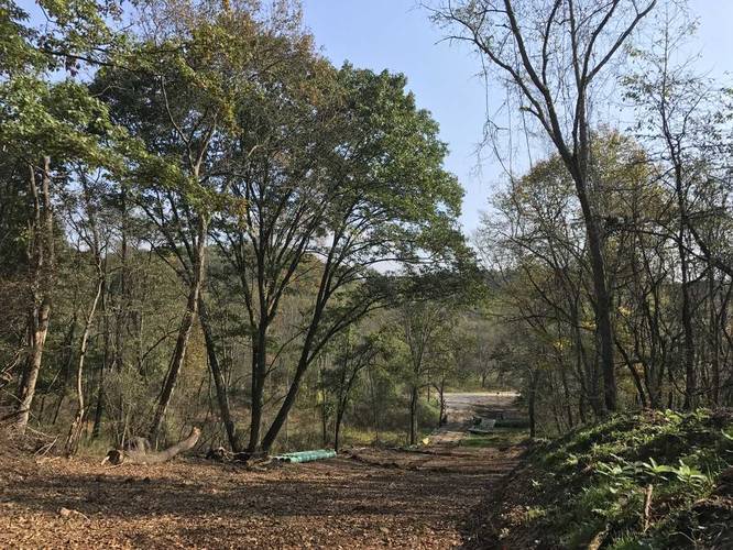
The trail ends at the entrance to Boyce Park along Old Frankstown Rd, so you'll need to hike an additional 0.3 miles to get back to parking for a total of 1.5 miles.
Explore 215 trails near Monroeville, PA

Know Before You Go

  • The Orange Blaze Loop Trail in Boyce Park, Monroeville, PA is an easy 1.2-mile loop suitable for most hikers.
  • The trail follows the park's fence line and features a small, somewhat inaccessible waterfall about halfway through.
  • The loop ends away from the parking lot, requiring an additional 0.3-mile walk along Old Frankstown Rd to return.
Interactive topographic map for Orange Blaze Loop Trail located in Monroeville, PA. Click the "View Map" button to load GPS coordinates and trail markers.
Get directions
Distance
1.2 mi
Difficulty
Easy
Type
Loop
Est. Time
36 min
Elev. Gain
177'
Rating
0.0
Added
October 15, 2017
Updated
June 06, 2018

Weather Forecast

Loading...
Total Change
134'
Ascent
177'
Descent
191'
Loading...

Download the GPX Data for Offline Use

Supporters get exclusive access to download trail routes to the MyHikes app for offline use. Stay prepared on your adventure, even without an internet connection! Become a Supporter today to unlock this feature and hike with confidence.

Download Orange Blaze Loop Trail GPX Data to the MyHikes Mobile App

Features

Dogs
Waterfalls
Water Source

Points of interest

  1. Parking

    40.454839, -79.740048
  2. Main Trailhead

    40.454361, -79.739984
  3. Trailhead at parking

    40.4544, -79.740019
    Trailhead at parking
  4. Cross the road to the trail

    40.454914, -79.736983
    Cross the road to the trail

Safety information

For your own safety: plan ahead, let someone know where you'll be, and hike at your own risk.

Markers

Blaze Color

Orange

Availability

All seasons

Surface type

Dirt

Trip Reports (Reviews)

Your opinion matters! Be the first to rate this trail.

Ready to help fellow hikers? Add a trip report to share your experience and provide valuable insights for other hikers!

1.2 miles / 1.9 km
July 21, 2020
Hiking
1.2 miles / 1.9 km
October 15, 2017
Dogs Hiking
No community routes found. To add your own hike as a Community Route for this Trail guide, leave a Trip Report with an attached GPX file.

Popular categories

Scenic mountain view representing vista trails
Vista trails
Scenic gorge of cascades representing waterfall trails
Waterfall hikes
Rugged mountain terrain representing summit trails
Summit trails
Scenic mountain view representing dog-friendly trails
Dog-friendly
Scenic campsite with a view representing camping trails
Camping trails
Appalachian Trail logo representing A.T. hikes
A.T. hikes

You May Also Like

New York's Best Waterfalls - Whether you're planning a day hike, roadside stop, or a leisurely short walk, this guide provides hikers, travelers, and locals alike with 63 different locations to over 100 scenic waterfalls to help plan your next adventure!
Explore

New York's Best Waterfalls

Whether you're planning a day hike, roadside stop, or a leisurely short walk, this guide provides hikers, travelers, and locals alike with 63 different locations to over 100 scenic waterfalls to help plan your next adventure!

Read
🍪 We use cookies to learn about site usage and to serve map tiles. You may block cookies manually in the browser. By continuing you agree. Learn more