The Blue Trail and Overlooks at Lindsay-Parsons Biodiversity Preserve in West Danby, New York is an easy 0.7-mile one-way trail that features meadow, kettle pond, and lake views.
Hike Description
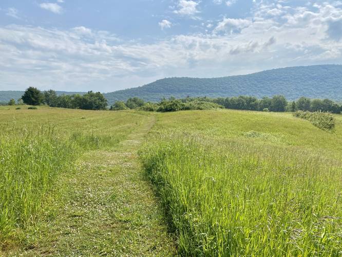
This trail is the main trail that provides hikers will access to many other trails at Lindsay-Parsons Biodiversity Preserve. The trail begins at the northern section of the parking lot and heads into the woods, following blue blazes. Hikers will pass a trailhead kiosk on their way in with trail information, maps, and history about the preserve. Shortly after, the trail heads out of the woods and into the open meadows where hikers will get beautiful views of the surrounding mountains and meadows.
Kettle Pond Overlook - Mile 0.3
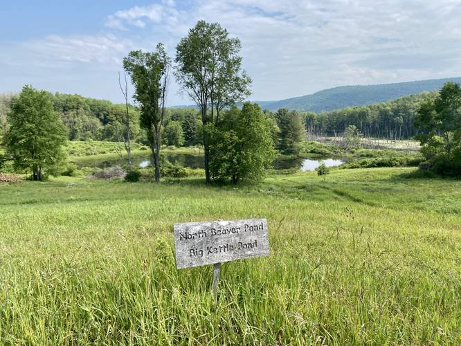
At mile 0.3, hikers will find a small sign labeled "Overlook" with a spur trail. This spur trail leads to a beautiful view of the North Beaver Pond (right) and Big Kettle Pond (straight) located around mile 0.35. The kettle hole is a remnant of a large chunk of ice that fell off an ancient glacier, causing a depression in the ground that now fills with water.
Lake Coleman View - Mile 0.6
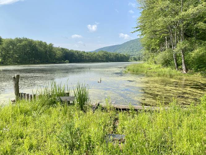
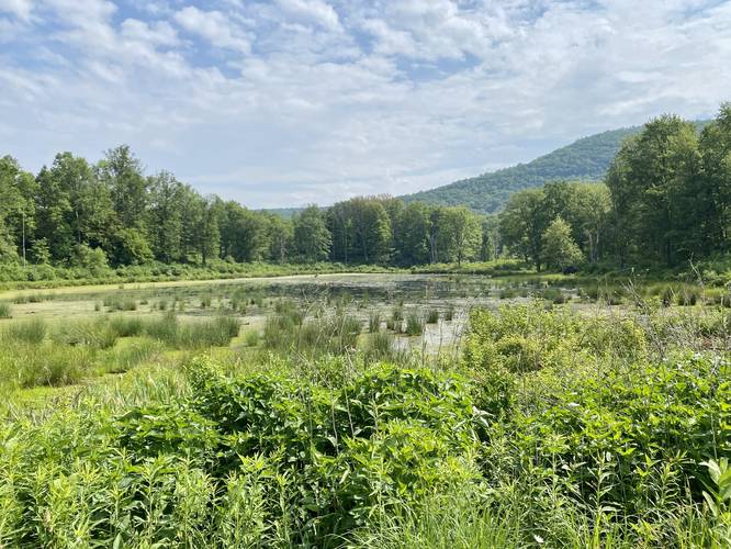
After visiting the first overlook, hikers will head back to the Blue Trail to continue hiking east. Pass the Red Trail on your left-hand side and continue down the hill to reach the shores of Lake Coleman and a Beaver Pond. Here you'll get views of both bodies of water - a really nice scenic stop. Note that during warmer days you might find a Northern Water Snake basking in the sun.
After visiting Lake Coleman and the Beaver Pond, hikers will head back to the Red Trail for a 0.7-mile hike.
Parking
Visitors will find a parking lot at the coordinates provided. It's large enough to fit a half-dozen vehicles or slightly more.
Pets
Dogs are allowed only if leashed and must be cleaned up after.
Warnings
Buggy: This trail can be very buggy during warmer months. The kettle holes, ponds, stagnant bodies of water, and long grasses help mosquitos, horseflies, and even ticks thrive here.
Poison ivy: This trail tends to have a lot of poison ivy located just off-trail. The path is skinny as well, which makes it easy to accidentally step on the poison ivy as well.
Hike Description
This trail is the main trail that provides hikers will access to many other trails at Lindsay-Parsons Biodiversity Preserve. The trail begins at the northern section of the parking lot and heads into the woods, following blue blazes. Hikers will pass a trailhead kiosk on their way in with trail information, maps, and history about the preserve. Shortly after, the trail heads out of the woods and into the open meadows where hikers will get beautiful views of the surrounding mountains and meadows.
Kettle Pond Overlook - Mile 0.3
At mile 0.3, hikers will find a small sign labeled "Overlook" with a spur trail. This spur trail leads to a beautiful view of the North Beaver Pond (right) and Big Kettle Pond (straight) located around mile 0.35. The kettle hole is a remnant of a large chunk of ice that fell off an ancient glacier, causing a depression in the ground that now fills with water.
Lake Coleman View - Mile 0.6
After visiting the first overlook, hikers will head back to the Blue Trail to continue hiking east. Pass the Red Trail on your left-hand side and continue down the hill to reach the shores of Lake Coleman and a Beaver Pond. Here you'll get views of both bodies of water - a really nice scenic stop. Note that during warmer days you might find a Northern Water Snake basking in the sun.
After visiting Lake Coleman and the Beaver Pond, hikers will head back to the Red Trail for a 0.7-mile hike.
Parking
Visitors will find a parking lot at the coordinates provided. It's large enough to fit a half-dozen vehicles or slightly more.
Pets
Dogs are allowed only if leashed and must be cleaned up after.
Warnings
Buggy: This trail can be very buggy during warmer months. The kettle holes, ponds, stagnant bodies of water, and long grasses help mosquitos, horseflies, and even ticks thrive here.
Poison ivy: This trail tends to have a lot of poison ivy located just off-trail. The path is skinny as well, which makes it easy to accidentally step on the poison ivy as well.