The Blue Trail at Houghton Land Preserve in Corning, New York is an easy 2-mile out-and-back trail that features beautiful vistas of the surrounding hills.
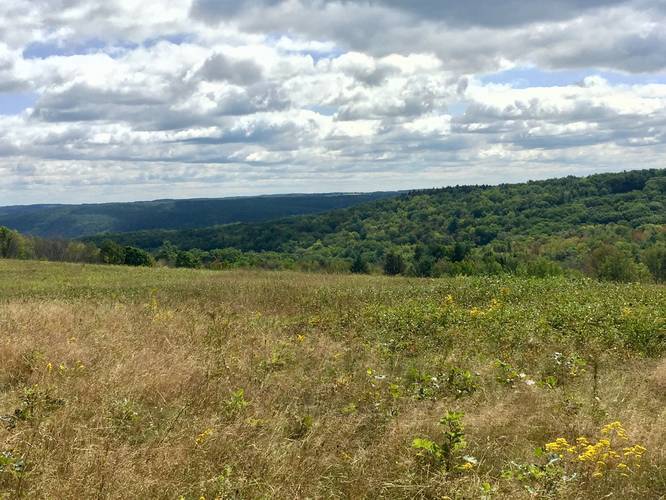
This blue-blazed trail begins at the main parking lot and heads north, heading gradually uphill, before reaching a trail junction. At the first junction, follow the blue blazes east and into a large open field with a beautiful view of the surrounding hills.
Hiking onward, the trail will continue heading east before reaching another junction - this time, with the Yellow Trail. The Blue Trail will turn right and head south for a short while before turning left and heading due-east yet again. Along this section of the trail is private property to the north - please stay on the trail and do not enter the private land.
Eventually the trail ends with a triple blue-blaze and a sign that states the trail has ended. Where the trail ends is a pipeline that cuts through the forest - here you can turn around and head to parking to complete the total out-and-back hike for 2-miles.
Vista
There's a view point along this trail which can be found between miles 0.4 and 0.6 at a large open field. There is no single vista point but the view follows the this trail for the length of the open field.
Pets
Dogs are allowed and must be kept on a leash at all times. Their waste must be carried out by the hiker.
Parking
Hikers can find a large parking lot at the coordinates provided. There's enough room to fit about 15 vehicles.
Hours
The Houghton Land Preserve is open from dawn to dusk and is closed at night.
Prohibited No motor vehicles, bicycles, or horses on the preserve. No camping, fires, collecting, littering, dumping, alcohol, or target shooting.
Hunting
Hunting is permitted here, so hikers should wear orange.