The Blue Myit Road Trail in Gibsonia Pennsylvania is an easy 3.8 mile out-and-back trail that leads through the Irwin Run Conservation Area. This old closed-off road (Irwin Road) has various urban legends that stem from the spooky mist that rolls onto the road in the evening. Since the trail is located next to North Park, the mist from the lake at North Park rolls into the ravine in the evening, hence giving the trail its name. The Blue Mist Road Trail is one of the most popular urban legend spots in western Pennsylvania and lies just outside of Pittsburgh; however, it's not nearly as spooky during the day than it is at night.
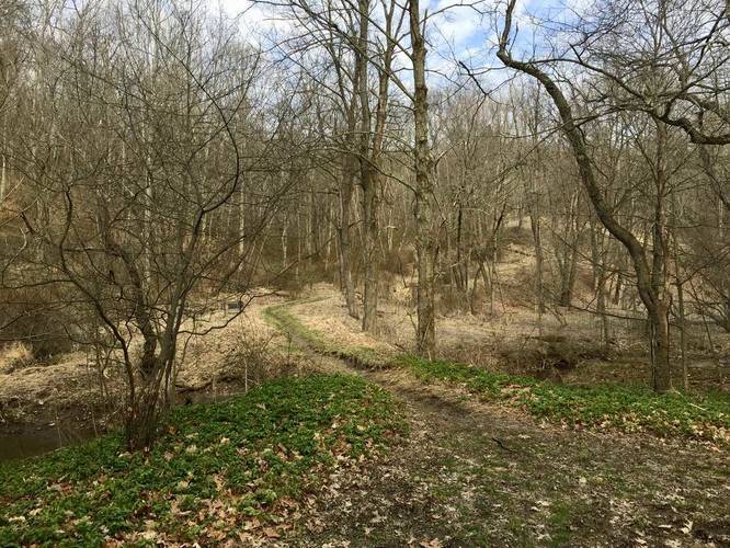
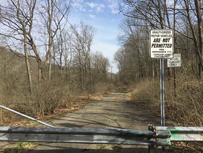
The trail, starting off along Jackson Road, heads downhill and runs along a creek for the entire hike. The trail sits within a ravine and runs parallel to North Park to the west. You'll be hiking along a gravel road/trail until you reach the paved section of Irwin Road about 1.2 miles into the hike. Once you reach the paved section, the trail seemingly ends, but you can hike the rest of Irwin Road to get to North Park to the south.
Eventually the trail levels out and you'll find a trail that heads west after about 1 mile into the hike - this is Hamilton Road (yet another closed road) and connects to North Park and the Rachel Carson Trail.
History: Along the trail are several old ruins of houses with just the foundations remaining - most of the urban legends, which have led to some claiming the trail is haunted, have popped up around these houses. Legends mention one of the houses was owned by a witch and another house was owned by a little person. None of the urban legends have been proven to be true; however, apparently a resident of one of the houses used to load rock salt into shotgun cartridges and fire them at nighttime trespassers.
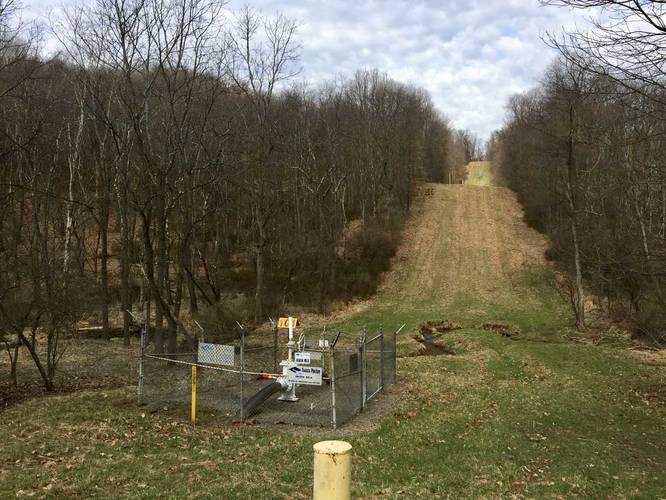
Parking: The trail has three main parking lots. The one listed here is located on Jackson Road in Gibsonia. The other parking lot can be found at the opposite end of the trail where Irwin Road meets Babcock Blvd. You'll find that the junction with Babcock Blvd and Irwin Road is a paved road with no real parking lot; however, most people park at the end of Iwrin Road off of Babcock and use the entirety of Irwin Road to hike up to Jackson Road for the total 2 miles. You can continue driving down Irwin Road (from Babcock Blvd) and park at the gate, about 0.5 miles from the turn off Babcock.
Pets
Dogs are allowed if leashed and their waste must be carried out by the hiker
Biking
Biking is permitted on this trail.
The trail, starting off along Jackson Road, heads downhill and runs along a creek for the entire hike. The trail sits within a ravine and runs parallel to North Park to the west. You'll be hiking along a gravel road/trail until you reach the paved section of Irwin Road about 1.2 miles into the hike. Once you reach the paved section, the trail seemingly ends, but you can hike the rest of Irwin Road to get to North Park to the south.
Eventually the trail levels out and you'll find a trail that heads west after about 1 mile into the hike - this is Hamilton Road (yet another closed road) and connects to North Park and the Rachel Carson Trail.
History: Along the trail are several old ruins of houses with just the foundations remaining - most of the urban legends, which have led to some claiming the trail is haunted, have popped up around these houses. Legends mention one of the houses was owned by a witch and another house was owned by a little person. None of the urban legends have been proven to be true; however, apparently a resident of one of the houses used to load rock salt into shotgun cartridges and fire them at nighttime trespassers.
Parking: The trail has three main parking lots. The one listed here is located on Jackson Road in Gibsonia. The other parking lot can be found at the opposite end of the trail where Irwin Road meets Babcock Blvd. You'll find that the junction with Babcock Blvd and Irwin Road is a paved road with no real parking lot; however, most people park at the end of Iwrin Road off of Babcock and use the entirety of Irwin Road to hike up to Jackson Road for the total 2 miles. You can continue driving down Irwin Road (from Babcock Blvd) and park at the gate, about 0.5 miles from the turn off Babcock.
Pets
Dogs are allowed if leashed and their waste must be carried out by the hiker
Biking
Biking is permitted on this trail.