Loading...

๐ŸŽ† 50% off 4th of July sale on Supporter Accounts โ€” now through July 6! Learn More.

Blue Heron Trail to Powells Island

Directions
Map
Pictures
Send to App
Distance:
6.7 Miles / 10.8 km
Type:
Out-and-Back
Difficulty:
Moderate
Time to Hike:
3 hours, ~21 minutes
Features:
Surface Type:
Dirt
Park:
Cutler Park Reservation
Town:
Dedham, Massachusetts
Directions:
42.270694, -71.191943
Added:
February 08, 2025
Updated:
May 07, 2025
Copy Trail Link Hiking this trail? Send a friend or family member a link to this trail guide for your own safety. Hike at your own risk (disclaimer)
Loading...
Loading...
62'

Total Change
121'

Ascent
126'

Descent

Download the Trail Route for Offline Use

Supporters get exclusive access to download trail routes to the MyHikes app for offline use. Stay prepared on your adventure, even without an internet connection! Become a Supporter today to unlock this feature and hike with confidence.

Send to App

Blue Heron Trail to Powells Island

The Blue Heron Trail to Powells Island at Cutler Park Reservation in Dedham, Massachusetts is an easy 6.7-mile out-and-back hike that leads to Powells Island and features views of the Charles River.

Hiking the Blue Heron Trail

This hike begins along Vine Rock Street, despite where the closest public parking lot is located on Needham Street. Alternatively, you can skip a portion of this route and start at the parking lot along Needham Street instead. If starting on Vine Rock Street, you'll find there's no parking along the road. For locals, this trailhead is heavily used and easy to walk to

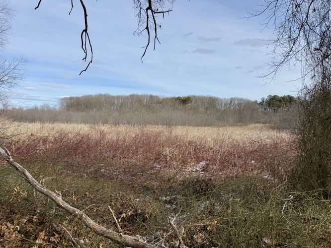
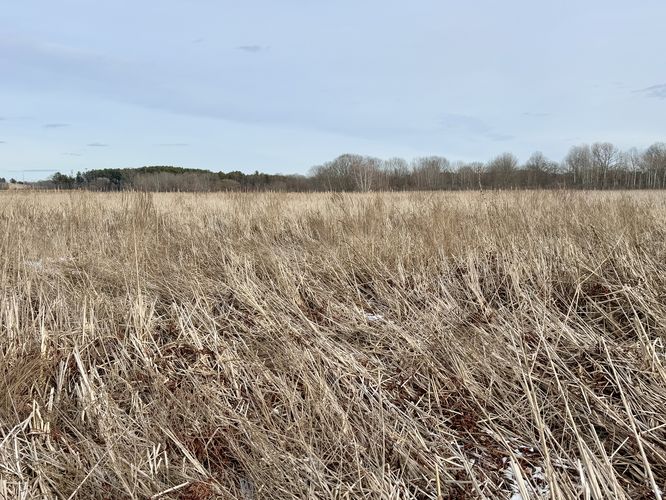
The Heron Trail starts by heading downhill through an open forest where fresh water marsh views with tall grasses like cattail grow. Here, you'll find some nice views of the open marshlands. Shortly after, the route leads out to a small section of land called "Candy Mountain" where you'll follow the trail in a loop before returning to the main Heron Trail path.

Needham Street Crossing - Mile 1.7

At mile 1.7, the trail leads to the always-busy Needham Street where you'll have to carefully cross the road to reach a sidewalk on the south side. Just up the road, at the public parking lot, is where you'll cross Needham Street once again to follow the Heron Trail. Watch for oncoming traffic and hike at your own risk. Note that you can start here if you wish to park and hit the trail without heading to the trailhead on Vine Rock Street.

Needham Street to Marshland Boardwalks - Mile 1.7 to 2.4

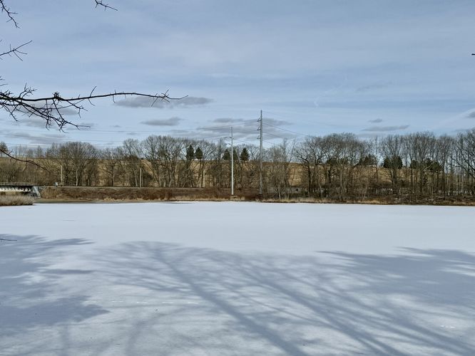
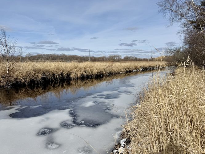
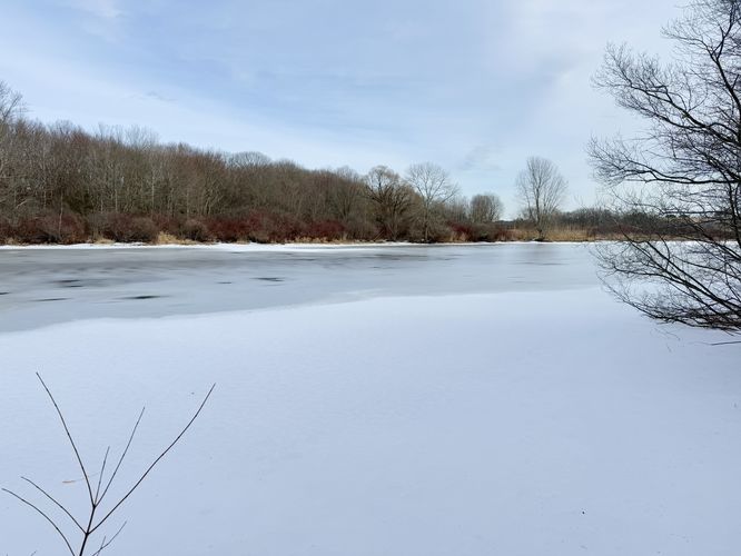
From Needham Street, the Heron Trail passes through the woods before leading out along a boardwalk that crosses the open marshlands. Despite the traffic noise from I-95, the boardwalk is surprisingly peaceful with beautiful open views from just above the tall grasses.

Hiking to Powells Island - Mile 2.4 to 4

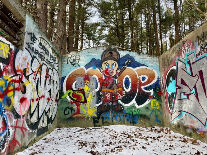
After passing the boardwalk, this route leads through the forest once again as it heads toward Powells Island. First, you'll pass through another section of forest before the trail reaches a raised train track bed where you'll hike east along that for a short distance. Be on the lookout for a graffiti tunnel that passes under the train tracks. The tunnel is filled with interesting graffiti and often changes from time to time. One of the highlights of the hike. Pass through the tunnel and hike through the forest to reach Powells Island. The trails on Powells Island are easy to follow as they lead out toward a view of the Charles River on the far side. We ended up hiking a figure-eight loop here before we started the hike back.

Hiking Back - Mile 4 to 6.7

After exploring Powells Island, the route leads hikers back to the main trailhead as an out-and-back hike. Not much to note here, except for the road crossing. Eventually, you'll reach the trailhead along Vine Rock Street to complete the hike for 6.7-miles.

Parking

As stated earlier, the parking coordinates for this hike will lead you to the official parking lot for Cutler Park Reservation along Needham Street. The lot is large enough to fit a handful of cars as of February 2025. There's an additional lot located to the west if this lot is full. The parking lot is located down the road from the trailhead and requires additional walking to reach. You can skip the first section of the hike if you wish to reduce road crossings or additional out-and-back walking.

Pets

Dogs are allowed if leashed and must be cleaned up after.

Warning

Poison ivy: This trail is littered with poison ivy during warm months, which grows on the side of the trail and in the overgrowth off-trail. It's best to keep on-trail to avoid brushing your clothes or footwear on it.
Explore 31 trails near Dedham, MA
  1. Parking

    42.270694, -71.191943
  2. Main Trailhead

    42.271001, -71.181381
  3. View / Overlook / Vista

    42.273039, -71.184342
    View / Overlook / Vista
  4. Abandoned concrete structure (Elmer Fudd's Hunting Lodge)

    42.276931, -71.185692
    Abandoned concrete structure (Elmer Fudd's Hunting Lodge)
  5. View / Overlook / Vista

    42.277422, -71.185378
    View / Overlook / Vista
  6. View / Overlook / Vista

    42.276028, -71.188011
    View / Overlook / Vista
  7. Survey marker (NSTAR Electric)

    42.277514, -71.197656
    Survey marker (NSTAR Electric)
  8. Graffiti tunnel of Cutler Preserve

    42.278289, -71.193825
    Graffiti tunnel of Cutler Preserve
  9. View of the Charles River from Powells Island

    42.286881, -71.192278
    View of the Charles River from Powells Island
  10. Open views above the tall grasses

    42.273883, -71.196464
    Open views above the tall grasses
No community routes found. To add your own hike as a Community Route for this Trail guide, leave a Trip Report with an attached GPX file.

Hazards

Ticks - Lyme Disease More Info (CDC)
Poison Ivy/Oak

Seasons

All

Weather Forecast

In Dedham, MA

Explore Hiking Trails

You May Also Like

Colorado's Million Dollar Highway - Plan a day's drive adventure along the iconic Million Dollar Highway in Colorado. Explore the best short trails, roadside stops, waterfalls, vistas, ghost towns, and hot springs within a ~6 hour road trip.
Explore

Colorado's Million Dollar Highway

Plan a day's drive adventure along the iconic Million Dollar Highway in Colorado. Explore the best short trails, roadside stops, waterfalls, vistas, ghost towns, and hot springs within a ~6 hour road trip.

Read
Glacier's Going-to-the-Sun Road - Discover the breathtaking beauty of Glacier National Park along the iconic Going-to-the-Sun Road. From stunning roadside stops to picturesque waterfalls and vistas, this engineering marvel offers endless opportunities for exploration.
Explore

Glacier's Going-to-the-Sun Road

Discover the breathtaking beauty of Glacier National Park along the iconic Going-to-the-Sun Road. From stunning roadside stops to picturesque waterfalls and vistas, this engineering marvel offers endless opportunities for exploration.

Read
New York's Best Waterfalls - Whether you're planning a day hike, roadside stop, or a leisurely short walk, this guide provides hikers, travelers, and locals alike with 63 different locations to over 100 scenic waterfalls to help plan your next adventure!
Explore

New York's Best Waterfalls

Whether you're planning a day hike, roadside stop, or a leisurely short walk, this guide provides hikers, travelers, and locals alike with 63 different locations to over 100 scenic waterfalls to help plan your next adventure!

Read

Before you boogie...

Find our trail guides useful? Consider becoming a Supporter to unlock perks!

MyHikes is an indie platform that makes exploring public trails easier for everyone. The platform has no investors, no ads, and is owned and operated by one person, Dave Miller. Dave has personally mapped and written over 1,800 trail guides on MyHikes for the public to explore. MyHikes has helped millions outdoor enthusiasts plan their next adventure.

But it takes a lot of time ๐Ÿ•ฆ, money ๐Ÿ’ฐ, work, and espresso shots โ˜• to run MyHikes, including hiking , mapping , writing , and publishing new trails with high-quality (accurate) information... along with software engineering (coding) the platform like building new features, website and mobile app development (iOS and Android), site maintainance . and much much more.

Supporters unlock website and mobile app perks with an annual one-time payment of $25 (you renew) ๐Ÿ˜Ž๐Ÿ‘. Or you can simply make a Donation of your choice. Otherwise, you can support us by telling your friends about MyHikes - both quick and free ๐ŸŽ‰

Admin user profile picture

Dave Miller
MyHikes Founder