Loading...

Distance:
1.0 Mile / 1.6 km
Type:
Out-and-Back
Difficulty:
Easy
Time to Hike:
~30 minutes
Features:
Surface Type:
Universal Access
Town:
Chicago, Illinois
Directions:
41.913299, -87.710207
Added:
September 25, 2022
Updated:
September 27, 2022
Loading...
Loading...
13 '

Total Change
13 '

Ascent
13 '

Descent

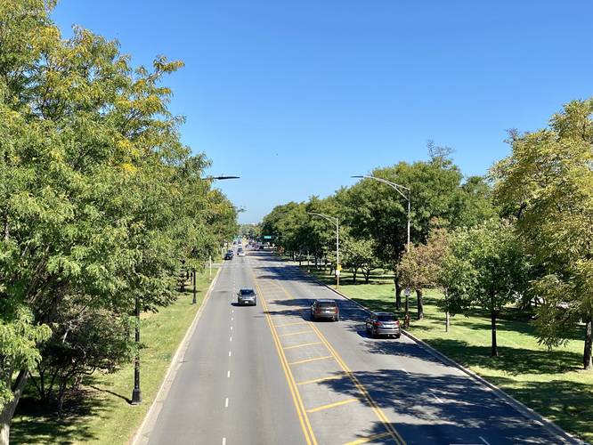
The Bloomingdale Trail to Humboldt Overlook in Chicago, Illinois is an easy 1-mile out-and-back walk that leads from N Spaulding Ave to the overlook above N Humboldt Blvd.

This short section of the Bloomingdale Trail is less of a hike and more of a short out-and-back walk that leads to the "overlook" that sits above N Humboldt Blvd.

Universal Access
This trail is universally accessible and paved.

Highly-Trafficked
This trail is highly-trafficked by foot and bike. Best etiquette is to keep right at all times, assuming bikers may zoom by at any time. Joggers and fast walkers will do the same - this trail can get a bit crowded on weekends.

Parking
Walkers can find parking near the coordinates provided on nearby streets that allow parking without permits.

Pets
Dogs are allowed if leashed and should be cleaned up after.

Explore 1 trail near Chicago, IL
  1. Parking

    41.913299, -87.710207
  2. Main Trailhead

    41.913642, -87.710226
  3. Humbolt Overlook

    41.913854, -87.702036
    Humbolt Overlook
  4. Graffiti under the trail

    41.913556, -87.71125
    Graffiti under the trail
No community routes found. To add your own hike as a Community Route for this Trail guide, leave a Trip Report with an attached GPX file.

Hazards

Ticks - Lyme Disease More Info (CDC)

Seasons

All

Photo Albums

2 Trip Reports

No Star-Ratings
Trail Guide By:
Admin user profile picture
1.0 mile / 1.6 km
Trail added
September 25, 2022
Hiked on
September 18, 2022
Updated on
September 27, 2022
1.0 mile / 1.6 km
September 18, 2022
Hiking

Weather Forecast

In Chicago, IL

Explore Hiking Trails

New Hikes

Gorge Trail (Stony Brook)
0.8 Miles
1.3 km
Moderate
One-Way
Mary's Lake Trail
0.6 Miles
1 km
Easy
Out-and-Back
Fish Dam Run Vista
0.2 Miles
0.3 km
Easy
Out-and-Back
Beaver Ponds Trail
0.1 Miles
0.2 km
Easy
Out-and-Back

Before you boogie...

Find our trail guides useful? Consider becoming a Supporter to unlock perks!

MyHikes is an indie platform that makes exploring public trails easier for everyone. The platform has no investors, runs no ads, and is owned and operated by one person, Dave Miller. Dave has personally mapped and written over 1,600 trail guides on MyHikes for the public to explore. As of 2024, MyHikes has helped over 1,300,000 outdoor enthusiasts plan their next adventure.

But it takes a lot of time 🕦, money 💰, and work, and espresso shots ☕ to run MyHikes, including hiking , mapping , writing , and publishing new trails with high-quality (accurate) information... along with software engineering (coding) the platform like building new features, site and mobile app development for iOS and Android, site maintainance . and much much more.

Supporters unlock website and mobile app perks with an annual one-time payment of $25 (you renew) 😎👍. Or you can simply make a Donation of your choice. Otherwise, you can support us by telling your friends about MyHikes - both quick and free 🎉

Admin user profile picture

Dave Miller
MyHikes Founder