Loading...

WINTER SALE! 50% OFF Supporter Accounts — now through January 31st. Learn More.

Blackrock Summit

The Blackrock Summit Trail at Shenandoah National Park in Crozet, Virginia is an easy 1.2 mile loop hike that leads out to Blackrock Summit and features stunning views of the Shenandoah mountain range.

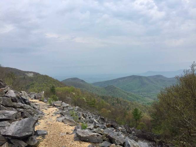
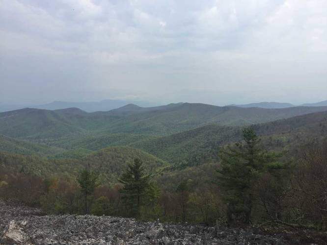
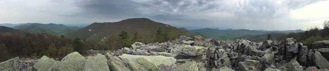
The trail starts off along the Appalachian Trail (white blazes) to the summit, which is only about 0.5 - 0.6 miles one-way. The summit gives you an almost-360 degree view of the southern Shenandoah area and a large rock scramble to climb if you want to take in panoramic views.

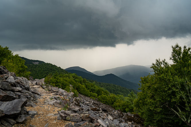
Continue on the trail and take a left at the sign post just beyond the summit area to return to the parking lot. The final hike out follows the blue blaze trail (Trayfoot Mountain Trail).

Pets
Dogs are allowed if leashed and their waste must be carried out by the hiker.

Camping
Camping is allowed on this trail - there were small areas along the Appalachian Trail along this route where thru-hikers can setup camp.

Difficulty
This hike should be considered easy to moderate, at worst.
Explore 58 trails near Crozet, VA

Know Before You Go

  • Blackrock Summit Trail is an easy 1.2-mile loop hike in Shenandoah National Park near Crozet, VA, offering panoramic views.
  • The trail follows a portion of the Appalachian Trail to the summit and the Trayfoot Mountain Trail for the return, featuring a rock scramble.
  • Leashed dogs are allowed, and camping is permitted along the Appalachian Trail section.
Interactive topographic map for Blackrock Summit located in Crozet, VA. Click the "View Map" button to load GPS coordinates and trail markers.
Get directions
Distance
1.2 mi
Difficulty
Moderate
Type
Loop
Est. Time
36 min
Elev. Gain
272'
Rating
5.0
Added
April 29, 2017
Updated
January 23, 2021

Weather Forecast

Loading...
Total Change
250'
Ascent
272'
Descent
222'
Loading...

Download the GPX Data for Offline Use

Supporters get exclusive access to download trail routes to the MyHikes app for offline use. Stay prepared on your adventure, even without an internet connection! Become a Supporter today to unlock this feature and hike with confidence.

Download Blackrock Summit GPX Data to the MyHikes Mobile App

Features

Vista / Lookout Point
Dogs
Mountain Summit
Camping
Biking
Appalachian Trail logo Appalachian Trail hike

Points of interest

  1. Parking

    38.222576, -78.733135
  2. Main Trailhead

    38.222962, -78.733375
  3. View / Overlook / Vista

    38.220062, -78.739942
    View / Overlook / Vista
  4. View / Overlook / Vista

    38.220174, -78.740074
    View / Overlook / Vista

Safety information

For your own safety: plan ahead, let someone know where you'll be, and hike at your own risk.

Hazards

Rockfalls, Ledges, or Scrambles

Markers

Blaze Color

White

Availability

Spring

Surface type

Dirt

Trip Reports (Reviews)

Rated 5.0 out of 5 based on 1 rating.

Ready to help fellow hikers? Add a trip report to share your experience and provide valuable insights for other hikers!

1.1 miles / 1.8 km
July 25, 2024
This is a great short hike that I did with the family while driving Skyline Drive. We didn't quite make the complete loop due to a Timber Rattlesnake on the trail and a storm coming. It's a hike I would do again
Hiking
1.2 miles / 1.9 km
April 30, 2017
Hiking

Explore other routes for this Trail guide, added by the MyHikes' community via Trip Reports (Reviews). To add your own hike as a Community Route for this Trail guide, leave a Trip Report and attached your GPX file!

Popular categories

Scenic mountain view representing vista trails
Vista trails
Scenic gorge of cascades representing waterfall trails
Waterfall hikes
Rugged mountain terrain representing summit trails
Summit trails
Scenic mountain view representing dog-friendly trails
Dog-friendly
Scenic campsite with a view representing camping trails
Camping trails
Appalachian Trail logo representing A.T. hikes
A.T. hikes

You May Also Like

25 Best Day Hikes in North Carolina - Discover the top 25 best day hikes in North Carolina, from breathtaking waterfalls to mountain peaks. Explore hidden gems, scenic views, and trails suitable for all skill levels, perfect for your next outdoor adventure.
Explore

25 Best Day Hikes in North Carolina

Discover the top 25 best day hikes in North Carolina, from breathtaking waterfalls to mountain peaks. Explore hidden gems, scenic views, and trails suitable for all skill levels, perfect for your next outdoor adventure.

Read
🍪 We use cookies to learn about site usage and to serve map tiles. You may block cookies manually in the browser. By continuing you agree. Learn more