Loading...

Distance:
0.1 Miles / 0.2 km
Type:
One-Way
Difficulty:
Easy
Time to Hike:
~5 minutes
Features:
Surface Type:
Dirt
Park:
Cascade Park
Town:
New Castle, Pennsylvania
Directions:
1928 E Washington St, New Castle, PA 16101
40.976544, -80.320276
Added:
November 04, 2017
Updated:
November 01, 2018
Loading...
Loading...
18 '

Total Change
12 '

Ascent
0 '

Descent

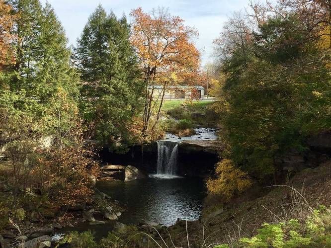
Big Run Falls at Cascade Park in New Castle, Pennsylvania is a small overlook walk to the Big Run Falls lookout point. Big Run Falls is a 20 to 25 foot waterfall located in the center of Cascade Park with a lookout point downstream. There's no way to hike down to the falls itself since the park discourages people swimming in the pool below, so this is less of a trail and more of an overlook.

To make more of a hike out of this trip, you can walk down the road/hill to the creek itself and then hike up along the side of the creek to the base of the falls - this would likely be a 1 mile out-and-back hike including getting down to the creek itself; however, the GPS data provided here just brings you to the overlook area.

History: Cascade Park is a former amusement park that ran from 1897 until the early 1980s. Shortly after its closure, the rides were removed and it was turned into a public space.

Explore 13 trails near New Castle, PA
  1. Parking

    40.976544, -80.320276
  2. Main Trailhead

    40.976923, -80.320892
  3. Vista of Big Run Falls

    40.97675, -80.32045
    Vista of Big Run Falls
No community routes found. To add your own hike as a Community Route for this Trail guide, leave a Trip Report with an attached GPX file.

Hazards

Ticks - Lyme Disease More Info (CDC)

Seasons

All

Photo Albums

2 Trip Reports

No Star-Ratings
Trail Guide By:
Admin user profile picture
0.1 miles / 0.2 km
Trail added
November 04, 2017
Hiked on
November 04, 2017
Updated on
November 01, 2018
0.1 miles / 0.2 km
November 04, 2017
Hiking

Weather Forecast

In New Castle, PA

Explore Hiking Trails

New Hikes

Hidden Valley Creek Trail
0.3 Miles
0.5 km
Easy
Out-and-Back
Sheep Lakes Lookout
0.1 Miles
0.2 km
Easy
Out-and-Back
Many Parks Curve Trail
0.4 Miles
0.6 km
Easy
Out-and-Back
Gorge Trail (Stony Brook)
0.8 Miles
1.3 km
Moderate
One-Way

Before you boogie...

Find our trail guides useful? Consider becoming a Supporter to unlock perks!

MyHikes is an indie platform that makes exploring public trails easier for everyone. The platform has no investors, runs no ads, and is owned and operated by one person, Dave Miller. Dave has personally mapped and written over 1,600 trail guides on MyHikes for the public to explore. As of 2024, MyHikes has helped over 1,300,000 outdoor enthusiasts plan their next adventure.

But it takes a lot of time 🕦, money 💰, and work, and espresso shots ☕ to run MyHikes, including hiking , mapping , writing , and publishing new trails with high-quality (accurate) information... along with software engineering (coding) the platform like building new features, site and mobile app development for iOS and Android, site maintainance . and much much more.

Supporters unlock website and mobile app perks with an annual one-time payment of $25 (you renew) 😎👍. Or you can simply make a Donation of your choice. Otherwise, you can support us by telling your friends about MyHikes - both quick and free 🎉

Admin user profile picture

Dave Miller
MyHikes Founder