Loading...

Distance:
6.1 Miles / 9.8 km
Type:
Out-and-Back
Difficulty:
Hard
Time to Hike:
3 hours, ~5 minutes
Features:
Surface Type:
Dirt
Park:
Mt. Greylock State Reservation
Town:
Adams, Massachusetts
Directions:
42.626998, -73.144881
Added:
October 09, 2018
Updated:
July 30, 2020
Loading...
Loading...
2,251 '

Total Change
2,255 '

Ascent
2,263 '

Descent

The Bellows Pipe Trail to the summit of Mt Greylock is located on Gould Rd in Adams, Massachusetts. This is a very popular trail even on a cold, wet, foggy, October day. The trail itself is fairly wide, with areas of loose rock, mud and some slight 'bouldering'. The trail is weaves up the mountain crossing the Thunderbolt Trail at several points and provides a steady moderate incline with spurts of steepness. 

The pictures on the trail maps are not the clearest in my opinion, though the trail is well marked at all turns.

Near the summit is the most difficult portion of the trail. It consists of a few steep long switchbacks, after which the trail merges with the AT and continues in some short steep bursts to the summit.

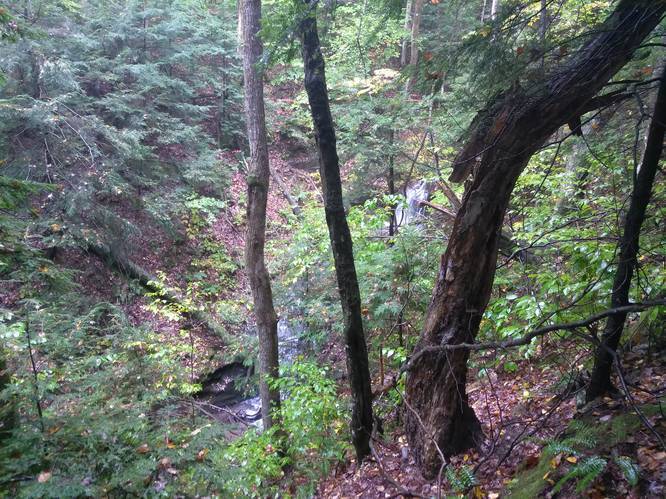
Waterfall: Around mile 0.8 there's a waterfall off the trail. Views of the waterfall are better when there are no leaves on the trees.

Explore 15 trails near Adams, MA
  1. Parking

    42.626998, -73.144881
  2. Main Trailhead

    42.627123, -73.145111
  3. Waterfall

    42.634037, -73.154283
    Waterfall
No community routes found. To add your own hike as a Community Route for this Trail guide, leave a Trip Report with an attached GPX file.

Hazards

Ticks - Lyme Disease More Info (CDC)

Seasons

All

Photo Albums

1 Trip Report

No Star-Ratings
Write-up by:
Tocra user profile picture
6.1 miles / 9.8 km
Trail added
October 09, 2018
Hiked on
October 08, 2018
Updated on
July 30, 2020

Weather Forecast

In Adams, MA

Explore Hiking Trails

New Hikes

Silver Cascade
0.2 Miles
0.3 km
Easy
Out-and-Back
Coquina Loop (Old Levi Mill Waterfall)
1.7 Miles
2.7 km
Moderate
Loop
Diana's Baths Trail
1.2 Miles
1.9 km
Easy
Out-and-Back
Congaree Boardwalk Loop
2.5 Miles
4 km
Easy
Loop

Before you leave...

MyHikes is an indie web platform aimed to make exploring public trails easier for everyone. The site has no investors and is owned and operated by one person, Dave Miller (Founder & Admin). As the Founder, main contributor, and doer-of-all-things for MyHikes, I share my trips with over-detailed write-ups for fun on a volunteer basis and I believe that public trail information should be available to everyone.

It takes a lot of time 🕦, money 💰, and effort (including espresso shots ☕) to run MyHikes, including hiking , mapping , writing , and publishing new trails with high-quality content... along with building new features, moderating, site maintainance, and app development for iOS and Android . I simply ask that if you find MyHikes' trail guides helpful to please consider becoming a Supporter to help keep the site, iOS, and Android apps available to everyone.

Supporters unlock website and in-app perks with a one-time payment of $25 (you renew) 😎👍. Or you can simply make a Donation of your choice without a MyHikes user account. Otherwise, telling your friends about MyHikes is the next-best thing - both quick and free 🎉

Thanks for visiting MyHikes and have a great hike!️

Admin user profile picture

Dave Miller
MyHikes Founder & Admin