Loading...

WINTER SALE! 50% OFF Supporter Accounts — now through January 31st. Learn More.

Beechwood Lake Dam Trail

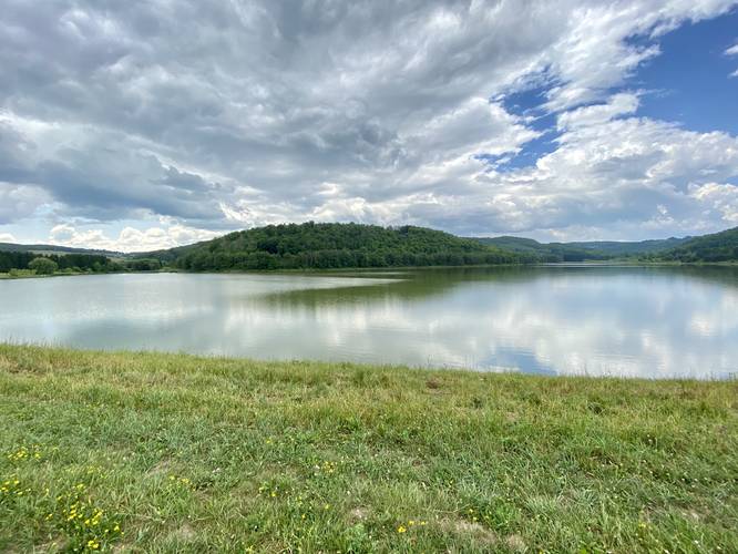
The Beechwood Lake Dike Trail in Westfield, Pennsylvania is an easy 0.6-mile out-and-back trail that features vies of Beechwood Lake and ample fishing opportunities along the shore of the lake.

This unofficial trail is just a grassy dike that holds back the reservoir at Beechwood Lake. Hikers will begin at the main parking lot, walk down the entrance road, and take a left-hand turn where the grassy hill slopes downward toward the lake. Hikers can walk the entire length of the dike (not included in the GPS track) to find a nice fishing spot or place to sit along the lake to relax.

Parking
Hikers and visitors will find a very large parking lot at the coordinates provided.

Pets
Dogs are allowed if leashed and their waste must be carried out.
Explore 262 trails near Westfield, PA

Know Before You Go

  • Short, easy 0.6-mile out-and-back trail in Westfield, PA, suitable for all skill levels.
  • Offers views of Beechwood Lake and opportunities for fishing along the shore.
  • Dogs are allowed on leashes, and visitors must clean up after them.
Interactive topographic map for Beechwood Lake Dam Trail located in Westfield, PA. Click the "View Map" button to load GPS coordinates and trail markers.
Get directions
Distance
0.6 mi
Difficulty
Easy
Type
Out-and-Back
Est. Time
18 min
Elev. Gain
60'
Rating
0.0
Added
January 25, 2021
Updated
March 05, 2021

Weather Forecast

Loading...
Total Change
33'
Ascent
60'
Descent
62'
Loading...

Download the GPX Data for Offline Use

Supporters get exclusive access to download trail routes to the MyHikes app for offline use. Stay prepared on your adventure, even without an internet connection! Become a Supporter today to unlock this feature and hike with confidence.

Download Beechwood Lake Dam Trail GPX Data to the MyHikes Mobile App

Features

Vista / Lookout Point
Dogs
Water Source
PA Wilds logo PA Wilds

Points of interest

  1. Parking

    41.853089, -77.509299
  2. Main Trailhead

    41.853101, -77.509412

Safety information

For your own safety: plan ahead, let someone know where you'll be, and hike at your own risk.

Availability

All seasons

Surface type

Dirt

Trip Reports (Reviews)

Your opinion matters! Be the first to rate this trail.

Ready to help fellow hikers? Add a trip report to share your experience and provide valuable insights for other hikers!

0.6 miles / 1.0 km
July 04, 2020
Hiking
No community routes found. To add your own hike as a Community Route for this Trail guide, leave a Trip Report with an attached GPX file.

Popular categories

Scenic mountain view representing vista trails
Vista trails
Scenic gorge of cascades representing waterfall trails
Waterfall hikes
Rugged mountain terrain representing summit trails
Summit trails
Scenic mountain view representing dog-friendly trails
Dog-friendly
Scenic campsite with a view representing camping trails
Camping trails
Appalachian Trail logo representing A.T. hikes
A.T. hikes

You May Also Like

New York's Best Waterfalls - Whether you're planning a day hike, roadside stop, or a leisurely short walk, this guide provides hikers, travelers, and locals alike with 63 different locations to over 100 scenic waterfalls to help plan your next adventure!
Explore

New York's Best Waterfalls

Whether you're planning a day hike, roadside stop, or a leisurely short walk, this guide provides hikers, travelers, and locals alike with 63 different locations to over 100 scenic waterfalls to help plan your next adventure!

Read
🍪 We use cookies to learn about site usage and to serve map tiles. You may block cookies manually in the browser. By continuing you agree. Learn more