The Yellow Loop Trail at Bear Run Nature Reserve in Mill Run, Pennsylvania is an easy 1.8 to 2.2 mile loop hike through the conifers and deciduous forests of Bear Run. If you plan to skip out on camping at Campsite #5, this is a 1.8 mile hike. This loop is a quiet, low-trafficked hike, like the rest of Bear Run Nature Reserve.
This recording brings you from the main parking lot at Bear Run, along the Yellow Loop, and up to Campsite #5, which sits along Bear Run Creek. The hike starts out at the main trailhead into Bear Run and follows the Yellow blazes by taking a left-hand turn first. You'll pass through evergreen trees in the initial part of the hike, but they slowly start to fade as you hike into the deciduous forests.
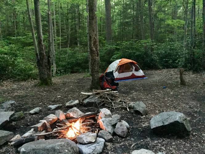
Campsite #5: When you reach mile 1, on the map below, you'll hit a turn to follow the Red blaze - follow the blaze for about 0.1 miles or so. You'll then hit another trail junction, follow the Orange blazes for about 0.2 - 0.3 miles to the campsite, which sits at the bottom of the hill next to Bear Run Creek.
The hike out from the campsite is easy - head back to the Yellow Loop the way you came into the campsite, but instead take a left-hand turn at the first trail junction where you left the Yellow blazes. The hike back to parking is fairly easy since most of it is downhill. You'll eventually pass through a coniferous forest before hitting the parking lot.
Dogs are allowed on this trail. No biking at Bear Run.
Hunting / wear orange: It's recommended to wear orange since hunting is permitted in Bear Run.
This recording brings you from the main parking lot at Bear Run, along the Yellow Loop, and up to Campsite #5, which sits along Bear Run Creek. The hike starts out at the main trailhead into Bear Run and follows the Yellow blazes by taking a left-hand turn first. You'll pass through evergreen trees in the initial part of the hike, but they slowly start to fade as you hike into the deciduous forests.
Campsite #5: When you reach mile 1, on the map below, you'll hit a turn to follow the Red blaze - follow the blaze for about 0.1 miles or so. You'll then hit another trail junction, follow the Orange blazes for about 0.2 - 0.3 miles to the campsite, which sits at the bottom of the hill next to Bear Run Creek.
The hike out from the campsite is easy - head back to the Yellow Loop the way you came into the campsite, but instead take a left-hand turn at the first trail junction where you left the Yellow blazes. The hike back to parking is fairly easy since most of it is downhill. You'll eventually pass through a coniferous forest before hitting the parking lot.
Dogs are allowed on this trail. No biking at Bear Run.
Hunting / wear orange: It's recommended to wear orange since hunting is permitted in Bear Run.