Beamer's Falls Trail at Beamer Memorial Conservation Area in Grimsby, Ontario is an easy 0.2 km out-and-back trail that leads to viewpoints above the ~7.5 meter (24.6-foot) tall waterfall, Beamer's Falls.
Trail
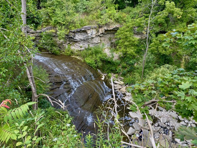
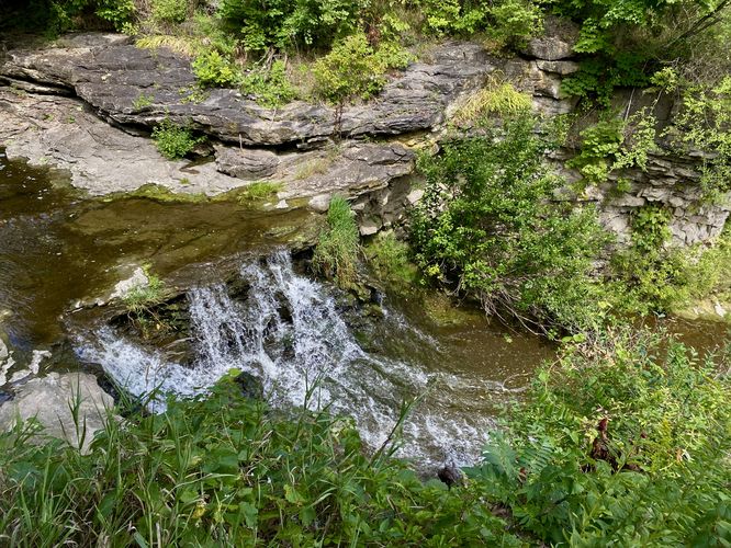
This is not necessarily a hike but rather a very short walk that leads along a tall and steep cliff line to reach two viewpoints above Beamer's Falls. The first viewpoint can be found within the first few meters from parking and is the best view of the largest cascade of the waterfall. This view sits high above the gorge with the waterfall below, so watch your step and stay back from the cliff for your own safety. If you follow the trail further, you'll find the upper portion of the waterfall cascading down the bedrock. During our visit we found a couple of people at the base of the waterfall and decided to give them privacy; however, there's a steep scramble that leads down to the base of the waterfall that appears to follow a fairly-defined path, but explore at your own risk.
Parking
Hikers will find a small parking lot at the coordinates provided, located on the north side of Ridge Rd West in Grimsby, On. The lot is large enough to fit less than a dozen vehicles as of August 2024.
Pets
Dogs are allowed only if leashed and must be cleaned up after.
Warning
Steep cliffs: This trail leads along very-steep and tall cliffs. Watch your step and hike at your own risk.
Trail
This is not necessarily a hike but rather a very short walk that leads along a tall and steep cliff line to reach two viewpoints above Beamer's Falls. The first viewpoint can be found within the first few meters from parking and is the best view of the largest cascade of the waterfall. This view sits high above the gorge with the waterfall below, so watch your step and stay back from the cliff for your own safety. If you follow the trail further, you'll find the upper portion of the waterfall cascading down the bedrock. During our visit we found a couple of people at the base of the waterfall and decided to give them privacy; however, there's a steep scramble that leads down to the base of the waterfall that appears to follow a fairly-defined path, but explore at your own risk.
Parking
Hikers will find a small parking lot at the coordinates provided, located on the north side of Ridge Rd West in Grimsby, On. The lot is large enough to fit less than a dozen vehicles as of August 2024.
Pets
Dogs are allowed only if leashed and must be cleaned up after.
Warning
Steep cliffs: This trail leads along very-steep and tall cliffs. Watch your step and hike at your own risk.