Loading...

๐ŸŽ‰ Enjoy a Free 7-Day Supporter Trial and Unlock Exclusive Perks โ€” No Credit Card Required. Learn more.

Batona Trail

Directions
Map
Pictures
Send to App
Distance:
53.5 Miles / 86.1 km
Type:
One-Way
Difficulty:
Moderate
Time to Hike:
26 hours, ~45 minutes
Features:
Surface Type:
Dirt
Park:
Wharton State Forest
Town:
Tabernacle, New Jersey
Directions:
39.67195, -74.546018
Added:
January 12, 2017
Updated:
November 27, 2017
Copy Trail Link Hiking this trail? Send a friend or family member a link to this trail guide for your own safety. Hike at your own risk (disclaimer)
Loading...
Loading...
67'

Total Change
135'

Ascent
108'

Descent

Download the Trail Route for Offline Use

Supporters get exclusive access to download trail routes to the MyHikes app for offline use. Stay prepared on your adventure, even without an internet connection! Become a Supporter today to unlock this feature and hike with confidence.

Send to App

Batona Trail

The Batona Trail at Wharton State Forest, NJ, is a 53.5 mile one-way hike that stretches through the Pine Barrens.

Note:
The GPS data for this trail right now only includes 1.7 miles (one-way) along the Batona Trail. You can park near the Carranza Memorial - there's a large parking lot just past the memorial and down the sandy road along the trail.

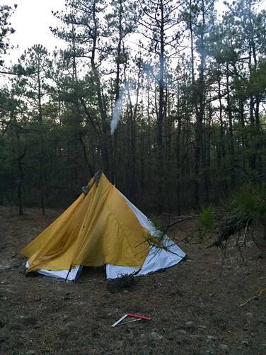
Camping is allowed on the trail with a permit only and you must camp in the designated camping areas - the permit can be obtained at the park office. Unfortunately there's no dispersed/primitive camping.

The trail is fairly skinny but runs along a sandy road through the park (at least the section mapped here). The surroundings are mostly pine trees with some bogs, fields, and low shrubs. The soil is mostly sandy as well which makes for an interesting hike.

The trail is marked with light-red blazes and has helpful arrow markers when the trail meets intersections and roads.

For better maps, check out http://www.njparksandforests.org/parks/docs/batona14web.pdfhttp://www.njparksandforests.org/parks/docs/batona14web.pdf
  1. Parking

    39.67195, -74.546018
  2. Main Trailhead

    39.776774, -74.632272
No community routes found. To add your own hike as a Community Route for this Trail guide, leave a Trip Report with an attached GPX file.

Hazards

Ticks - Lyme Disease More Info (CDC)

Seasons

All

Blaze Color

Red

Photo Albums

Trip Reports

Trail Guide By:
Dorus user profile picture
53.5 miles / 86.1 km
3.4 miles / 5.5 km
February 05, 2017
First time backpacking a trail that someone else added! We camped in early February with a hot tent and Liteoutdoors light weight stove. Got down to about 20 degrees F that night.
Camping Hiking
15.0 miles / 24.1 km
December 10, 2016
Hiking

Weather Forecast

In Tabernacle, NJ

Explore Hiking Trails

You May Also Like

Colorado's Million Dollar Highway - Plan a day's drive adventure along the iconic Million Dollar Highway in Colorado. Explore the best short trails, roadside stops, waterfalls, vistas, ghost towns, and hot springs within a ~6 hour road trip.
Explore

Colorado's Million Dollar Highway

Plan a day's drive adventure along the iconic Million Dollar Highway in Colorado. Explore the best short trails, roadside stops, waterfalls, vistas, ghost towns, and hot springs within a ~6 hour road trip.

Read
Glacier's Going-to-the-Sun Road - Discover the breathtaking beauty of Glacier National Park along the iconic Going-to-the-Sun Road. From stunning roadside stops to picturesque waterfalls and vistas, this engineering marvel offers endless opportunities for exploration.
Explore

Glacier's Going-to-the-Sun Road

Discover the breathtaking beauty of Glacier National Park along the iconic Going-to-the-Sun Road. From stunning roadside stops to picturesque waterfalls and vistas, this engineering marvel offers endless opportunities for exploration.

Read
New York's Best Waterfalls - Whether you're planning a day hike, roadside stop, or a leisurely short walk, this guide provides hikers, travelers, and locals alike with 63 different locations to over 100 scenic waterfalls to help plan your next adventure!
Explore

New York's Best Waterfalls

Whether you're planning a day hike, roadside stop, or a leisurely short walk, this guide provides hikers, travelers, and locals alike with 63 different locations to over 100 scenic waterfalls to help plan your next adventure!

Read

Before you boogie...

Find our trail guides useful? Consider becoming a Supporter to unlock perks!

MyHikes is an indie platform that makes exploring public trails easier for everyone. The platform has no investors, no ads, and is owned and operated by one person, Dave Miller. Dave has personally mapped and written over 1,800 trail guides on MyHikes for the public to explore. MyHikes has helped millions outdoor enthusiasts plan their next adventure.

But it takes a lot of time ๐Ÿ•ฆ, money ๐Ÿ’ฐ, work, and espresso shots โ˜• to run MyHikes, including hiking , mapping , writing , and publishing new trails with high-quality (accurate) information... along with software engineering (coding) the platform like building new features, website and mobile app development (iOS and Android), site maintainance . and much much more.

Supporters unlock website and mobile app perks with an annual one-time payment of $25 (you renew) ๐Ÿ˜Ž๐Ÿ‘. Or you can simply make a Donation of your choice. Otherwise, you can support us by telling your friends about MyHikes - both quick and free ๐ŸŽ‰

Admin user profile picture

Dave Miller
MyHikes Founder