The Barton Dam Spillway & Portage Trail at Barton Nature Area in Ann Arbor, Michigan is an easy 0.5-mile out-and-back walk that leads to views of the Huron River, the Barton Dam Spillway, and Barton Pond. This walk is also used as a portage for kayakers and canoers who want to continue paddling from Barton Pond to the Huron River or vice versa.
Walk Description
This is less of a hike and more of an easy walk that follows a dirt path as it leads from the main parking lot for the Barton Nature Area, heading southeast, to reach the Huron River.
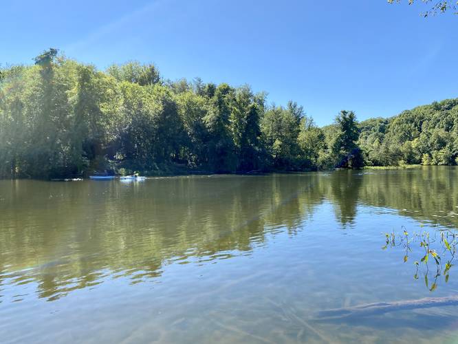
Huron River Portage - Mile 0.1
At mile 0.1, walkers will reach a dock along the Huron River that allows kayakers and canoers to put their boat in the water.
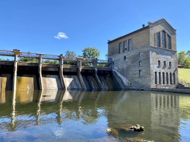
Barton Dam Spillway - Mile 0.2
Walking north from here leads under a railroad bridge to reach a view of the Barton Dam Spillway, around mile 0.2. This dam releases water when necessary, thus, visitors can sometimes find a nice human-made waterfall cascading down the spillway's slopes. During this visit, the spillway at the Barton Dam was almost completely dry.
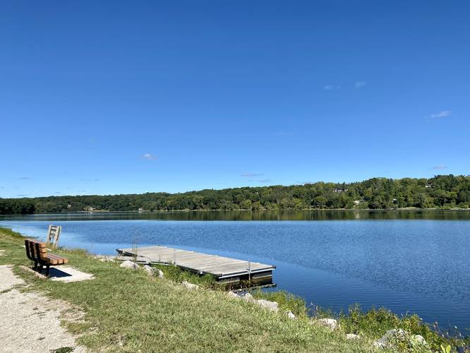
Barton Pond View & Portage - Mile 0.3
After passing the Barton Dam, walkers will head up a series of stairs that leads to a flat gravel trail that runs along Barton Pond. Here is where this track ends, at a bench with a view of Barton Pond. Kayakers and canoers can put their boats in at this junction as there's a dock in Barton Pond that provides portage access.
Parking
Visitors will find parking at the coordinates provided. The lot is large enough to fit over a dozen vehicles.
Pets
Dogs are allowed if leashed and their waste should be carried out.
Biking
There were no signs stating biking is prohibited, thus, biking appears to be allowed along the trails at the Barton Nature Area. Please double-check the rules in-person before biking.
Waterfalls
Please note that this walk does not lead to a natural waterfall, but rather a human-made "waterfall" that cascades down the Barton Dam Spillway.
Walk Description
This is less of a hike and more of an easy walk that follows a dirt path as it leads from the main parking lot for the Barton Nature Area, heading southeast, to reach the Huron River.
Huron River Portage - Mile 0.1
At mile 0.1, walkers will reach a dock along the Huron River that allows kayakers and canoers to put their boat in the water.
Barton Dam Spillway - Mile 0.2
Walking north from here leads under a railroad bridge to reach a view of the Barton Dam Spillway, around mile 0.2. This dam releases water when necessary, thus, visitors can sometimes find a nice human-made waterfall cascading down the spillway's slopes. During this visit, the spillway at the Barton Dam was almost completely dry.
Barton Pond View & Portage - Mile 0.3
After passing the Barton Dam, walkers will head up a series of stairs that leads to a flat gravel trail that runs along Barton Pond. Here is where this track ends, at a bench with a view of Barton Pond. Kayakers and canoers can put their boats in at this junction as there's a dock in Barton Pond that provides portage access.
Parking
Visitors will find parking at the coordinates provided. The lot is large enough to fit over a dozen vehicles.
Pets
Dogs are allowed if leashed and their waste should be carried out.
Biking
There were no signs stating biking is prohibited, thus, biking appears to be allowed along the trails at the Barton Nature Area. Please double-check the rules in-person before biking.
Waterfalls
Please note that this walk does not lead to a natural waterfall, but rather a human-made "waterfall" that cascades down the Barton Dam Spillway.