This post details the hiker's early explore through this intriguing area in the Susquehannock State Forest near Coudersport, Pennsylvania. Hikers should be aware that this out-and-back with a lollipop loop does not follow well defined trails. Some parts of this hike included bushwhacking, climbing over or around fallen trees, topographical map reading, and even creek crossings and traverse of swampy wet areas. Hikers should bring an offline tracker, a physical map, and be prepared to understand how to traverse the topography off-trail in order to prepare for this hike.
This adventurer has often discovered that finding unexpected serendipity is the hiker's strongest ally and many of my most memorable treks were issued from seldom travelled wildlands … Don't be overly apprehensive about hiking on unmarked trails but be prepared and be careful to only do short outings so as not to go too far into unexplored sections.
Trails
The good news for the hiking community is that there are many old footpaths that are still here and can be hiked on still yet today. This edition explores two of these unmarked but useable trails, called the Barren Hollow Trail and the Aspen Trail, with the hope to reopen the trails that track along on old railroad beds with the intent to conjure up a hiking route between two established State Forest Hiking Trails.
Here lays two old unmarked trail along the proposed route between the two established State Forest Hiking Trails; and on a section of the route from the Bucktail Path Trail in the west, crossing into the Austin Dam Memorial Park as a midpoint and then connects to the Susquehanna Trail System to the east. This route continues on existing roads, trails, and old railroad beds in connecting the two State Forest Hiking Trails.
Hike Description
Hiker's Birthday Hike on December 16, 2021. This scouting hike explored two named trails: Barren Hollow Trail and the Aspen Trail. These trails are unmarked and seldom used, but provided for a spectacular explore at this time of the year.
Barren Hollow Trail (Unmarked) - 1.5 miles
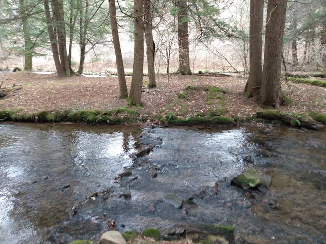
From the small turn-out parking spot on the east side of the South Woods Road, the trail immediately crosses South Woods Branch before following a mostly-dry path that heads northeast on an old railroad grade that follows the creek up the Barren Hollow for about 1.5 miles (one-way).
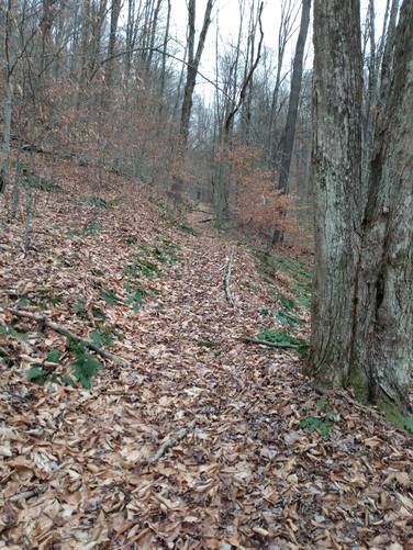
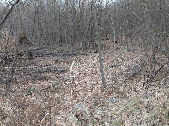
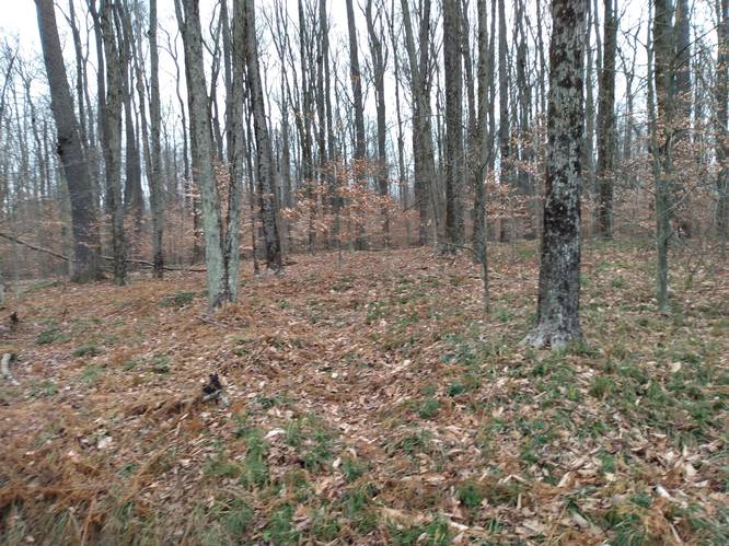
South Woods Branch normally flows with less than one-foot depth; notice the stepping stones placed across the creek. Once across the South Woods Branch, there are a few springs here, that cause the area at the lower end of the Barren Hollow Trail hollow to be wet. This lower end on the trail could benefit from some clearing of some brush at the entrance to the trail, but it is only for a short distance until the conditions improve. Also, along the trail there are some climbing over or around fallen trees, but most of path is open. At the very top end, the hiker will come to an area that has a brushy thicket with a narrow treadway that comes to a forest service road that leads to the Elevenmile Road at the top of the Barren Hollow Trail.
Elevenmile Road and Pipeline Lollipop - 2.4 miles
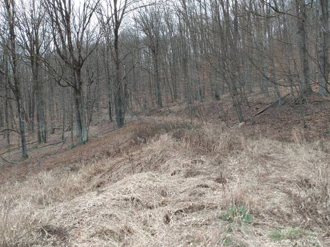
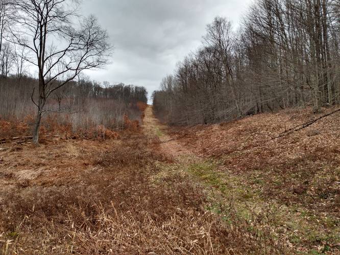
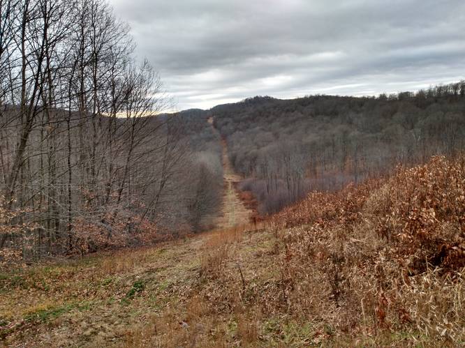
This hike also explored along a pipeline that tracked from the upper end of Big Younglove Hollow to the southern ridgeline above the Aspen Trail hollow. The views from the pipeline track offered this day's best vistas. Hikers Tip: Anytime one finds oneself nearby a pipeline when hiking in Potter County, Pennsylvania, it is often advantageous to investigate that geographical feature for a vista opportunity.
On this hike, due to threating rain, the hiker at this point returned on the Elevenmile Road by bushwhacking across the ridgeline to the northwest to find the Elevenmile Road at the top of the Aspen Trail. From here, the hiker went south on the Elevenmile Road to the Barren Hollow Trailhead and followed Barren Hollow Trail back to the starting point.
Aspen Trail (Unmarked) - Not Hiked Yet
At the time of this initial publishing, the Aspen Trail is yet to be hiked. Note that the total mileage here (approx. 5.2-miles) does not include this section that was left out of the GPS track. This Aspen Trail hiking data will be added as a future update.
Parking
This hike begins and ends on the western terminus along the low-volume South Woods Road in Homer Township. There is a turn-out suitable for parking along the east-side of South Woods Road about 300 feet north of the trail marker for the eastern terminus of Odin Hoxie Trail.
This parking spot is the same as the one that is used for the eastern terminus of Odin Hoxie Trail.
Pets
Dogs are allowed if leashed.
Camping
No suitable campsites were identified along these connector trails. For dispersed and primitive camping in other areas of the state forest, please follow the state forest rules and regulations and only camp on state lands.
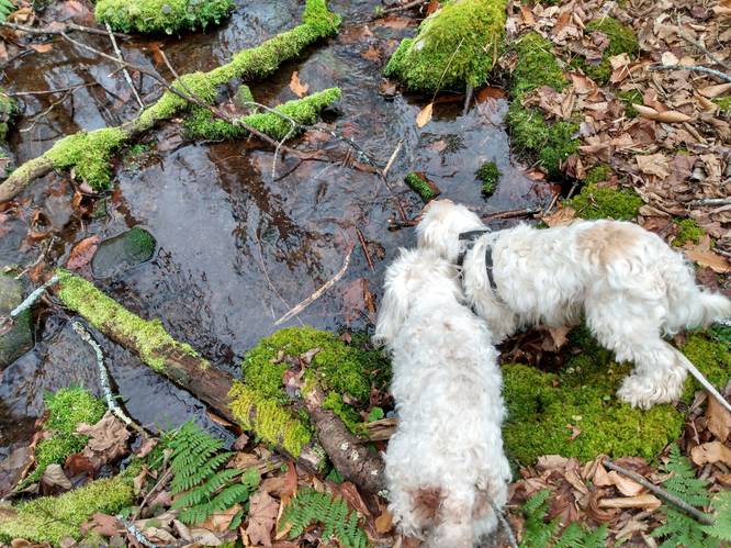
Creek crossings:
The creek crossings were not too difficult. However without the proper foot gear, the unprepared hiker will be left with not only wet feet but also water-laden footwear. One technique for dealing with creek crossings is to stow along a pair of light-wieght, knee-high waders, to change into during the creek crossings. When hiking on the dry portions of the trail change back into the more-supportive hiking boots necessary for rough terrain walking on the hillside trails.
Hikers Note: The best way for the hiker to deal with these shallow creek crossings is to have the good pair of water resistant hiking boots, and carry along a good quality pair of Gaiters designed for Wet Hiking. This combination, along with a set of Trekking Poles and extra dry hiking socks, would serve the hiker well, and be an excellent investment for backpacking and long day hikes under these less than ideal trail conditions.