Loading...

📌 Love our trails? Set MyHikes as your preferred Google source. Add Now ⛰️

Barnes Camp Loop Trail

Trail name(s)

Barnes Camp Wetland Walk Trail, Barnes Camp Loop Trail, Long Trail South

Location

Barnes Camp Visitor Center, Route 108, Stowe VT

Permitted uses

Hiking, Nature Study

Prohibited uses

No camping, No fires

Hours

Dawn to Dusk. The road to Smuggler’s Notch is closed during the winter season.  

Fees and Parking

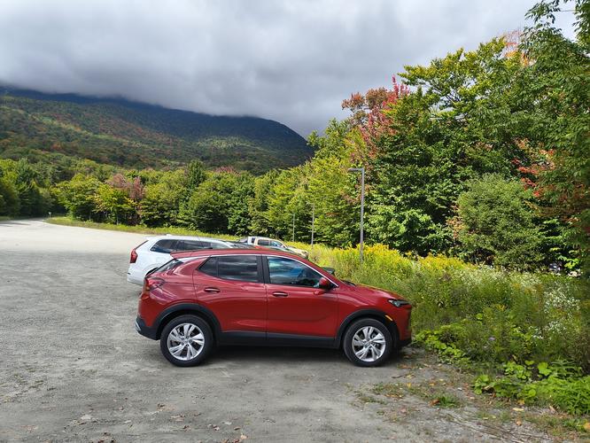
There is no fee to park or to use the trails. Parking at the Barnes Camp Visitor Center is limited to 30 minutes. For those planning on staying longer than 30 minutes, parking is available across the street at the base of the Stowe Mountain Resort. There is plenty of parking available across the street in two enormous parking areas. There is a pathway that leads from the parking area closest to the Visitor Center, across the street to the Base Camp Visitor Center.

Pets

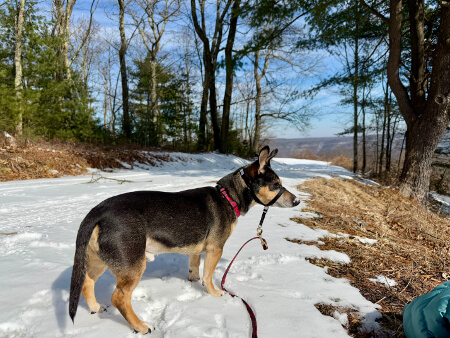
Dogs are allowed on the trail and are asked to be kept on a leash.

Accessibility

There is a section of boardwalk that is wheelchair accessible. The Base Camp Loop Trail and Long Trail are not wheelchair accessible.

Hiker amenities

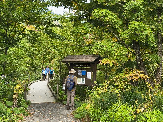
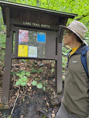
When the Barnes Camp Visitor Center is open, there are bathrooms available. There is an information kiosk at the Center and there is a posted map. There is also a QR code posted that gives hikers a description of the hikes. There is also a written description posted at the kiosk in both English and French. There are two additional information kiosks: one at the start of the Boardwalk that had Long Trail South on it, and the second, on the opposite area nearer to the Barnes Camp Visitor Center, that had Long Trail North.

Length and Trail information

This hike was done as a Loop Hike and was approximately 1.4 miles long. The hike is described as easy/moderate. The easy part of the hike is found along the 600 foot long, 5 foot wide, boardwalk and at the start of the hike and a short distance into the woods before any water crossings. After the water crossings the hike is more moderate than easy. Hikers are warned via a post at the kiosks,that this area has live rock slides and visitors should use caution while hiking.

We chose to start our hike at the Long Trail South kiosk adjacent to the Boardwalk, but because this is a loop hike, it can be done in either direction.

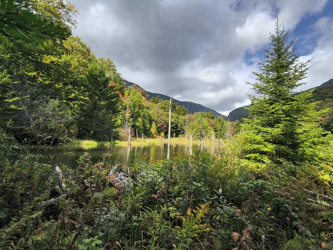
The boardwalk is universally accessible and leads visitors along Notch Brook wetland area to a viewing platform that overlooks a beaver pond and Smuggler’s Notch in the distance. There are education plaques installed along the walkway and at the viewing platform for those interested in learning more about the area and its history. This boardwalk offers a great opportunity to view wildlife because you are literally surrounded by the wetland.

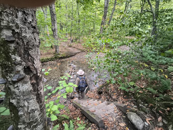
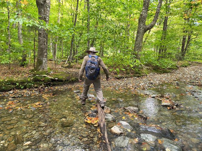
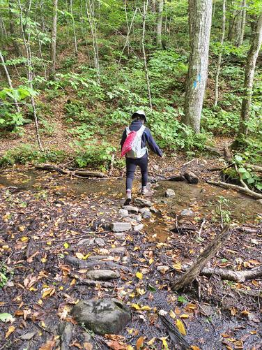
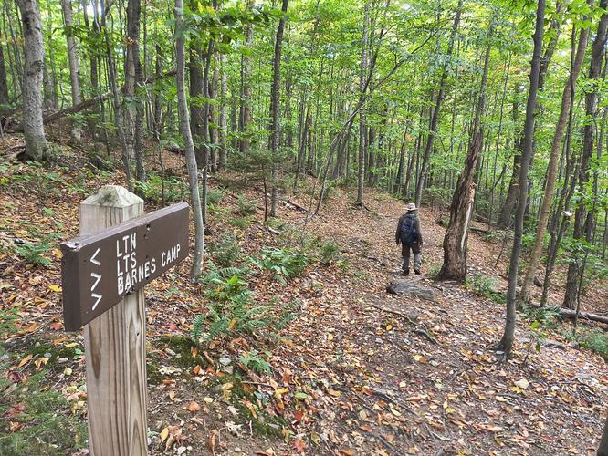
Exiting the boardwalk, hikers enter a mixed forest with the typical woodland substrate of roots and rock along a narrow path. The trail is easy to follow and is marked by blue trail blazes and engraved wooden signs. There were two stream crossings during our hike. The first one we encountered included a descent down a steep staircase with no handrails. Please use caution as the steps can be wet and slippery, as is the crossing of the stream over partial submerged wet rocks. The next crossing was over stones that were also partially submerged. No doubt this is a very wet area after spring rains or summer showers. Again,use caution when traversing over partially submerged rocks. We found that after the second water crossing, there was a steady ascent and the hiking became more strenuous. It is a short hike, but there is also a 400 foot elevation change. Once on the Long Trail, the trail blaze changes to white.

We thoroughly enjoyed the hike, listening to birdsong and searching for fungi. It’s a surprisingly good workout in a short distance and would recommend it for the beauty of the area, especially during the fall foliage season.

Explore 2 trails near Stowe, VT

Know Before You Go

  • An accessible 600-foot boardwalk with a viewing platform offers scenic wetland views for all visitors, with a 30-minute limit at the Visitor Center lot. Long-term parking is free and abundant right across the street at the Stowe Mountain Resort base.
  • The hike transitions from an easy, flat boardwalk into a moderate 1.4-mile loop featuring stream crossings, wet rocks, and a 400-foot elevation gain. Caution is advised when traversing slippery stones, steep staircases without handrails, and active rock slide areas.
  • Leashed dogs are welcome along the trail, making it a great day hike for dog owners. On-site amenities at the Visitor Center include seasonal restrooms, bilingual information kiosks (English/French), and downloadable trail guides via QR code.
Interactive topographic map for Barnes Camp Loop Trail located in Stowe, VT. Click the "View Map" button to load GPS coordinates and trail markers.
Get directions
Distance
1.4 mi
Difficulty
Moderate
Type
Loop
Est. Time
42 min
Elev. Gain
453'
Rating
0.0
Added
October 24, 2026
Updated
October 27, 2026

Weather Forecast

Don't let Google decide who you trust.

Loading...
Total Change
391 ft.
119 m
Ascent
453 ft.
138 m
Descent
427 ft.
130 m
Loading...

Download the GPX Data for Offline Use

Supporters get exclusive access to download trail routes to the MyHikes app for offline use. Stay prepared on your adventure, even without an internet connection! Become a Supporter today to unlock this feature and hike with confidence.

Download Barnes Camp Loop Trail GPX Data to the MyHikes Mobile App

Features

Dogs
Water Source

Points of interest

  1. Parking

    44.532493, -72.786484
  2. Main Trailhead

    44.533461, -72.787201
  3. Plenty of parking across the street from the Visitor Center

    44.5328, -72.787
    Plenty of parking across the street from the Visitor Center
  4. Kiosk at the beginning of the Boardwalk

    44.5334, -72.7872
    Kiosk at the beginning of the Boardwalk

Safety information

For your own safety: plan ahead, let someone know where you'll be, and hike at your own risk.

Hazards

Poison Ivy or Poison Oak
Rockfalls, Ledges, or Scrambles

Markers

Blaze Color

Blue

Blaze Dot Color

White

Availability

Spring, Summer, Fall

Surface type

Dirt

Trip Reports (Reviews)

Your opinion matters! Be the first to rate this trail.

Ready to help fellow hikers? Add a trip report to share your experience!

No community routes found. To add your own hike as a Community Route for this Trail guide, leave a Trip Report with an attached GPX file.

Explore Autumn Foliage

No Change
Some Color
Low Color
Moderate Color
High Color
Peak Color
Past Peak
Sept 1 Sept 8 Sept 15 Sept 22 Sept 29 Oct 6 Oct 13 Oct 20 Oct 27 Nov 3 Nov 10 Nov 17 Nov 24

Find Hiking Trails Near Me

You may also like

Colorado's Million Dollar Highway - Plan a day's drive adventure along the iconic Million Dollar Highway in Colorado. Explore the best short trails, roadside stops, waterfalls, vistas, ghost towns, and hot springs within a ~6 hour road trip.
Explore

Colorado's Million Dollar Highway

Plan a day's drive adventure along the iconic Million Dollar Highway in Colorado. Explore the best short trails, roadside stops, waterfalls, vistas, ghost towns, and hot springs within a ~6 hour road trip.

Read
Glacier's Going-to-the-Sun Road - Discover the breathtaking beauty of Glacier National Park along the iconic Going-to-the-Sun Road. From stunning roadside stops to picturesque waterfalls and vistas, this engineering marvel offers endless opportunities for exploration.
Explore

Glacier's Going-to-the-Sun Road

Discover the breathtaking beauty of Glacier National Park along the iconic Going-to-the-Sun Road. From stunning roadside stops to picturesque waterfalls and vistas, this engineering marvel offers endless opportunities for exploration.

Read
🍪 We use cookies to learn about site usage and to serve map tiles. You may block cookies manually in the browser. By continuing you agree. Learn more