Loading...

🎉 Enjoy a Free 7-Day Supporter Trial and Unlock Exclusive Perks — No Credit Card Required. Learn more.

Easement Trail

Directions
Map
Pictures
Send to App
Distance:
1.0 Mile / 1.6 km
Type:
Out-and-Back
Difficulty:
Hard
Time to Hike:
~30 minutes
Features:
Surface Type:
Dirt
Park:
Barking Slopes Conservation Area
Town:
Verona, Pennsylvania
Directions:
40.52908, -79.791944
Added:
October 07, 2017
Updated:
June 06, 2018
Copy Trail Link Hiking this trail? Send a friend or family member a link to this trail guide for your own safety. Hike at your own risk (disclaimer)
Loading...
Loading...
163'

Total Change
270'

Ascent
164'

Descent

Download the Trail Route for Offline Use

Supporters get exclusive access to download trail routes to the MyHikes app for offline use. Stay prepared on your adventure, even without an internet connection! Become a Supporter today to unlock this feature and hike with confidence.

Send to App

Easement Trail

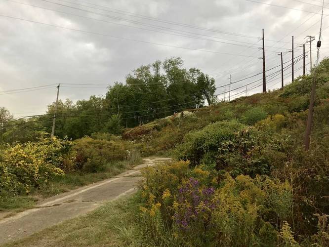
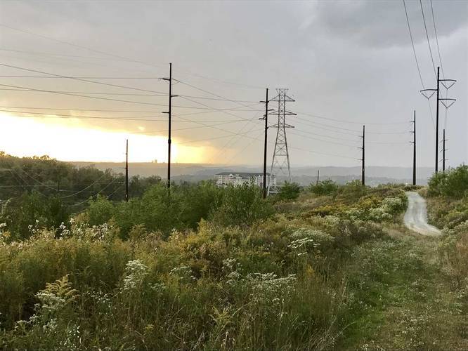
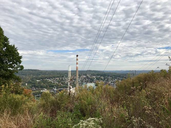
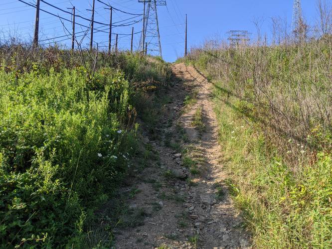
The Easement Trail at Barking Slopes Conversation Area near Verona, PA (just outside of Pittsburgh) is a difficult 1 mile out-and-back hike. The trail immediately shoots up a steep grade slope before leveling out. At the top of the hill you can see the skyscrapers of downtown Pittsburgh along with the Cathedral of Learning at the University of Pittsburgh. This trail's difficulty is set as "hard" because of the elevation grade on both sides of the hill.

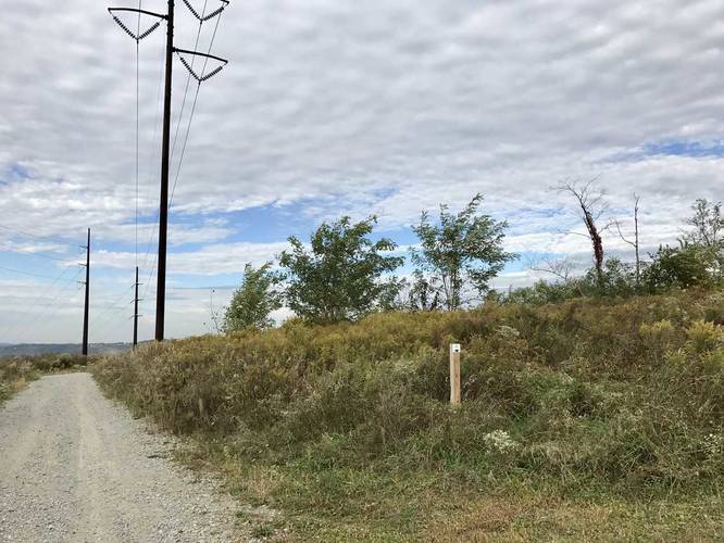
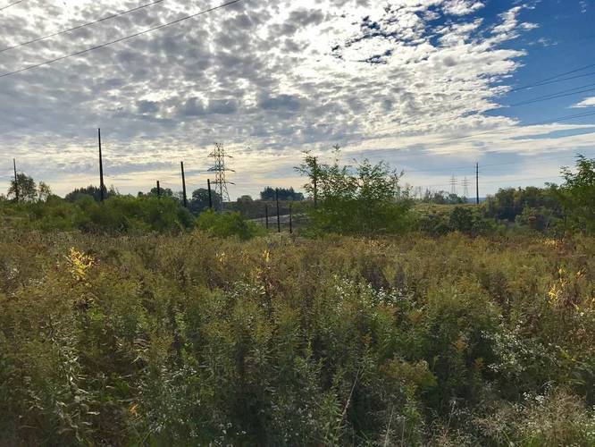
Follow the small white signs with the Allegheny Land Trust logo on them to stay on the proper trail. On the far side of the hill, you'll start hiking downhill again. Watch your step as the trail consists of what looks like baseball-sized volcanic rock and makes it easy to roll your ankle.

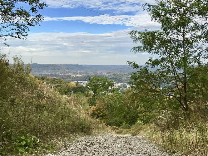
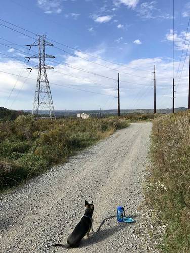
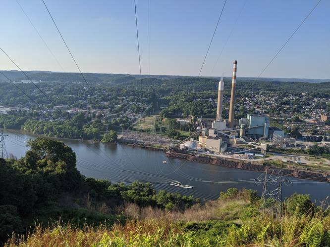
At the end of the trail you'll start the Uplands Trail which leads to an overlook to the west end of the trail.
Explore 214 trails near Verona, PA
  1. Parking

    40.52908, -79.791944
  2. Main Trailhead

    40.529107, -79.792167
  3. Heading uphill near the trailhead

    40.529156, -79.792039
    Heading uphill near the trailhead
  4. View of Pittsburgh, PA from the top of the hill

    40.530692, -79.793097
    View of Pittsburgh, PA from the top of the hill
  5. Trail junction - take a right hand turn

    40.530734, -79.793925
    Trail junction - take a right hand turn
  6. Vista toward Harmar, PA

    40.531434, -79.794068
    Vista toward Harmar, PA
  7. Vista of Cheswick, PA

    40.531907, -79.794602
    Vista of Cheswick, PA
  8. View of the powerlines and fields at the top of the hill

    40.53095, -79.793942
    View of the powerlines and fields at the top of the hill
  9. Vista toward Pittsburgh, PA

    40.530719, -79.794206
    Vista toward Pittsburgh, PA
  10. Got lost and came across view of Cheswick Generating Station. Coal barges!

    40.530942, -79.792045
    Got lost and came across view of Cheswick Generating Station. Coal barges!
No community routes found. To add your own hike as a Community Route for this Trail guide, leave a Trip Report with an attached GPX file.

Hazards

Ticks - Lyme Disease More Info (CDC)

Seasons

All

Trip Reports

Trail Guide By:
Admin user profile picture
1.0 mile / 1.6 km
1.0 mile / 1.6 km
August 09, 2020
The loose rocks make this pretty treacherous, I had a number of close calls on both sides of the hill. It was worth it for the off-trail view of the coal power plant across the river - take a right to go uphill/east when it levels out.
Hiking
0.4 miles / 0.6 km
September 01, 2017
Dogs Hiking
0.4 miles / 0.6 km
September 01, 2017
Dogs Hiking

Weather Forecast

In Verona, PA

Explore Hiking Trails

You May Also Like

Colorado's Million Dollar Highway - Plan a day's drive adventure along the iconic Million Dollar Highway in Colorado. Explore the best short trails, roadside stops, waterfalls, vistas, ghost towns, and hot springs within a ~6 hour road trip.
Explore

Colorado's Million Dollar Highway

Plan a day's drive adventure along the iconic Million Dollar Highway in Colorado. Explore the best short trails, roadside stops, waterfalls, vistas, ghost towns, and hot springs within a ~6 hour road trip.

Read
New York's Best Waterfalls - Whether you're planning a day hike, roadside stop, or a leisurely short walk, this guide provides hikers, travelers, and locals alike with 63 different locations to over 100 scenic waterfalls to help plan your next adventure!
Explore

New York's Best Waterfalls

Whether you're planning a day hike, roadside stop, or a leisurely short walk, this guide provides hikers, travelers, and locals alike with 63 different locations to over 100 scenic waterfalls to help plan your next adventure!

Read

Before you boogie...

Find our trail guides useful? Consider becoming a Supporter to unlock perks!

MyHikes is an indie platform that makes exploring public trails easier for everyone. The platform has no investors, no ads, and is owned and operated by one person, Dave Miller. Dave has personally mapped and written over 1,800 trail guides on MyHikes for the public to explore. MyHikes has helped millions outdoor enthusiasts plan their next adventure.

But it takes a lot of time 🕦, money 💰, work, and espresso shots ☕ to run MyHikes, including hiking , mapping , writing , and publishing new trails with high-quality (accurate) information... along with software engineering (coding) the platform like building new features, website and mobile app development (iOS and Android), site maintainance . and much much more.

Supporters unlock website and mobile app perks with an annual one-time payment of $25 (you renew) 😎👍. Or you can simply make a Donation of your choice. Otherwise, you can support us by telling your friends about MyHikes - both quick and free 🎉

Admin user profile picture

Dave Miller
MyHikes Founder