Loading...

🍁 Fall is here! Check out our foliage map to plan your autumn hikes! Learn more.

Bark Shanty CCC Camp Trail

Directions
Map
Pictures
Send to App
Distance:
1.4 Miles / 2.3 km
Type:
Out-and-Back
Difficulty:
Easy
Time to Hike:
~42 minutes
Features:
PA Wilds
Surface Type:
Dirt
Park:
Susquehannock State Forest
Town:
Austin, Pennsylvania
Get Directions:
41.684023, -78.113779
Added:
December 06, 2019
Updated:
March 30, 2024
Guide by:
Copy Trail Link Hiking this trail? Send a friend or family member a link to this trail guide for your own safety. Hike at your own risk (disclaimer)
Loading...
Loading...
230'

Total Change
270'

Ascent
270'

Descent

Download the Trail Route for Offline Use

Supporters get exclusive access to download trail routes to the MyHikes app for offline use. Stay prepared on your adventure, even without an internet connection! Become a Supporter today to unlock this feature and hike with confidence.

Send to App

Key Takeaways

  • The Bark Shanty CCC Camp Trail is a 2.2-mile out-and-back spur off the Jacob Run and Stuckey Hollow Loop Trail in Susquehannock State Forest, leading to the remnants of a former CCC camp.
  • The trail follows forest trails and state forest roads, descends/ascends about 200 feet, and offers connections to other trails via the Gas Well Road, which was constructed by the CCC.
  • Visitors should be aware of private land bordering the camp site, adhere to leash laws for pets, and can find parking near the trailhead along Gas Well Road and Bark Shanty Road.

Bark Shanty CCC Camp Trail

This Bark Shanty CCC camp trail spurs off of the Jacob Run and Stuckey Hollow Loop Trail that begins and ends next to the Austin Dam Memorial Park. This spur trail lies within Susquehannock State Forest and is an easy 2.2-mile out-and-back hike.

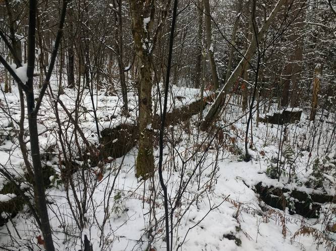
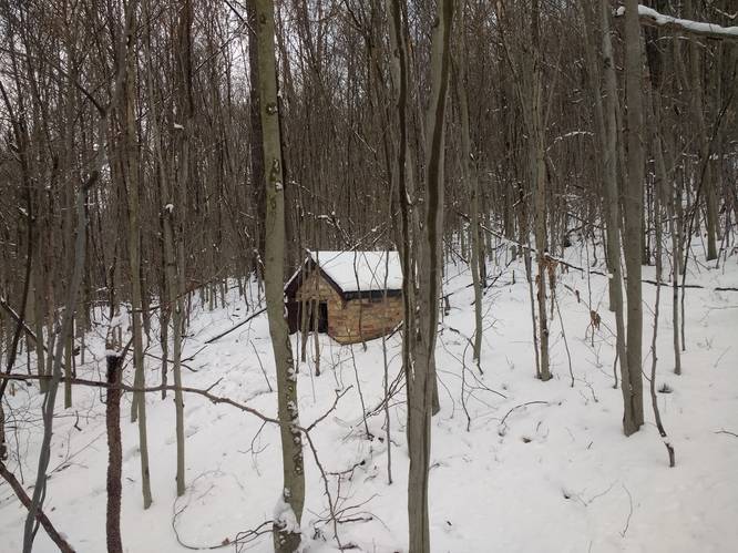
This trail descends and ascends approximately 200' on the Gas Well road to the location of the Bark Shanty CCC Camp near the intersection of Gas Well Road and Bark Shanty Road, where only the concrete foundation ruins of the Bark Shanty CCC camp remain today. S-146, Bark Shanty, PA was established in July of 1935. The camp closed near the end of 1941. Work projects completed by the company include the Gas Well Road, leading from the lower boundaries of the camp site westward to the hard-surface highway 607 connecting Austin and Keating Summit, and Jones Run, a road leading from the upper part of the camp site eastward to highway 872; and Bark Shanty (formally known as Trout Run), a connection between Pennsylvania highways 872 and 607 was also serviced by this camp.

Trails
This track follows a mix of forest trails and state forest roads. Hikers can explore around the old Bark Shanty CCC Camp location using the short forest trails at that location or use the Gas Well Road to connect to additional hiking trails. The Gas Well Road was constructed during the Great Depression by the Civilian Conservation Corps.

Private Land
The Bark Shanty CCC camp location adjoins private land to the east. Please respect the land owners and stay on the trails within the state forest lands at all times.

Parking

Hikers can find parking at the coordinates provided, next to the trailhead, along Gas Well Road and Bark Shanty Road.

Pets
Dogs are allowed if leashed.
Explore 88 trails near Austin, PA
  1. Parking

    41.684023, -78.113779
  2. Main Trailhead

    41.677745, -78.112816
  3. Bark Shanty CCC Camp Foundation

    41.684483, -78.111463
    Bark Shanty CCC Camp Foundation
  4. Old Dynamite Shed

    41.678954, -78.111602
    Old Dynamite Shed
Explore other routes for this Trail guide, added by the MyHikes' community via Trip Reports (reviews). To add your own hike as a Community Route for this Trail guide, leave a Trip Report with an attached GPX file.

Hazards

Ticks - Lyme Disease More Info (CDC)

Seasons

All

Photo Albums

+ Add Photo Album

Upload your photos from the trail to help others know what to expect.

Preview of the MyHikes mobile app interface

Track, Log, and Explore Hikes with the MyHikes App

Explore Autumn Foliage

No Change
Some Color
Low Color
Moderate Color
High Color
Peak Color
Past Peak
Sept 1 Sept 8 Sept 15 Sept 22 Sept 29 Oct 6 Oct 13 Oct 20 Oct 27 Nov 3 Nov 10 Nov 17 Nov 24
Shop Landscape Prints
Shop our landscape prints from the Grand Canyon of Pennsylvania

Trip Reports (Reviews)

Ready to help fellow hikers? Add a trip report to share your experience and provide valuable insights for those planning their next hike. Your review makes the trail better for everyone.

Your opinion matters! Be the first to rate this trail.
2.3 miles / 3.7 km
February 13, 2023
Rewalked the route to include the walk to the TNT shed.
Hiking

Weather Forecast

In Austin, PA

Explore Hiking Trails

You May Also Like

Colorado's Million Dollar Highway - Plan a day's drive adventure along the iconic Million Dollar Highway in Colorado. Explore the best short trails, roadside stops, waterfalls, vistas, ghost towns, and hot springs within a ~6 hour road trip.
Explore

Colorado's Million Dollar Highway

Plan a day's drive adventure along the iconic Million Dollar Highway in Colorado. Explore the best short trails, roadside stops, waterfalls, vistas, ghost towns, and hot springs within a ~6 hour road trip.

Read
New York's Best Waterfalls - Whether you're planning a day hike, roadside stop, or a leisurely short walk, this guide provides hikers, travelers, and locals alike with 63 different locations to over 100 scenic waterfalls to help plan your next adventure!
Explore

New York's Best Waterfalls

Whether you're planning a day hike, roadside stop, or a leisurely short walk, this guide provides hikers, travelers, and locals alike with 63 different locations to over 100 scenic waterfalls to help plan your next adventure!

Read

Before you boogie...

Find our trail guides useful? Consider becoming a Supporter to unlock perks!

MyHikes is an indie platform that makes exploring public trails easier for everyone. The platform has no investors, no ads, and is owned and operated by one person, Dave Miller. Dave has personally mapped and written over 1,800 trail guides on MyHikes for the public to explore. MyHikes has helped millions outdoor enthusiasts plan their next adventure.

But it takes a lot of time 🕦, money 💰, work, and espresso shots ☕ to run MyHikes, including hiking , mapping , writing , and publishing new trails with high-quality (accurate) information... along with software engineering (coding) the platform like building new features, website and mobile app development (iOS and Android), site maintainance . and much much more.

Supporters unlock website and mobile app perks with an annual one-time payment of $25 (you renew) 😎👍. Or you can simply make a Donation of your choice. Otherwise, you can support us by telling your friends about MyHikes - both quick and free 🎉

Admin user profile picture

Dave Miller
MyHikes Founder