Loading...

🎉 Enjoy a Free 7-Day Supporter Trial and Unlock Exclusive Perks — No Credit Card Required. Learn more.

Banshee Reeks Loop

Directions
Map
Pictures
Send to App
Distance:
6.8 Miles / 10.9 km
Type:
Loop
Difficulty:
Easy
Time to Hike:
3 hours, ~24 minutes
Features:
Surface Type:
Dirt
Park:
Banshee Reeks Nature Preserve
Town:
Leesburg, Virginia
Directions:
39.028991, -77.59983
Added:
April 24, 2024
Updated:
May 13, 2024
Copy Trail Link Hiking this trail? Send a friend or family member a link to this trail guide for your own safety. Hike at your own risk (disclaimer)
Loading...
Loading...
203'

Total Change
435'

Ascent
337'

Descent

Download the Trail Route for Offline Use

Supporters get exclusive access to download trail routes to the MyHikes app for offline use. Stay prepared on your adventure, even without an internet connection! Become a Supporter today to unlock this feature and hike with confidence.

Send to App

Banshee Reeks Loop

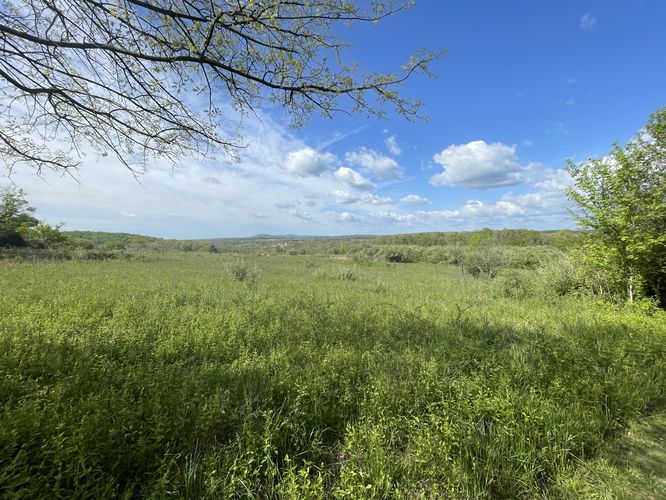
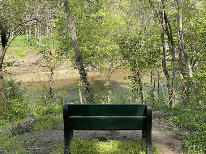
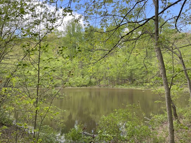
The Bansee Reeks Loop at Banshee Reeks Nature Preserve in Leesburg, Virginia is an easy 6.8-mile loop hike that features views of Goose Creek, Corner Pond, and meanders through open meadows.

This hike uses multiple trails to circumnavigate the perimeter of the park, however there are a labyrinth of trails to make just about any length of hike you like. With a diverse environment of grass trails along Goose Creek to wooded trails, this suburban park has a little of everything. Great for all skill levels of hikers this park is a nice distraction to the surrounding bustle of Northern Virginia.

Views
Note that this mostly-flat hike leads to views of ponds, creeks, and open meadows, but does not provide any true lookout points or overlooks.

Parking
Hikers will find parking at the coordinates provided, located at the main parking lot. Note that if the main parking lot is full, you can park and start your hike at the trailhead coordinates provided.

Pets
Dogs are allowed only if leashed and must be cleaned up after.
Explore 36 trails near Leesburg, VA
  1. Parking

    39.028991, -77.59983
  2. Main Trailhead

    39.029994, -77.599405
  3. Open field view

    39.030728, -77.600272
    Open field view
  4. Creekside view of Goose Creek w/bench

    39.029125, -77.607414
    Creekside view of Goose Creek w/bench
  5. View of Corner Pond

    39.032611, -77.593536
    View of Corner Pond
No community routes found. To add your own hike as a Community Route for this Trail guide, leave a Trip Report with an attached GPX file.

Hazards

Ticks - Lyme Disease More Info (CDC)
Poison Ivy/Oak

Seasons

All

Trip Reports

Trail Guide By:
AuzzieHiker user profile picture
6.8 miles / 10.9 km

Weather Forecast

In Leesburg, VA

Explore Hiking Trails

You May Also Like

New York's Best Waterfalls - Whether you're planning a day hike, roadside stop, or a leisurely short walk, this guide provides hikers, travelers, and locals alike with 63 different locations to over 100 scenic waterfalls to help plan your next adventure!
Explore

New York's Best Waterfalls

Whether you're planning a day hike, roadside stop, or a leisurely short walk, this guide provides hikers, travelers, and locals alike with 63 different locations to over 100 scenic waterfalls to help plan your next adventure!

Read
25 Best Day Hikes in North Carolina - Discover the top 25 best day hikes in North Carolina, from breathtaking waterfalls to mountain peaks. Explore hidden gems, scenic views, and trails suitable for all skill levels, perfect for your next outdoor adventure.
Explore

25 Best Day Hikes in North Carolina

Discover the top 25 best day hikes in North Carolina, from breathtaking waterfalls to mountain peaks. Explore hidden gems, scenic views, and trails suitable for all skill levels, perfect for your next outdoor adventure.

Read

Before you boogie...

Find our trail guides useful? Consider becoming a Supporter to unlock perks!

MyHikes is an indie platform that makes exploring public trails easier for everyone. The platform has no investors, no ads, and is owned and operated by one person, Dave Miller. Dave has personally mapped and written over 1,800 trail guides on MyHikes for the public to explore. MyHikes has helped millions outdoor enthusiasts plan their next adventure.

But it takes a lot of time 🕦, money 💰, work, and espresso shots ☕ to run MyHikes, including hiking , mapping , writing , and publishing new trails with high-quality (accurate) information... along with software engineering (coding) the platform like building new features, website and mobile app development (iOS and Android), site maintainance . and much much more.

Supporters unlock website and mobile app perks with an annual one-time payment of $25 (you renew) 😎👍. Or you can simply make a Donation of your choice. Otherwise, you can support us by telling your friends about MyHikes - both quick and free 🎉

Admin user profile picture

Dave Miller
MyHikes Founder