Bald Mountain (Rondaxe) Fire Tower Trail at Adirondack Park near Old Forge, New York is a moderate 2-mile out-and-back hike that features stunning views of the lakes and mountains near Old Forge.
Trails
This hike follows on named trail: Bald Mountain Fire Tower Trail (red blazes).
Hike Description
This hike begins at the parking coordinates provided, located on the south side of Rondaxe Road in Old Forge, NY and heads in along the Bald Mountain Fire Tower Trail. The trail starts off easy as it heads gradually uphill through an open deciduous forest as it follows red blazes.
Steeper Grade - Mile 0.15 to 0.3
Soon, the trail begins to climb a steep elevation from mile 0.15 to mile 0.3. While not difficult, during the winter, some of the terrain can be precarious without ice spikes.
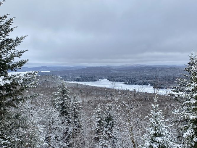
Off-Trail View of Fourth Lake - Mile 0.31
At the top of the hill, just beyond the steep uphill section, lies an off-trail view of Fourth Lake, facing East.
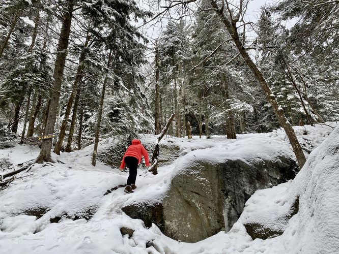
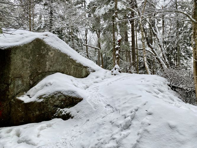
Just beyond the first off-trail view, the trail will ascend some very-large boulders. From here, the trail gradually heads uphill to reach more views.
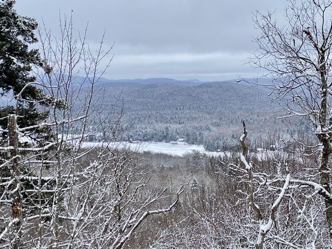
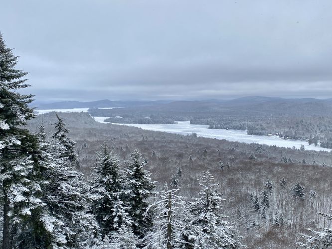
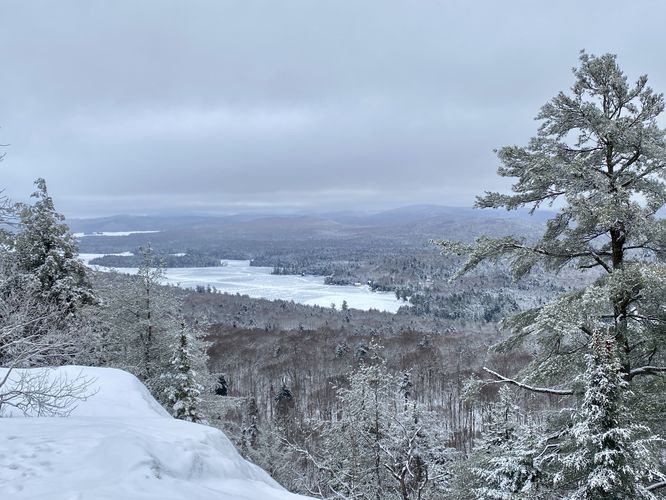
Third & Fourth Lakes View - Mile 0.5
After hiking uphill through the evergreen-filled forest of Bald Mountain, hikers will pop out at another view around mile 0.5. This view includes Third Lake on the right-hand side and Fourth Lake on the left-hand side. You can also see mountains in the distance, especially those that surround the lakes near Old Forge.
After passing the second view, hikers will head back into the forest as they traverse over more rocky outcroppings.
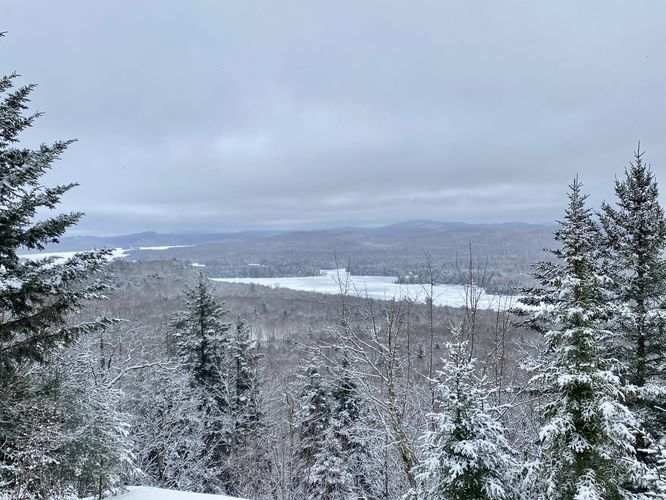
Fourth Lake View - Mile 0.67
Around mile 0.67, hikers will reach the third view along the hike. This one features views of Fourth Lake and the mountains surrounding it.
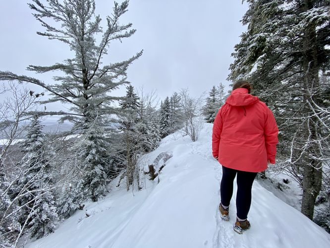
Outcropping Ridge Walk - Mile 0.88
Around mile 0.88, hikers will find a rocky outcropping that lines the top of Bald Mountain. This outcropping has slopes on each side, so hikers must traverse it by hiking along the very-top of this rock ridge. During the winter, this part of the hike can be a bit precarious; however, if you slip, you won't slide very far. Watch your step.
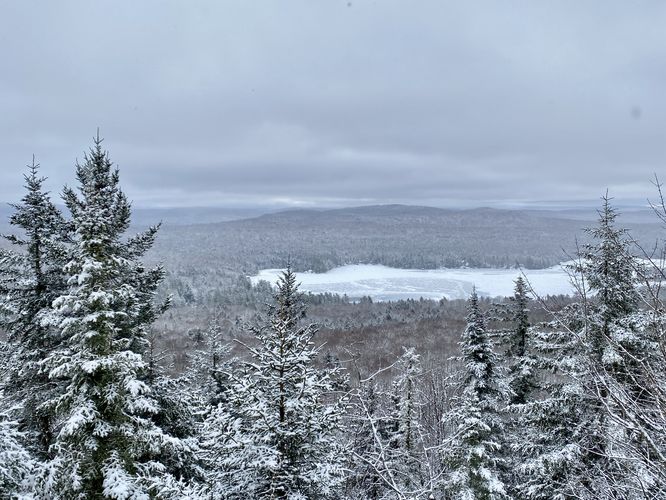
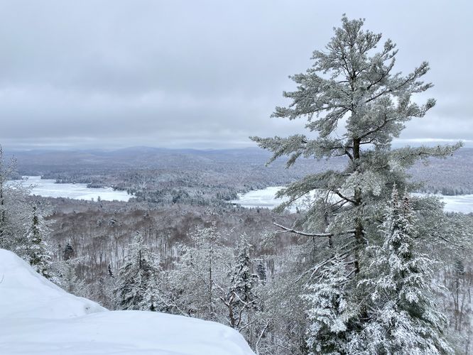
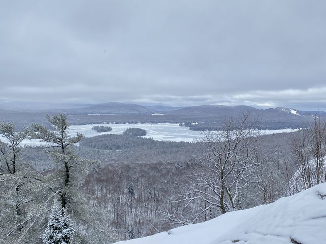
More Lake Views - Mile 0.93
After passing the rock ridge, hikers will come across another view opening on the side of the mountain, which features more lake views. Here you can see First, Second, Third, and Fourth Lakes below your feet. The pine trees that surround the view add more scenery, especially when snow-covered in the winter.
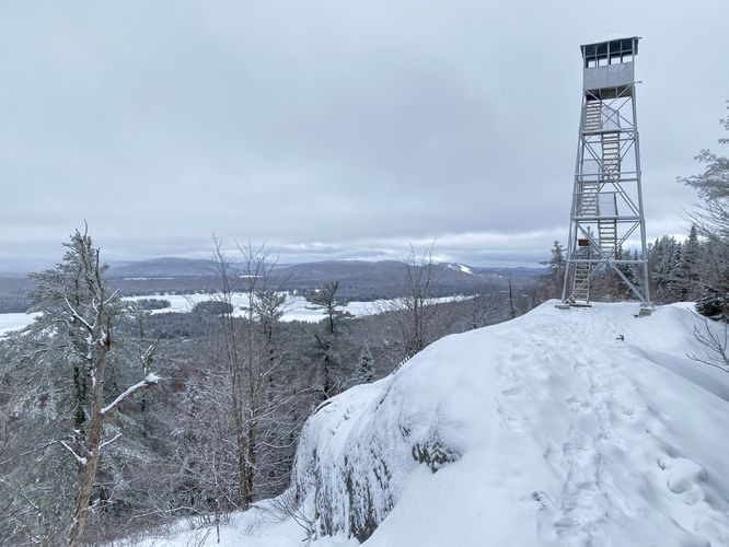
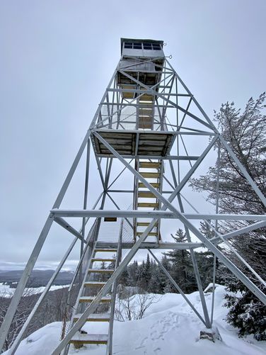
Bald Mountain Fire Tower & Views - Mile 1
At mile 1, hikers will reach the base of the Bald Mountain (Rondaxe) Fire Tower. Here, you'll find more views of the surrounding area including better views of First, Second, and Third Lakes below your feet -- and of course, the surrounding mountains. Hikers can head up to the top of the fire tower if they wish -- based on the rules as of January 2024, no more than 10 people on the tower at a time. From the Bald Mountain (Rondaxe) Fire Tower, hikers will get panoramic views of the area. After exploring the fire tower, the hike back to parking begins. Take your time exploring and taking in the sights before heading back.
On your hike out, you'll get the benefit of hitting the same views you stopped at on the way out. Depending on the weather during your hike, you may get better views on your way out.
Parking
Hikers will find a very large parking lot at the coordinates provided, located on the south side of Rondaxe Road in Old Forge, New York. The lot is large enough to fit a few dozen vehicles.
Pets
Dogs are allowed only if leashed and must be cleaned up after.
Warnings
Rock outcrop hiking: There are a couple of spots where hikers will traverse the top of a rocky outcropping ridge. During the winter, these ridge walks can be a bit precarious, however, if you slide, you will not go too far. Watch your step and hike at your own risk.
Trails
This hike follows on named trail: Bald Mountain Fire Tower Trail (red blazes).
Hike Description
This hike begins at the parking coordinates provided, located on the south side of Rondaxe Road in Old Forge, NY and heads in along the Bald Mountain Fire Tower Trail. The trail starts off easy as it heads gradually uphill through an open deciduous forest as it follows red blazes.
Steeper Grade - Mile 0.15 to 0.3
Soon, the trail begins to climb a steep elevation from mile 0.15 to mile 0.3. While not difficult, during the winter, some of the terrain can be precarious without ice spikes.
Off-Trail View of Fourth Lake - Mile 0.31
At the top of the hill, just beyond the steep uphill section, lies an off-trail view of Fourth Lake, facing East.
Just beyond the first off-trail view, the trail will ascend some very-large boulders. From here, the trail gradually heads uphill to reach more views.
Third & Fourth Lakes View - Mile 0.5
After hiking uphill through the evergreen-filled forest of Bald Mountain, hikers will pop out at another view around mile 0.5. This view includes Third Lake on the right-hand side and Fourth Lake on the left-hand side. You can also see mountains in the distance, especially those that surround the lakes near Old Forge.
After passing the second view, hikers will head back into the forest as they traverse over more rocky outcroppings.
Fourth Lake View - Mile 0.67
Around mile 0.67, hikers will reach the third view along the hike. This one features views of Fourth Lake and the mountains surrounding it.
Outcropping Ridge Walk - Mile 0.88
Around mile 0.88, hikers will find a rocky outcropping that lines the top of Bald Mountain. This outcropping has slopes on each side, so hikers must traverse it by hiking along the very-top of this rock ridge. During the winter, this part of the hike can be a bit precarious; however, if you slip, you won't slide very far. Watch your step.
More Lake Views - Mile 0.93
After passing the rock ridge, hikers will come across another view opening on the side of the mountain, which features more lake views. Here you can see First, Second, Third, and Fourth Lakes below your feet. The pine trees that surround the view add more scenery, especially when snow-covered in the winter.
Bald Mountain Fire Tower & Views - Mile 1
At mile 1, hikers will reach the base of the Bald Mountain (Rondaxe) Fire Tower. Here, you'll find more views of the surrounding area including better views of First, Second, and Third Lakes below your feet -- and of course, the surrounding mountains. Hikers can head up to the top of the fire tower if they wish -- based on the rules as of January 2024, no more than 10 people on the tower at a time. From the Bald Mountain (Rondaxe) Fire Tower, hikers will get panoramic views of the area. After exploring the fire tower, the hike back to parking begins. Take your time exploring and taking in the sights before heading back.
On your hike out, you'll get the benefit of hitting the same views you stopped at on the way out. Depending on the weather during your hike, you may get better views on your way out.
Parking
Hikers will find a very large parking lot at the coordinates provided, located on the south side of Rondaxe Road in Old Forge, New York. The lot is large enough to fit a few dozen vehicles.
Pets
Dogs are allowed only if leashed and must be cleaned up after.
Warnings
Rock outcrop hiking: There are a couple of spots where hikers will traverse the top of a rocky outcropping ridge. During the winter, these ridge walks can be a bit precarious, however, if you slide, you will not go too far. Watch your step and hike at your own risk.