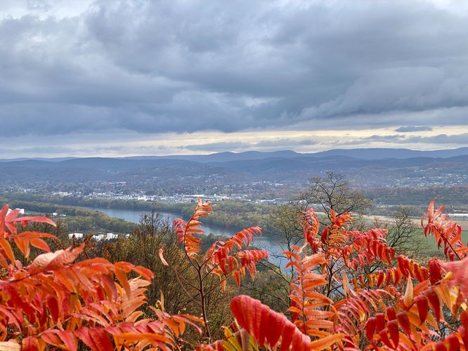
The Bald Eagle Mtn Overlook near Montoursville, Pennsylvania is an easy 0.1-mile loop walk that features views of Williamsport, Montoursville, the West Branch Susquehanna River, and the surrounding mountains and hills.
This short walk begins at the main parking lot for the Montgomery Pike Bald Eagle Mountain Overlook (scenic overlook) and follows the paved trail from the parking lot over to the main lookout point. From the lookout, visitors get views directly into Williamsport with the mountains north of I-180 as the backdrop. To the east is the town of Montoursville, which visitors will get a view of as well. Between your feet and both towns below is the West Branch Susquehanna River that cuts through the valley. During Autumn, this is a beautiful place to stop to take-in the views.
Parking
Visitors will find a very large parking lot at the coordinates provided. The lot is large enough to fit a couple dozen vehicles, as of October 2023.
Pets
Dogs are allowed only if leashed and must be cleaned up after.