Bake Oven Knob via Appalachian Trail at State Game Lands 217 near Germansville, Pennsylvania is a moderate 0.9-mile out-and-back trail that leads to the summit of Bake Oven Knob and features stunning views of the Lehigh Valley.
Hike Description
Hikers will find the trailhead located on the east side of Bake Oven Road in Germansville, Pennsylvania where the Appalachian Trail (AT) continues northward at the end of the parking lot. Hikers simply follow the white blazes of the AT to reach the summit of Bake Oven Knob.
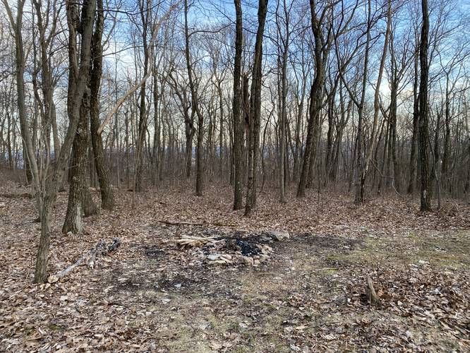
The Appalachian Trail follows a smooth trail substrate, passing an off-trail campsite, before beginning the rocky ascent to Bake Oven Knob summit. While this hike should be considered easy to moderate, the rocks provide a challenge of their own, helping cement the term "Rocksylvania".
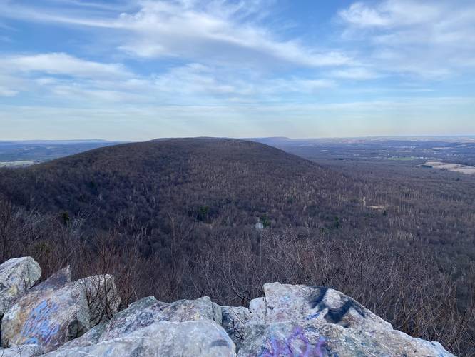
North Vista - Mile 0.4
After hiking 0.4 miles, hikers will reach the north-facing vista which is mostly a seasonal view. The view from this north-facing vista provides hikers will a view into Lansford and Jim Thorpe, PA.
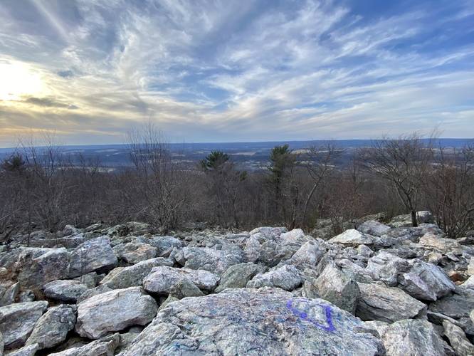
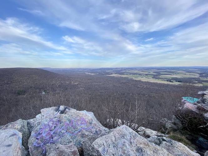
Bake Oven Knob Vista - Mile 0.45
Just behind the north-facing vista is a small spur trail that leads out to the rocky outcropping of Bake Oven Knob. Here, the short day hike hits the turn-around point, but provides hikers with stunning views of the Lehigh Valley and mountain range that the Appalachian Trail continues to follow.
Parking
Hikers will find a massive parking lot at the coordinates provided and is large enough to fit many dozen vehicles.
Popularity
This trail is by far one of the most popular day hikes near Allentown, PA and in the Lehigh Valley. Expect plenty of people anytime.
Pets
Dogs are allowed if leashed and their waste should be carried out by the hiker.
Camping and Backpacking
Backpacking and camping is well-accepted along the Appalachian Trail and hence, this section hike is not exception to that rule. When backcountry / dispersed / primitive camping, hikers should remain off-trail. Please follow all state game lands rules and regulations when camping.
Hunting
Note that hunting is permitted in and around this trail. It's advised to wear blaze orange to make your presence known.
Prohibited
Spray painting, painting the rocks, etc. is strictly forbidden here - as it should be at all natural formations. Unfortunately it seems many organizations have spent a lot of money removing graffiti from this trail over the years, but still a ton of it exists. Please refrain from tagging Bake Oven Knob or the surrounding natural area.
Hike Description
Hikers will find the trailhead located on the east side of Bake Oven Road in Germansville, Pennsylvania where the Appalachian Trail (AT) continues northward at the end of the parking lot. Hikers simply follow the white blazes of the AT to reach the summit of Bake Oven Knob.
The Appalachian Trail follows a smooth trail substrate, passing an off-trail campsite, before beginning the rocky ascent to Bake Oven Knob summit. While this hike should be considered easy to moderate, the rocks provide a challenge of their own, helping cement the term "Rocksylvania".
North Vista - Mile 0.4
After hiking 0.4 miles, hikers will reach the north-facing vista which is mostly a seasonal view. The view from this north-facing vista provides hikers will a view into Lansford and Jim Thorpe, PA.
Bake Oven Knob Vista - Mile 0.45
Just behind the north-facing vista is a small spur trail that leads out to the rocky outcropping of Bake Oven Knob. Here, the short day hike hits the turn-around point, but provides hikers with stunning views of the Lehigh Valley and mountain range that the Appalachian Trail continues to follow.
Parking
Hikers will find a massive parking lot at the coordinates provided and is large enough to fit many dozen vehicles.
Popularity
This trail is by far one of the most popular day hikes near Allentown, PA and in the Lehigh Valley. Expect plenty of people anytime.
Pets
Dogs are allowed if leashed and their waste should be carried out by the hiker.
Camping and Backpacking
Backpacking and camping is well-accepted along the Appalachian Trail and hence, this section hike is not exception to that rule. When backcountry / dispersed / primitive camping, hikers should remain off-trail. Please follow all state game lands rules and regulations when camping.
Hunting
Note that hunting is permitted in and around this trail. It's advised to wear blaze orange to make your presence known.
Prohibited
Spray painting, painting the rocks, etc. is strictly forbidden here - as it should be at all natural formations. Unfortunately it seems many organizations have spent a lot of money removing graffiti from this trail over the years, but still a ton of it exists. Please refrain from tagging Bake Oven Knob or the surrounding natural area.